Below is a complete listing of all Ohio Historical Markers. To find a detailed marker listing including text, photographs, and locations, click on a county below. Our listing is updated by the markers program as new markers are installed and older markers are reported damaged or missing.
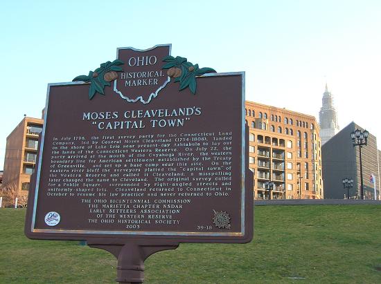
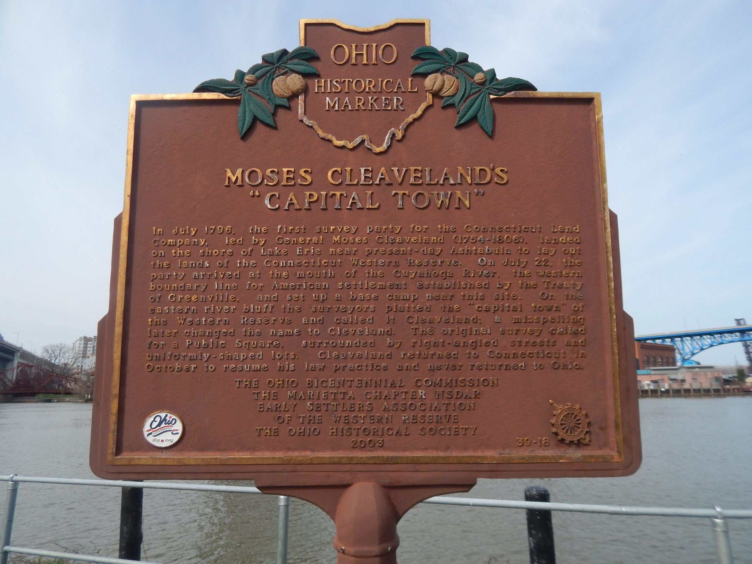
Side A: In July 1796, the first survey party for the Connecticut Land Company, led by General Moses Cleaveland (1754-1806), landed on the shore of Lake Erie near present-day Ashtabula to lay out the lands of the Connecticut Western Reserve. On July 22, the party arrived at the mouth of the Cuyahoga River, the western boundary line for American settlement established by the Treaty of Greenville, and set up a base camp near this site. On the eastern river bluff the surveyors platted the “capital town” of the Western Reserve and called it Cleaveland; a misspelling later changed the name to Cleveland. The original survey called for a Public Square, surrounded by right-angled streets and uniformly-shaped lots. Cleaveland returned to Connecticut in October to resume his law practice and never returned to Ohio.