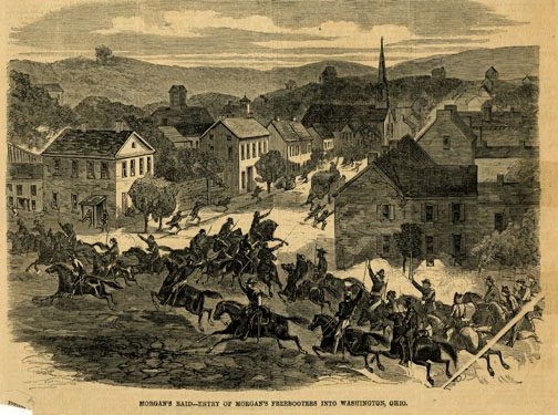
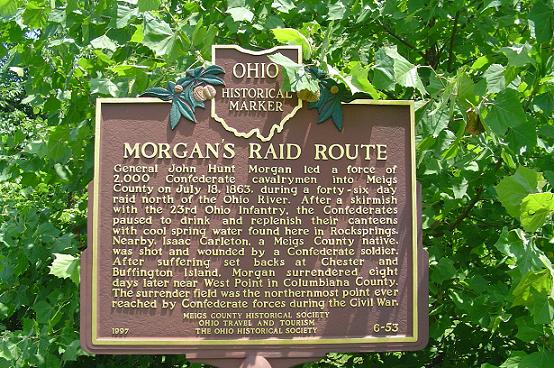
Side A: General John Hunt Morgan led a force of 2,000 Confederate calvarymen into Meigs County on July 18, 1863, during a forty-six day raid north of the Ohio River. After a skirmish with the 23rd Ohio Infantry, the Confederates paused to drink and replenish their canteens with cool spring water found in Rocksprings. Nearby, Isaac Carleton, a Meigs County native, was shot and wounded by a Confederate soldier. After suffering set backs at Chester and Buffington Island, Morgan surrendered eight days later near West Point in Columbiana County. The surrender field was the northernmost point ever reached by Confederate forces during the Civil War.