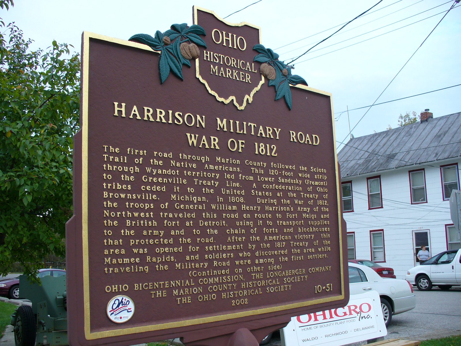
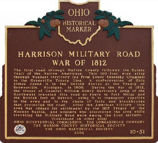
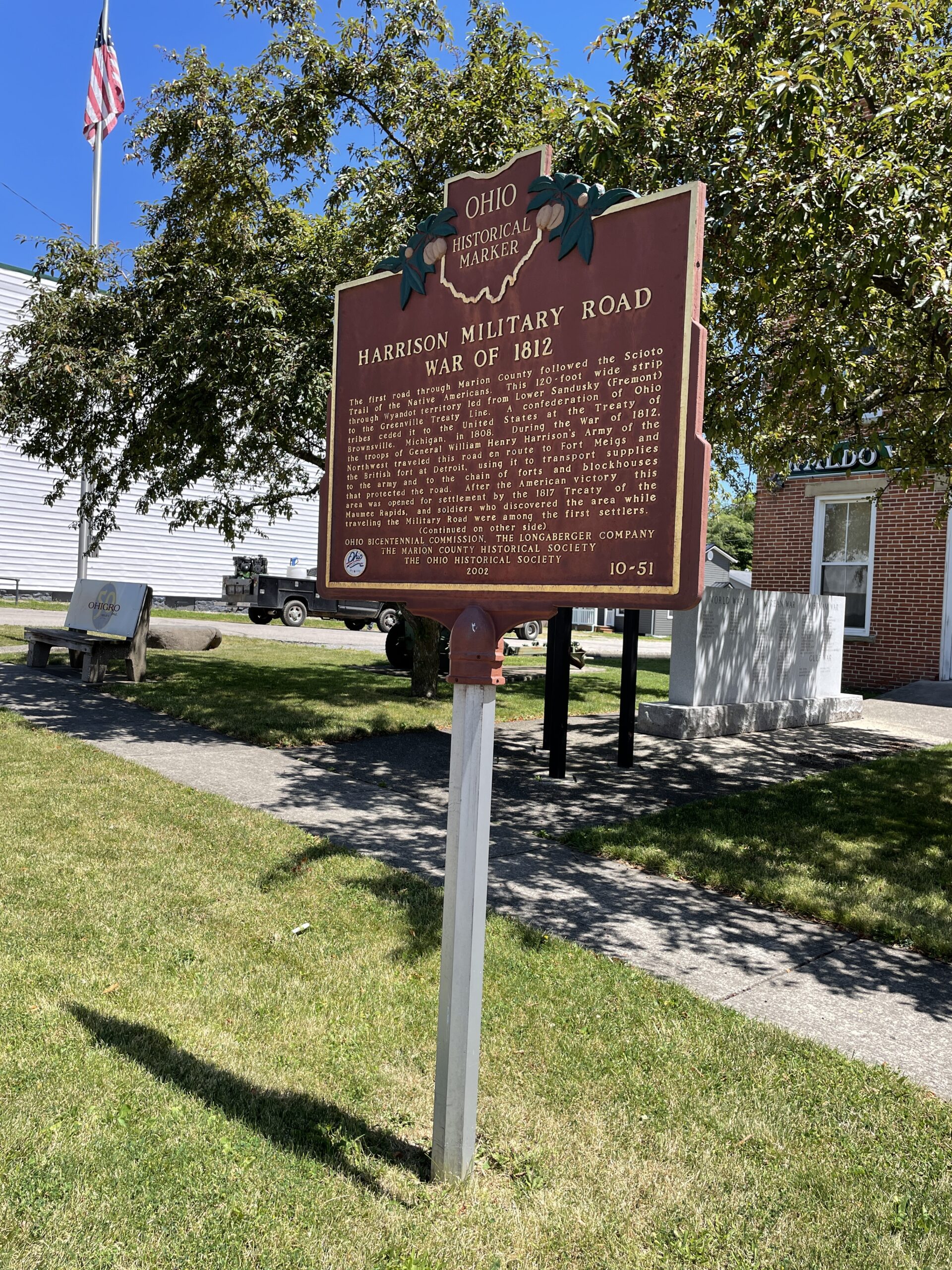
Side A: The first road through Marion County followed the Scioto Trail of the Native Americans. This 120-foot wide strip through Wyandot territory led from Lower Sandusky (Fremont) to the Greenville Treaty Line. A confederation of Ohio tribes ceded it to the United States at the Treaty of Brownsville, Michigan, in 1808. During the War of 1812, the troops of General William Henry Harrison’s Army of the Northwest traveled this road en route to Fort Meigs and the British fort at Detroit, using it to transport supplies to the army and to the chain of forts and blockhouses that protected the road. After the American victory, this area was opened for settlement by the 1817 Treaty of the Maumee Rapids, and soldiers who discovered the area while traveling the Military Road were among the first settlers. (continued on other side)
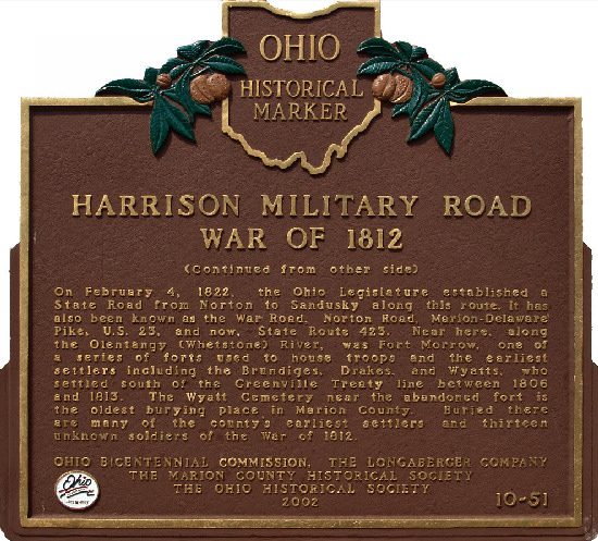
Side B: (Continued from other side) On February 4, 1822, the Ohio Legislature established a State Road from Norton to Sandusky along this route. It has also been known as the War Road, Norton Road, Marion-Delaware Pike, U.S. 23, and now, State Route 423. Near here, along the Olentangy (Whetstone) River, was Fort Morrow, one of a series of forts used to house troops and the earliest settlers including the Brundiges, Drakes, and Wyatts, who settled south of the Greenville Treaty line between 1806 and 1813. The Wyatt Cemetery near the abandoned fort is the oldest burying place in Marion County. Buried there are many of the county’s earliest settlers and thirteen unknown soldiers of the War of 1812.
Sponsors: Ohio Bicentennial Commission, The Longaberger Company, The Marion County Historical Society, and The Ohio Historical Society