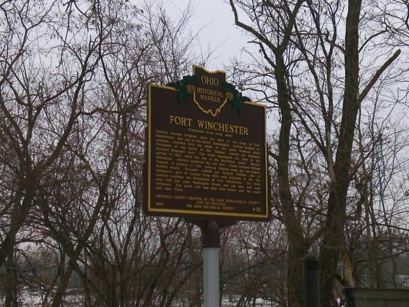
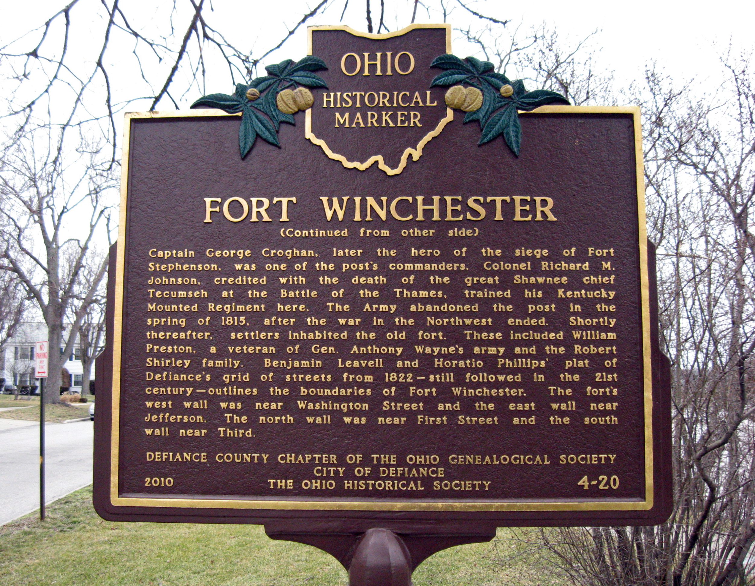
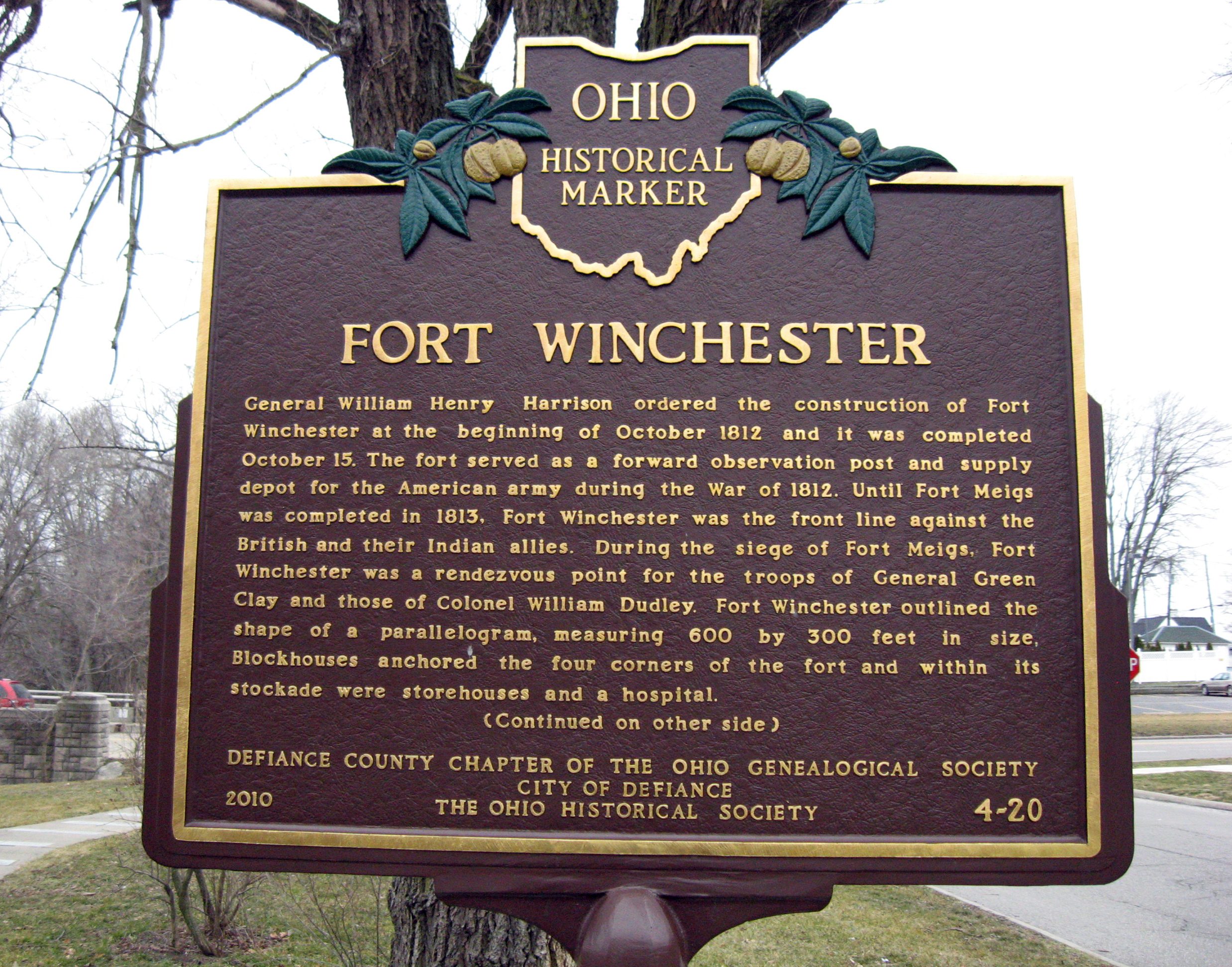
Side A: General William Henry Harrison ordered the construction of Fort Winchester at the beginning of October 1812 and it was completed October 15. The fort served as a forward observation post and supply depot for the American army during the War of 1812. Until Fort Meigs was completed in 1813, Fort Winchester was the front line against the British and their Indian allies. During the siege of Fort Meigs, Fort Winchester was a rendezvous point for the troops of General Green Clay and those of Colonel William Dudley. Fort Winchester outlined the shape of a parallelogram, measuring 600 by 300 feet in size. Blockhouses anchored the four corners of the fort and within its stockade were storehouses and a hospital.
Side B: Captain George Croghan, later the hero of the siege of Fort Stephenson, was one of the post’s commanders. Colonel Richard M. Johnson, credited with the death of the great Shawnee chief Tecumseh at the Battle of the Thames, trained his Kentucky Mounted Regiment here. The Army abandoned the post in the spring of 1815, after the war in the Northwest ended. Shortly thereafter, settlers inhabited the old fort. These included William Preston, a veteran of Gen. Anthony Wayne’s army and the Robert Shirley family. Benjamin Leavell and Horatio Phillips’ plat of Defiance’s grid of streets from 1822—still followed in the 21st century—outlines the boundaries of Fort Winchester. The fort’s west wall was near Washington Street and the east wall near Jefferson. The north wall was near First Street and the south wall near Third.
Sponsors: Defiance County Chapter of the Ohio Genealogical Society, City of Defiance, and The Ohio Historical Society