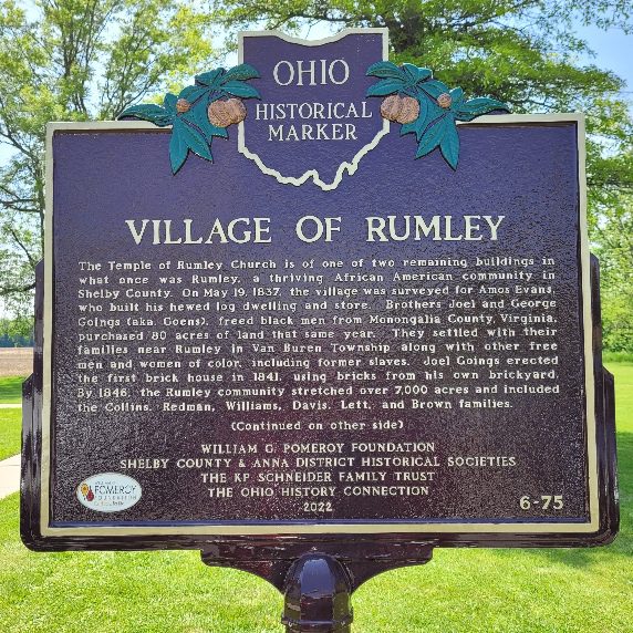
Side A: The Temple of Rumley Church is of one of two remaining buildings in what once was Rumley, a thriving African American community in Shelby County. On May 19, 1837, the village was surveyed for Amos Evans, who built his hewed log dwelling and store. Brothers Joel and George Goings (aka. Goens), freed black men from Monongalia County, Virginia, purchased 80 acres of land that same year. They settled with their families near Rumley in Van Buren Township along with other free men and women of color, including former slaves. Joel Goings erected the first brick house in 1841, using bricks from his own brickyard. By 1846, the Rumley community stretched over 7,000 acres and included the Collins, Redman, Williams, Davis, Lett, and Brown families. (Continued on other side)
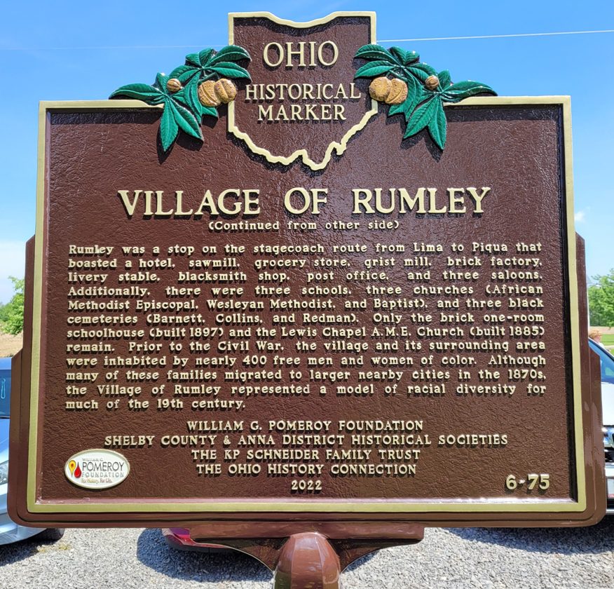
Side B: (Continued from other side) Rumley was a stop on the stagecoach route from Lima to Piqua that boasted a hotel, sawmill, grocery store, grist mill, brick factory, livery stable, blacksmith shop, post office, and three saloons. Additionally, there were three schools, three churches (African Methodist Episcopal, Wesleyan Methodist, and Baptist), and three black cemeteries (Barnett, Collins, and Redman). Only the brick one-room schoolhouse (built 1897) and the Lewis Chapel A.M.E. Church (built 1885) remain. Prior to the Civil War, the village and its surrounding area were inhabited by nearly 400 free men and women of color. Although many of these families migrated to larger nearby cities in the 1870s, the Village of Rumley represented a model of racial diversity for much of the 19th century.