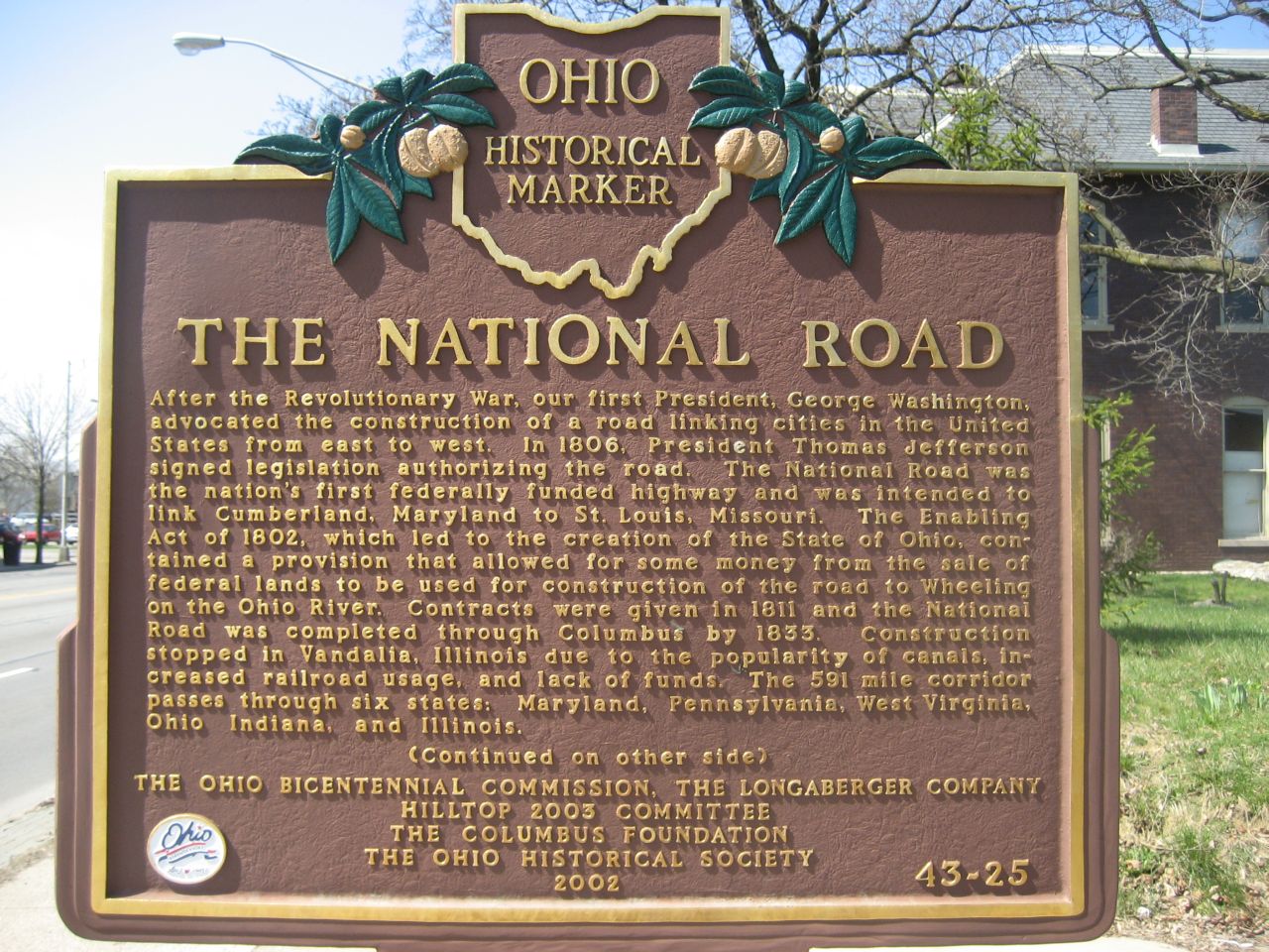
Side A: After the Revolutionary War, our first President, George Washington, advocated the construction of a road linking cities in the United States from east to west. In 1806, President Thomas Jefferson signed legislation authorizing the road. The National Road was the nation’s first federally funded highway and was intended to link Cumberland, Maryland to St. Louis, Missouri. The Enabling Act of 1802, which led to the creation of the state of Ohio, contained a provision that allowed for some money from the sale of federal lands to be used for construction of the road to Wheeling on the Ohio River. Contracts were given in 1811 and the National Road was completed through Columbus by 1833. Construction stopped in Vandalia, Illinois due to the popularity of canals, increased railroad usage, and lack of funds. The 591-mile corridor passes through six states: Maryland, Pennsylvania, West Virginia, Ohio, Indiana, and Illinois.
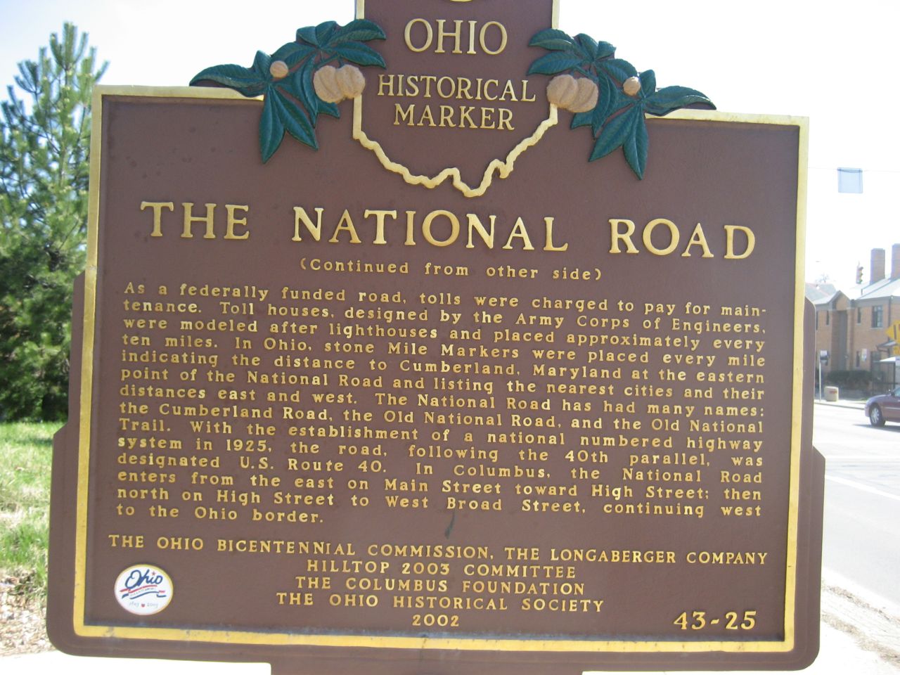
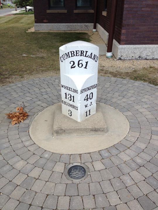
Side B: As a federally funded road, tolls were charged to pay for maintenance. Toll houses, designed by the Army Corps of Engineers, were modeled after lighthouses and placed approximately every ten miles. In Ohio, stone Mile Markers were placed every mile indicating the distance to Cumberland, Maryland at the eastern point of the National Road and listing the nearest cities and their distances east and west. The National Road has had many names: the Cumberland Road, the Old National Road, and the Old National Trail. With the establishment of a national numbered highway system in 1925, the road, following the 40th parallel, was designated U.S. Route 40. In Columbus, the National Road enters from the east on Main Street toward High Street; then north on High Street to West Broad Street, continuing west to the Ohio border.
Sponsors: Ohio Bicentennial Commission, The Longaberger Company, Hilltop 2003 Committee, The Columbus Foundation, and The Ohio Historical Society