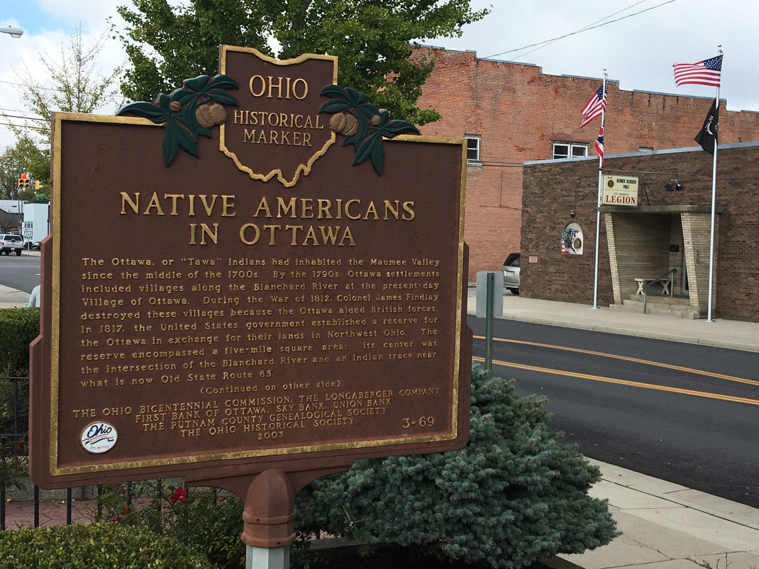
Side A: The Ottawa, or “Tawa” Indians had inhabited the Maumee Valley since the middle of the 1700s. By the 1790s, Ottawa settlements included villages along the Blanchard River at the present-day Village of Ottawa. During the War of 1812, Colonel James Findlay destroyed these villages because the Ottawa aided British forces. In 1817, the United States government established a reserve for the Ottawa in exchange for their lands in Northwest Ohio. The reserve encompassed a five-mile square area; its center was the intersection of the Blanchard River and an Indian trace near what is now Old State Route 65. (Continued on other side)
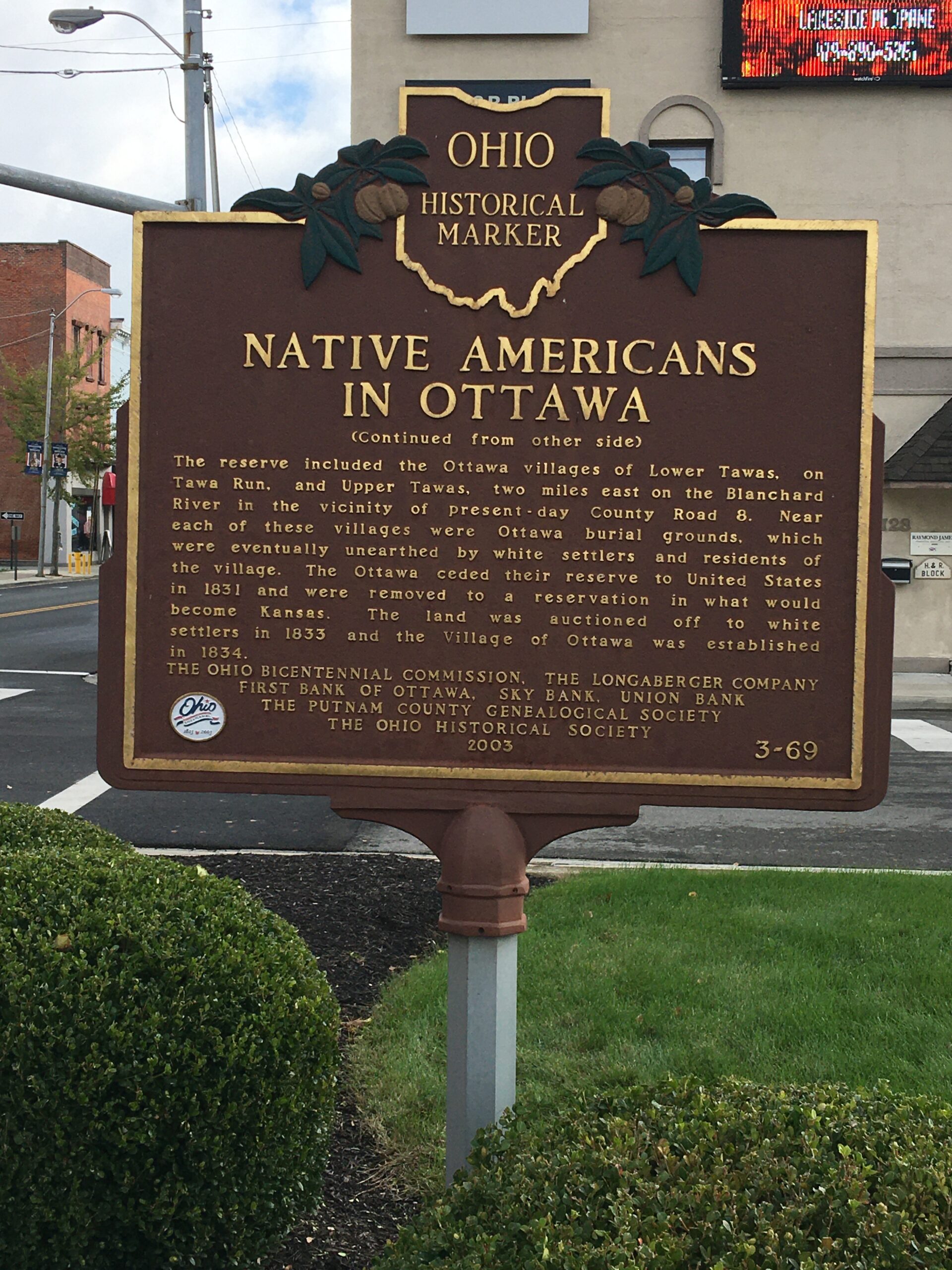
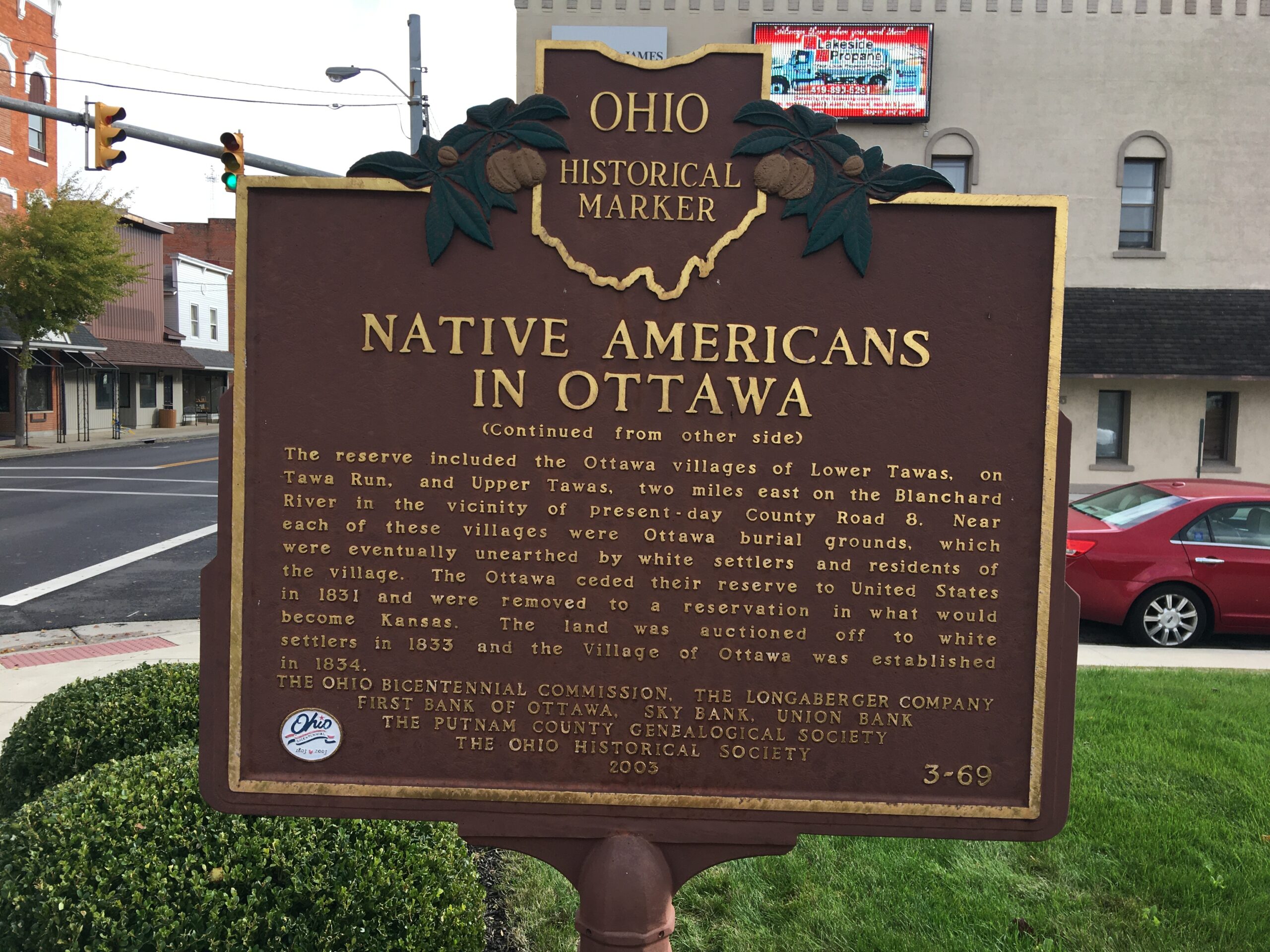
Side B: (Continued from other side) The reserve included the Ottawa villages of Lower Tawas, on Tawa Run, and Upper Tawas, two miles east on the Blanchard River in the vicinity of present-day County Road 8. Near each of these villages were Ottawa burial grounds, which were eventually unearthed by white settlers and residents of the village. The Ottawa ceded their reserve to United States in 1831 and were removed to a reservation in what would become Kansas. The land was auctioned off to white settlers in 1833 and the Village of Ottawa was established in 1834.
Sponsors: Ohio Bicentennial Commission, The Longaberger Company, First Bank of Ottawa, Sky Bank, Union Bank, The Putnam County Genealogical Society, and The Ohio Historical Society