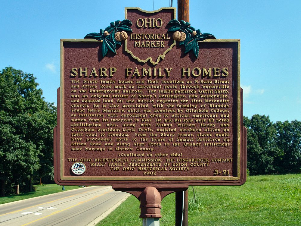
Side A: The Sharp family homes and their locations on N. State Street and Africa Road mark an important route through Westerville on the Underground Railroad. The family patriarch, Garrit Sharp, was an original settler of Sharp’s Settlement, now Westerville, and donated land for and helped organize the first Methodist church. He is also associated with the founding of Blendon Young Men’s Seminary, which was acquired by Otterbein College, an institution with enrollment open to African Americans and women from its inception in 1847. He and his sons were all noted abolitionists who, along with Bishop William Hanby and Otterbein president Lewis Davis, assisted southern slaves on their road to freedom. From the Sharp homes, slaves would have proceeded north to the house of Samuel Patterson on Africa Road and along Alum Creek to the Quaker settlement near Marengo in Morrow County.
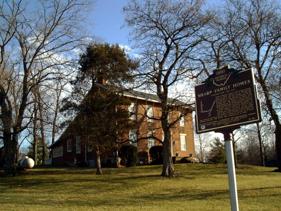
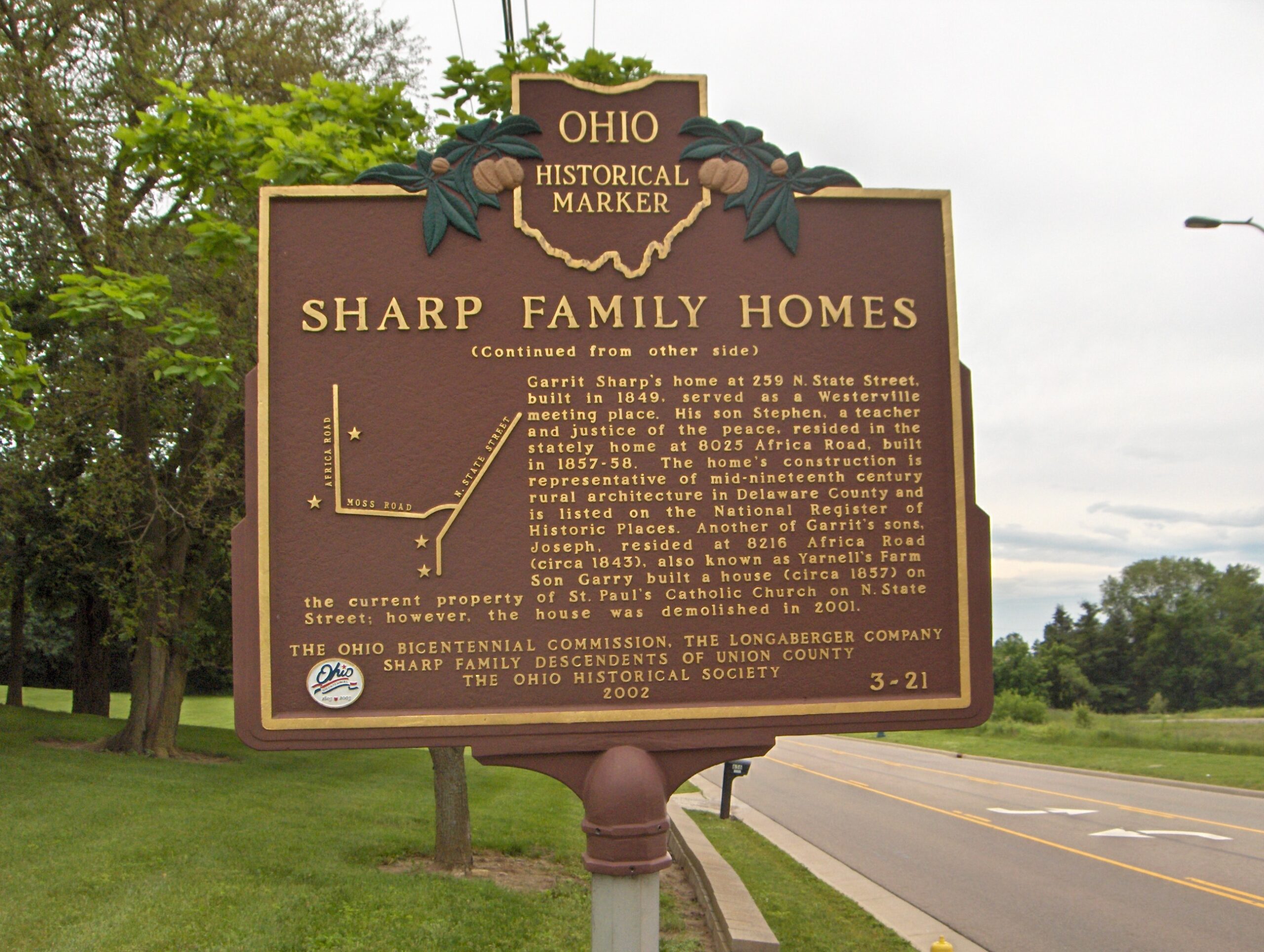
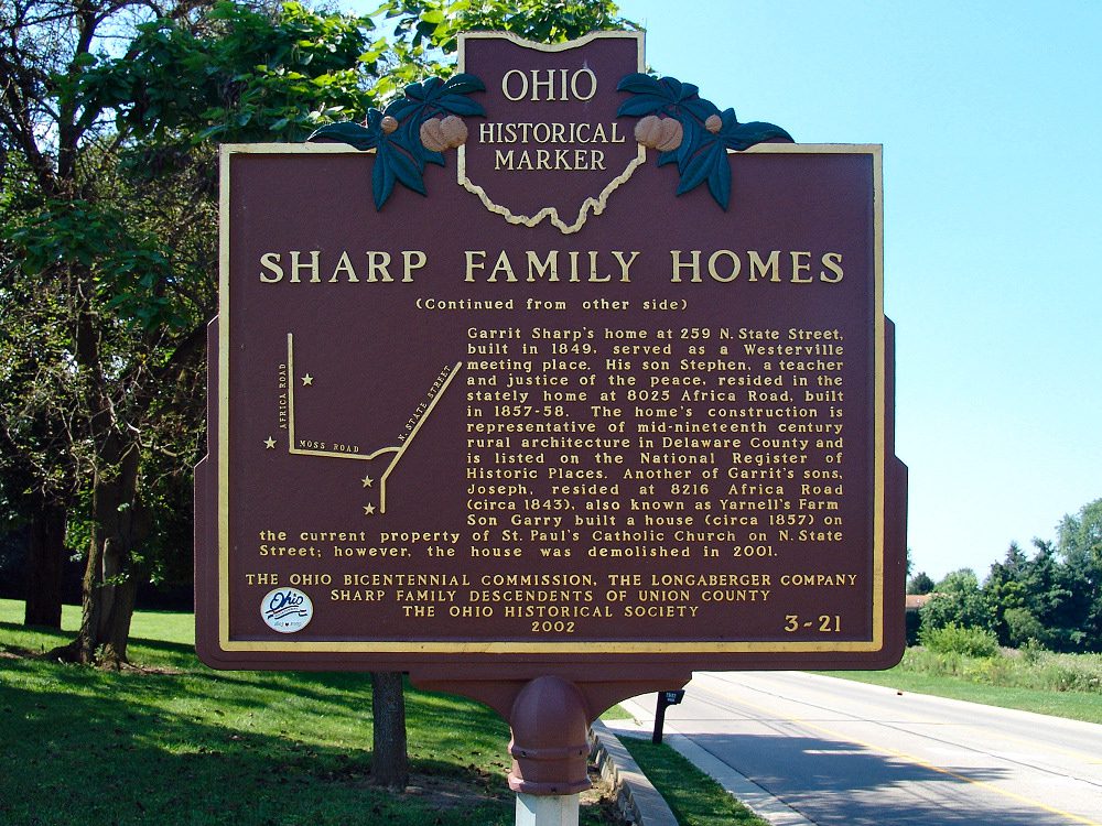
Side B: Garrit Sharp’s home at 259 N. State Street, built in 1849, served as a Westerville meeting place. His son Stephen, a teacher and justice of the peace, resided in the stately home at 8025 Africa Road, built in 1857-58. The home’s construction is representative of mid-nineteenth century rural architecture in Delaware County and is listed on the National Register of Historic Places. Another of Garrit’s sons, Joseph, resided at 8216 Africa Road (circa 1843), also known as Yarnell’s Farm. Son Garry built a house (circa 1857) on the current property of St. Paul’s Catholic Church on N. State Street; however, the house was demolished in 2001.
Sponsors: Ohio Bicentennial Commission, The Longaberger Company, Sharp Family Descendents of Union County, and The Ohio Historical Society