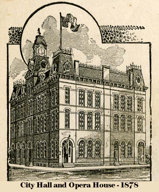
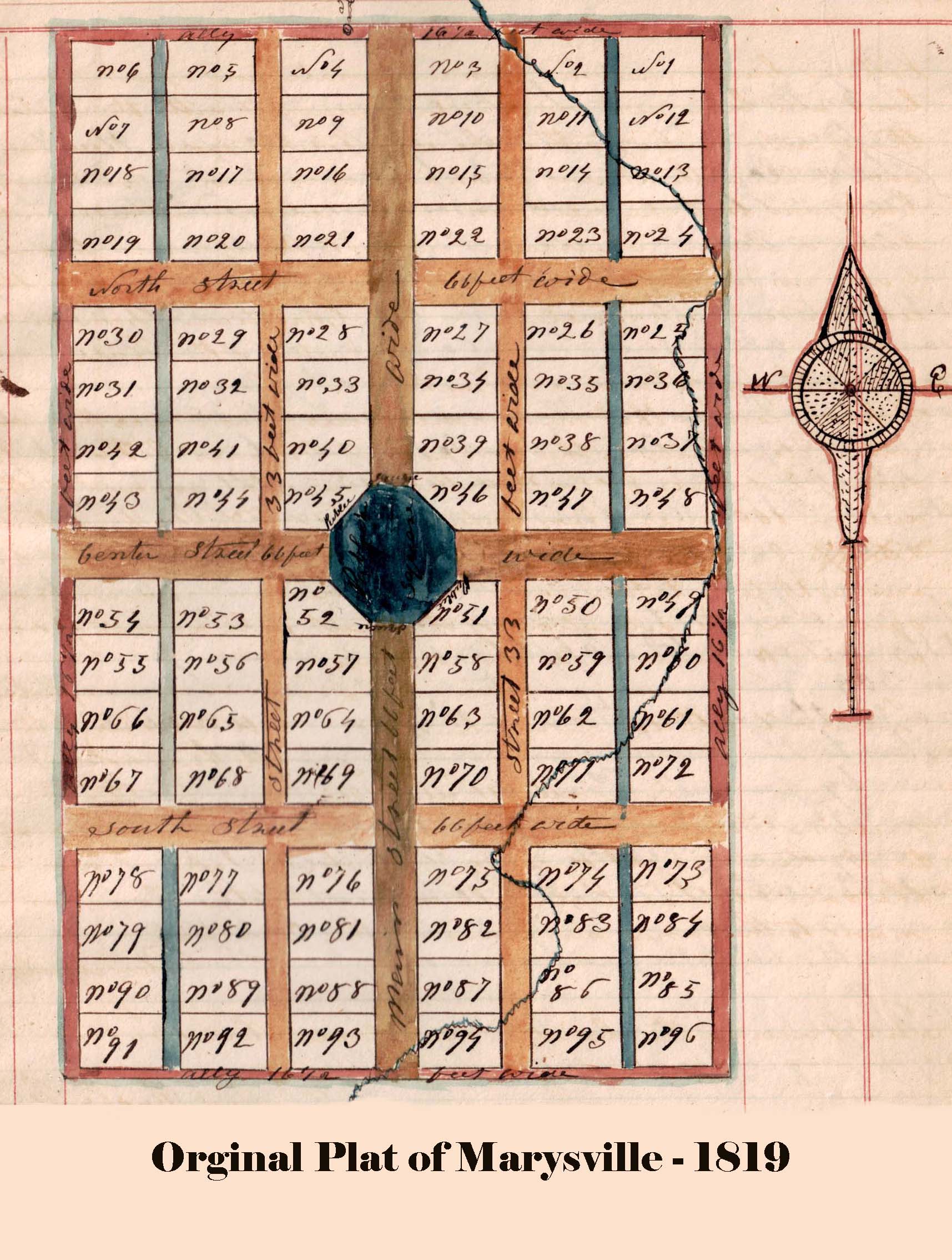
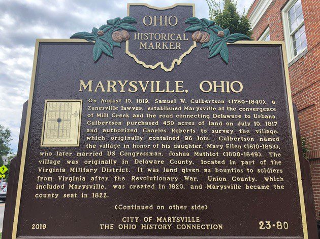
Side A: Marysville, Ohio. On August 10, 1819, Samuel W. Culbertson (1780-1840), a Zanesville lawyer, established Marysville at the convergence of Mill Creek and the road connecting Delaware to Urbana. Culbertson purchased 450 acres of land on July 10, 1817 and authorized Charles Roberts to survey the village, which originally contained 96 lots. Culbertson named the village in honor of his daughter, Mary Ellen (1810-1853), who later married US Congressman, Joshua Mathiot (1800-1849). The village was originally in Delaware County, located in part of the Virginia Military District. It was land given as bounties to soldiers from Virginia after the Revolutionary War. Union County, which included Marysville, was created in 1820, and Marysville became the county seat in 1822. (Continued on other side)
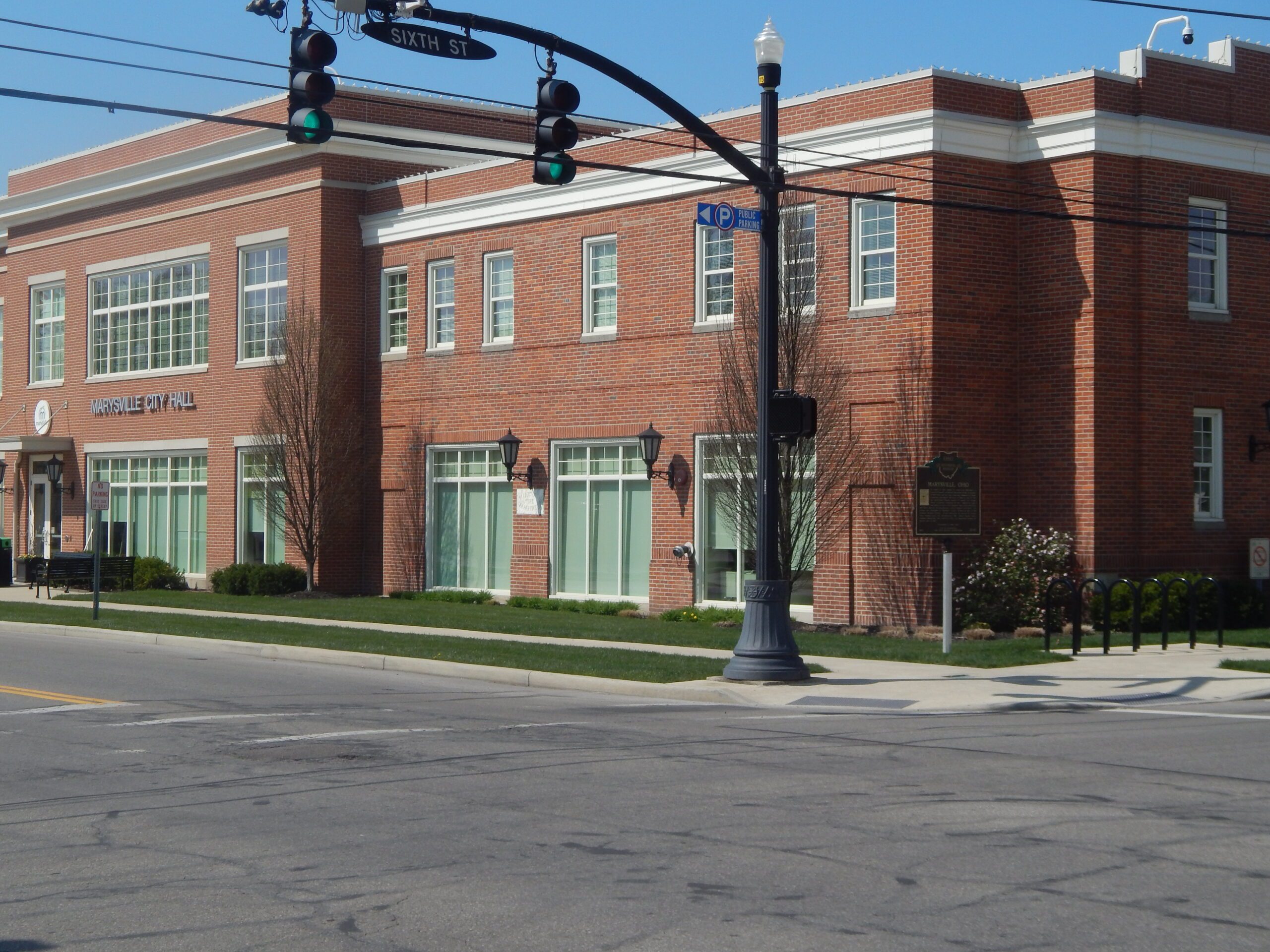
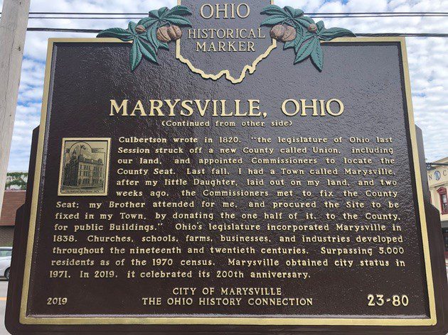
Side B: (Continued from other side) Culbertson wrote in 1820, “the legislature of Ohio last Session struck off a new County called Union, including our land, and appointed Commissioners to locate the County Seat. Last fall, I had a Town called Marysville, after my little Daughter, laid out on my land, and two weeks ago, the Commissioners met to fix the County Seat; my Brother attended for me, and procured the Site to be fixed in my Town, by donating the one half of it, to the County, for public Buildings.” Ohio’s legislature incorporated Marysville in 1838. Churches, schools, farms, businesses, and industries developed throughout the nineteenth and twentieth centuries. Surpassing 5,000 residents as of the 1970 census, Marysville obtained city status in 1971. In 2019, it celebrated its 200th anniversary.