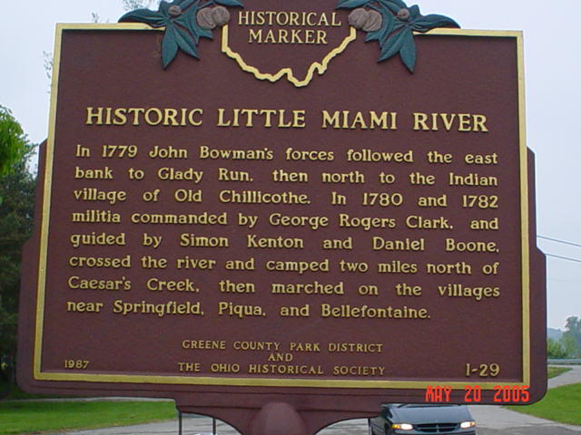
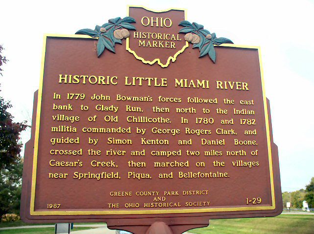
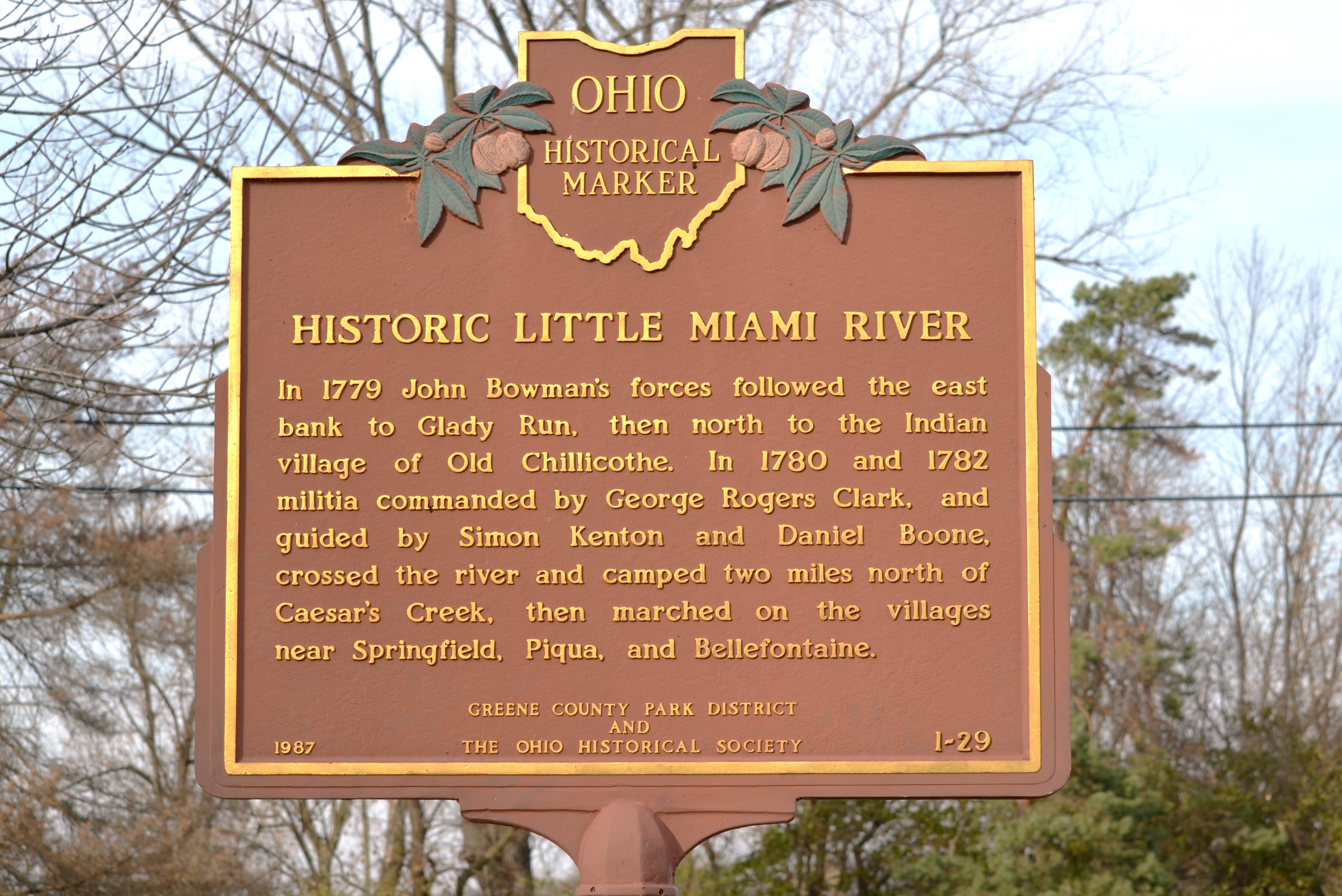
Side A: In 1779 John Bowman’s forces followed the east bank to Glady Run, then north to the Indian village of Old Chillicothe. In 1780 and 1782 militia commanded by George Rogers Clark, and guided by Simon Kenton and Daniel Boone, crossed the river and camped two miles north of Caesar’s Creek, then marched on the villages near Springfield, Piqua, and Bellefontaine.
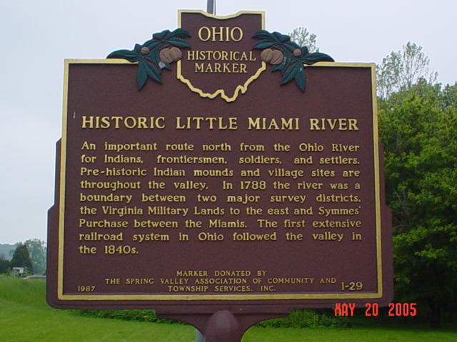
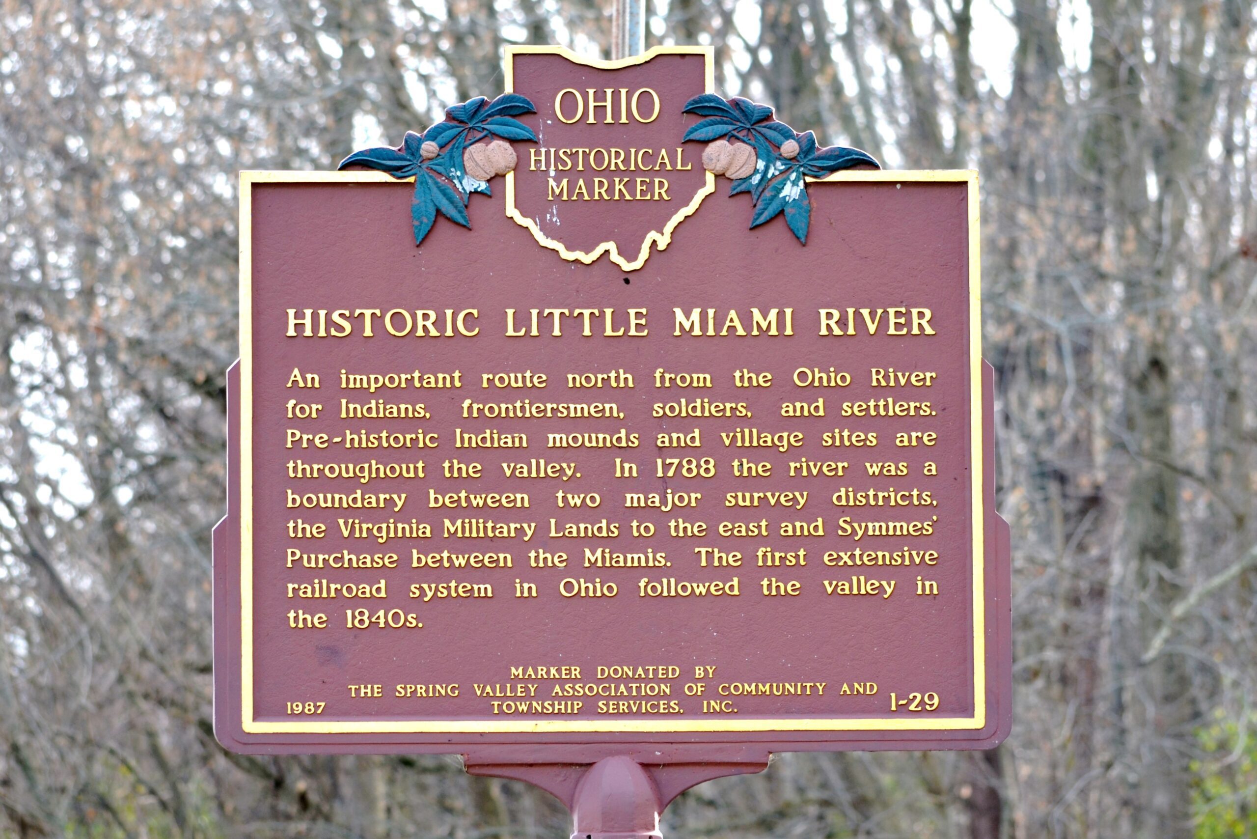
Side B: An important route north from the Ohio River for Indians, frontiersmen, soldiers, and settlers. Pre-historic Indian mounds and village sites are throughout the valley. In 1788 the river was a boundary between two major survey districts, The Virginia Military Lands to the east and Symme’s Purchase between the Miamis. The first extensive railroad system in Ohio followed the valley in the 1840s.