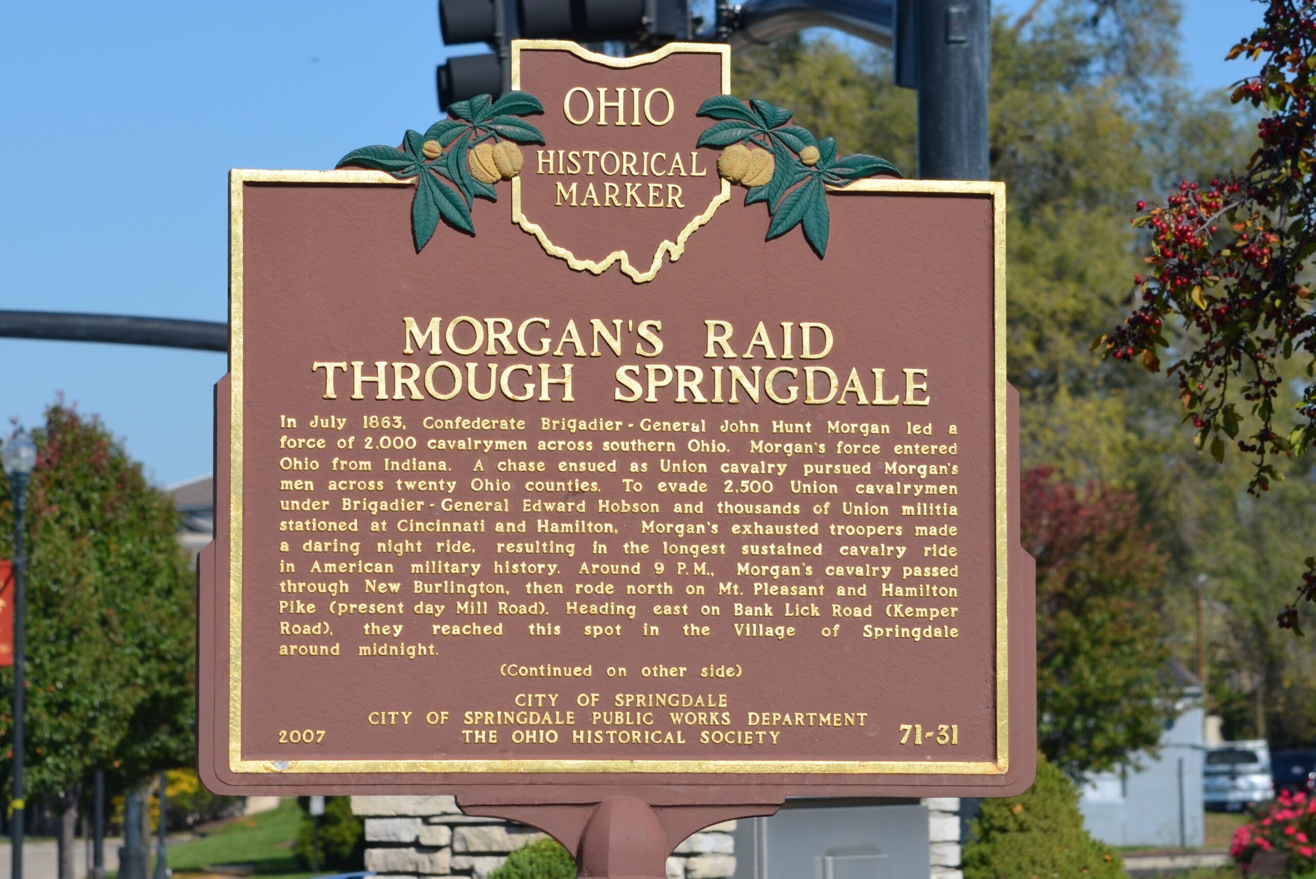
Side A: In July 1863, Confederate Brigadier-General John Hunt Morgan led a force of 2,000 cavalrymen across southern Ohio. Morgan’s force entered Ohio from Indiana. A chase ensued as Union cavalry pursued Morgan’s men across twenty Ohio counties. To evade 2,500 Union cavalrymen under Brigadier-General Edward Hobson and thousands of Union militia stationed at Cincinnati and Hamilton, Morgan’s exhausted troopers made a daring night ride, resulting in the longest sustained cavalry ride in American military history. Around 9 P.M., Morgan’s cavalry passed through New Burlington, then rode north on Mt. Pleasant and Hamilton Pike (present day Mill Road). Heading east on Bank Lick Road (Kemper Road), they reached this spot in the Village of Springdale around midnight. (Continued on other side)
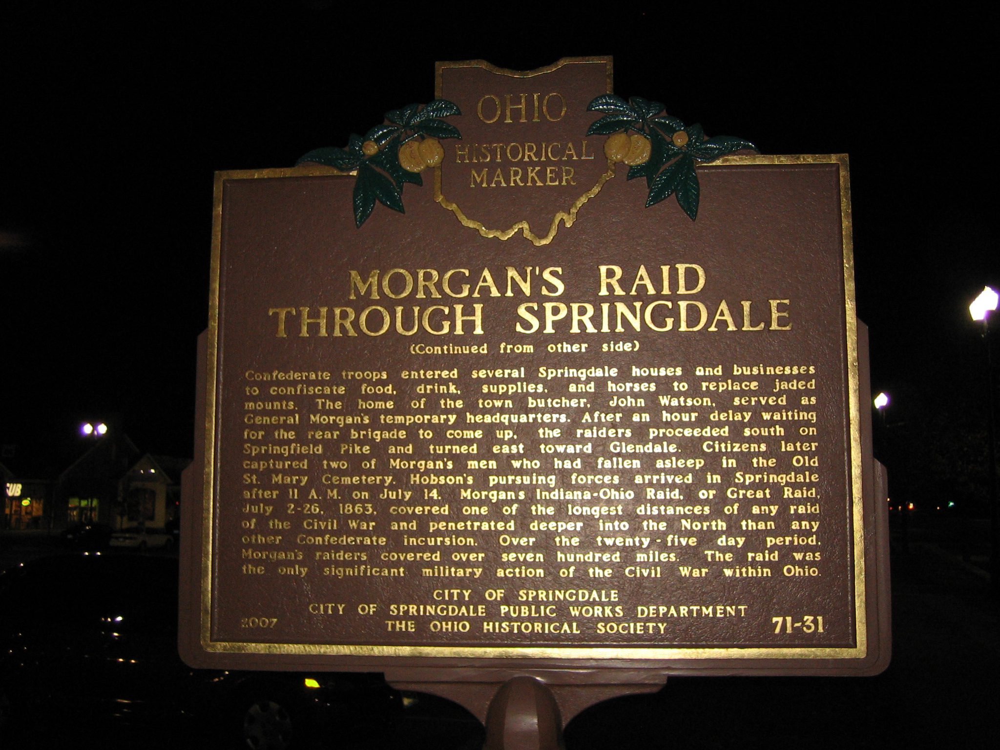
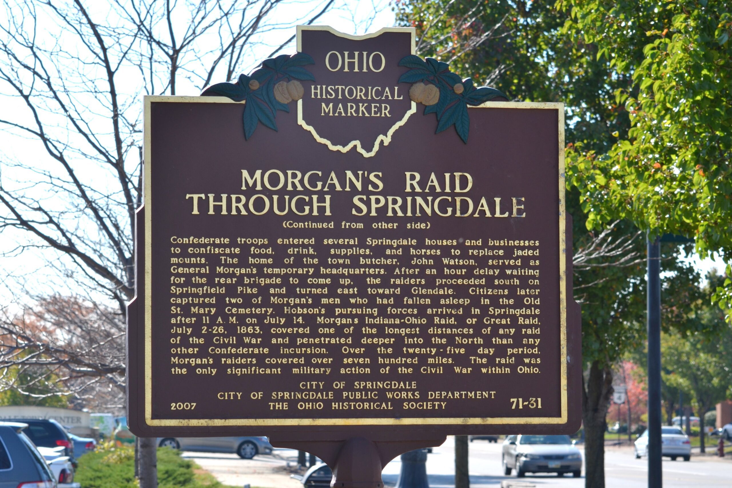
Side B: (Continued from other side) Confederate troops entered several Springdale houses and businesses to confiscate food, drink, supplies, and horses to replace jaded mounts. The home of the town butcher, John Watson, served as General Morgan’s temporary headquarters. After an hour delay waiting for the rear brigade to come up, the raiders proceeded south on Springfield Pike and turned east toward Glendale. Citizens later captured two of Morgan’s men who had fallen asleep in the Old St. Mary Cemetery. Hobson’s pursuing forces arrived in Springdale after 11 A.M. on July 14. Morgan’s Indiana-Ohio Raid, or Great Raid, July 2-26, 1863, covered one of the longest distances of any raid of the Civil War and penetrated deeper into the North than any other Confederate incursion. Over the twenty-five day period, Morgan’s raiders covered over seven hundred miles. The raid was the only significant military action of the Civil War within Ohio.
Sponsors: City of Springdale, City of Springdale Public Works Department, and The Ohio Historical Society