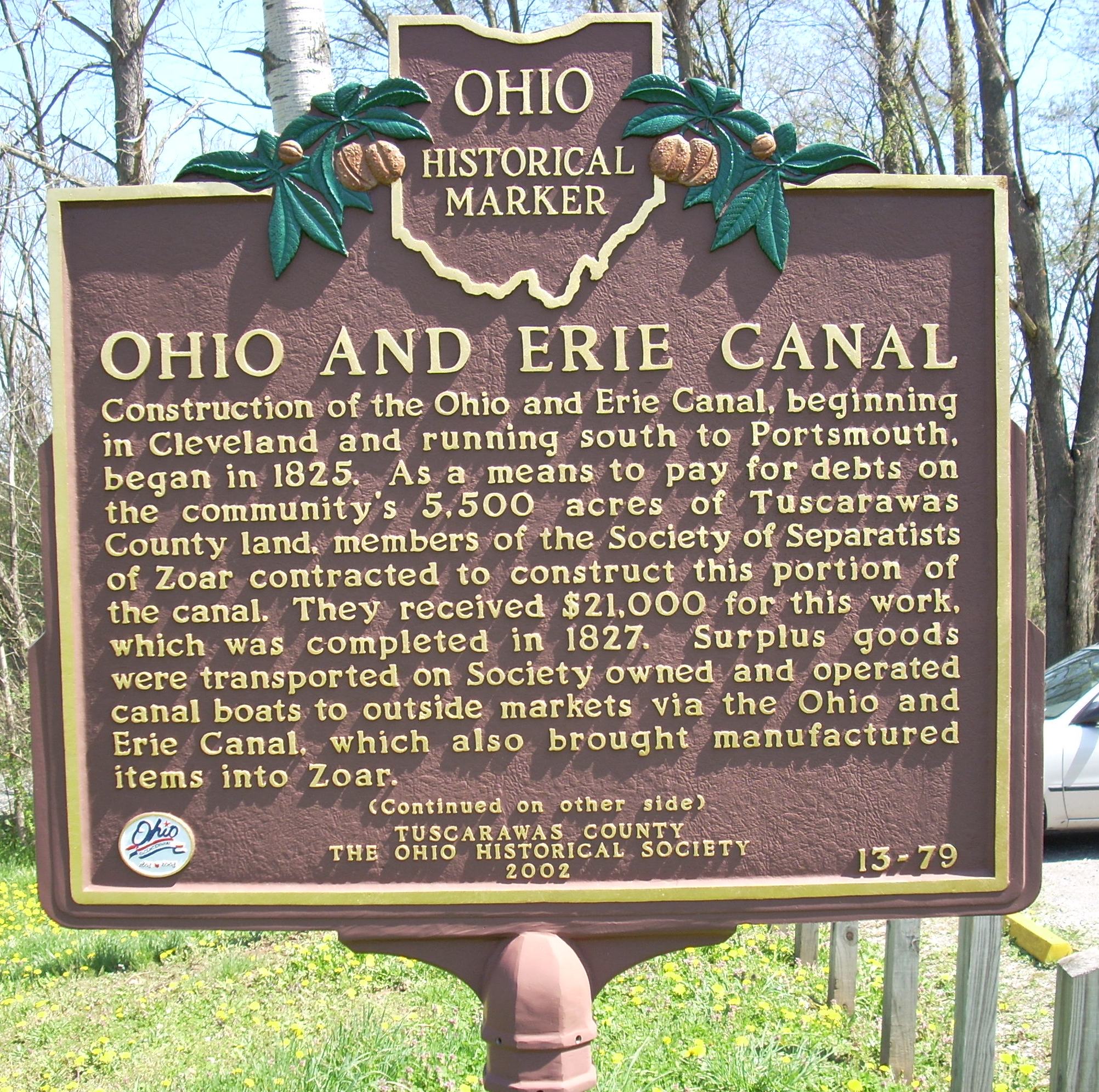
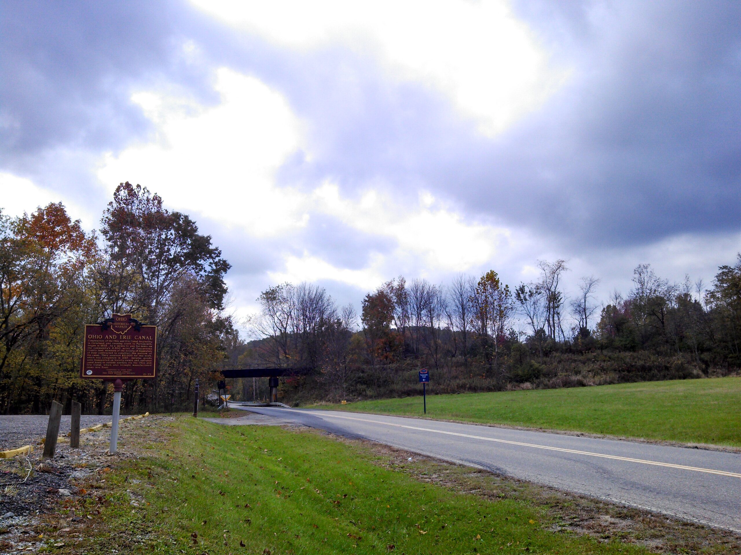
Side A: Construction of the Ohio and Erie Canal, beginning in Cleveland and running south to Portsmouth, began in 1825. As a means to pay for debts on the community’s 5,500 acres of Tuscarawas County land, members of the Society of Separatists of Zoar contracted to construct this portion of the canal. They received $21,000 for this work, which was completed in 1827. Surplus goods were transported on Society owned and operated canal boats to outside markets via the Ohio and Erie Canal, which also brought manufactured items into Zoar. (continued on other side)
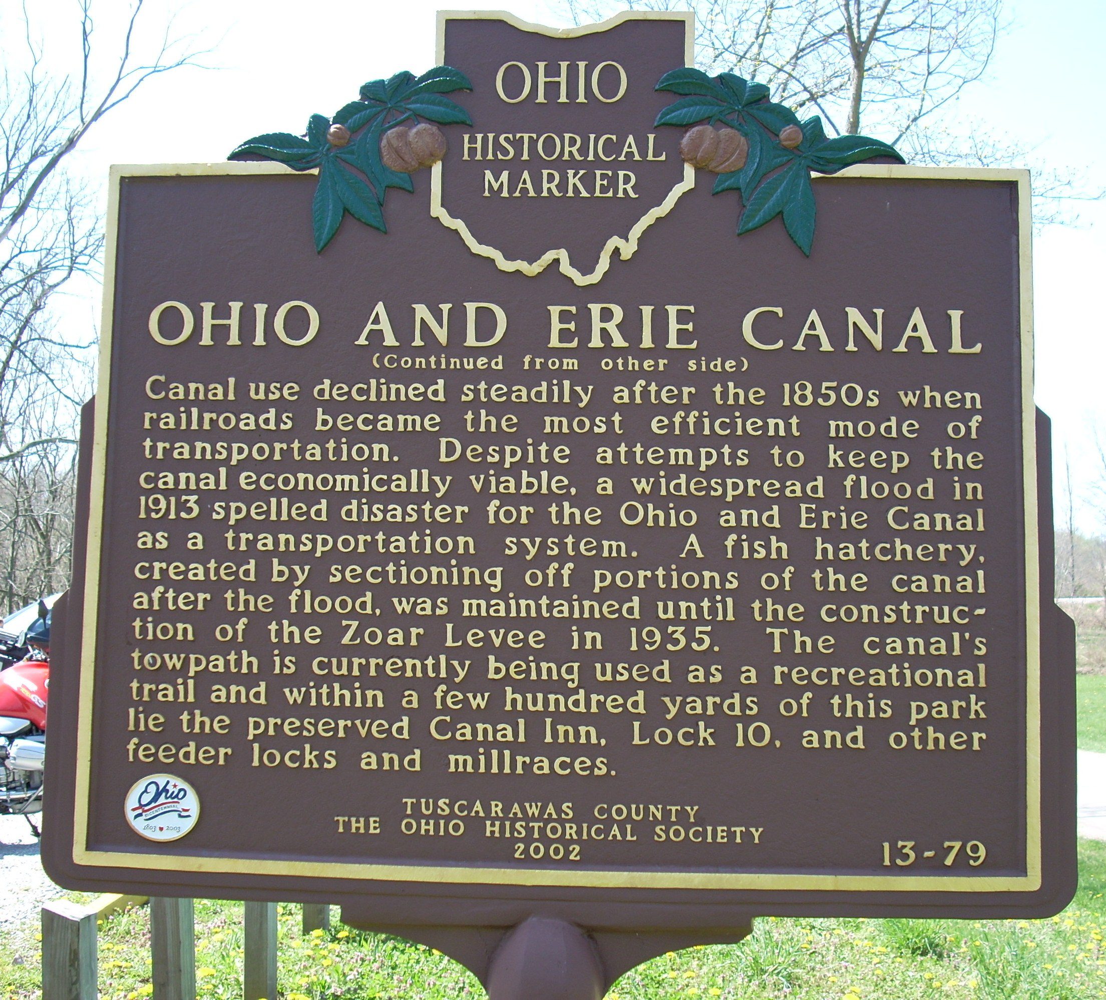
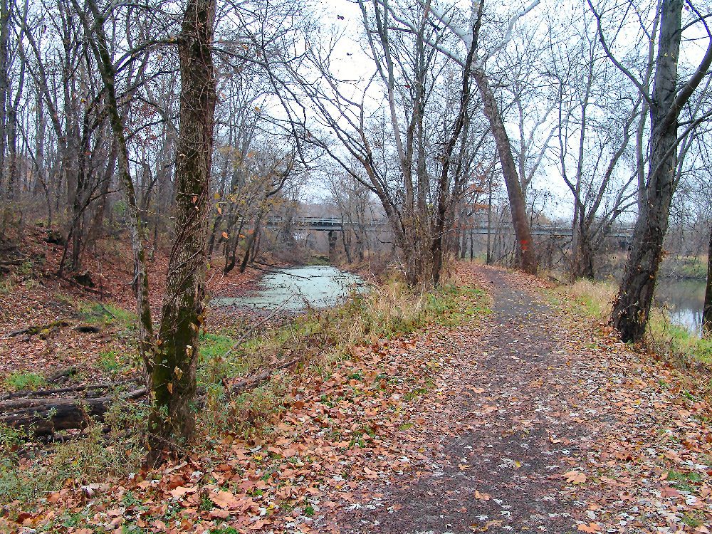
Side B: (continued from other side) Canal use declined steadily after the 1850s when railroads became the most efficient mode of transportation. Despite attempts to keep the canal economically viable, a widespread flood in 1913 spelled disaster for the Ohio and Erie Canal as a transportation system. A fish hatchery, created by sectioning off portions of the canal after the flood, was maintained until the construction of the Zoar Levee in 1935. The canal’s towpath is currently being used as a recreational trail and within a few hundred yards of this park lie the preserved Canal Inn, Lock 10, and other feeder locks and millraces.