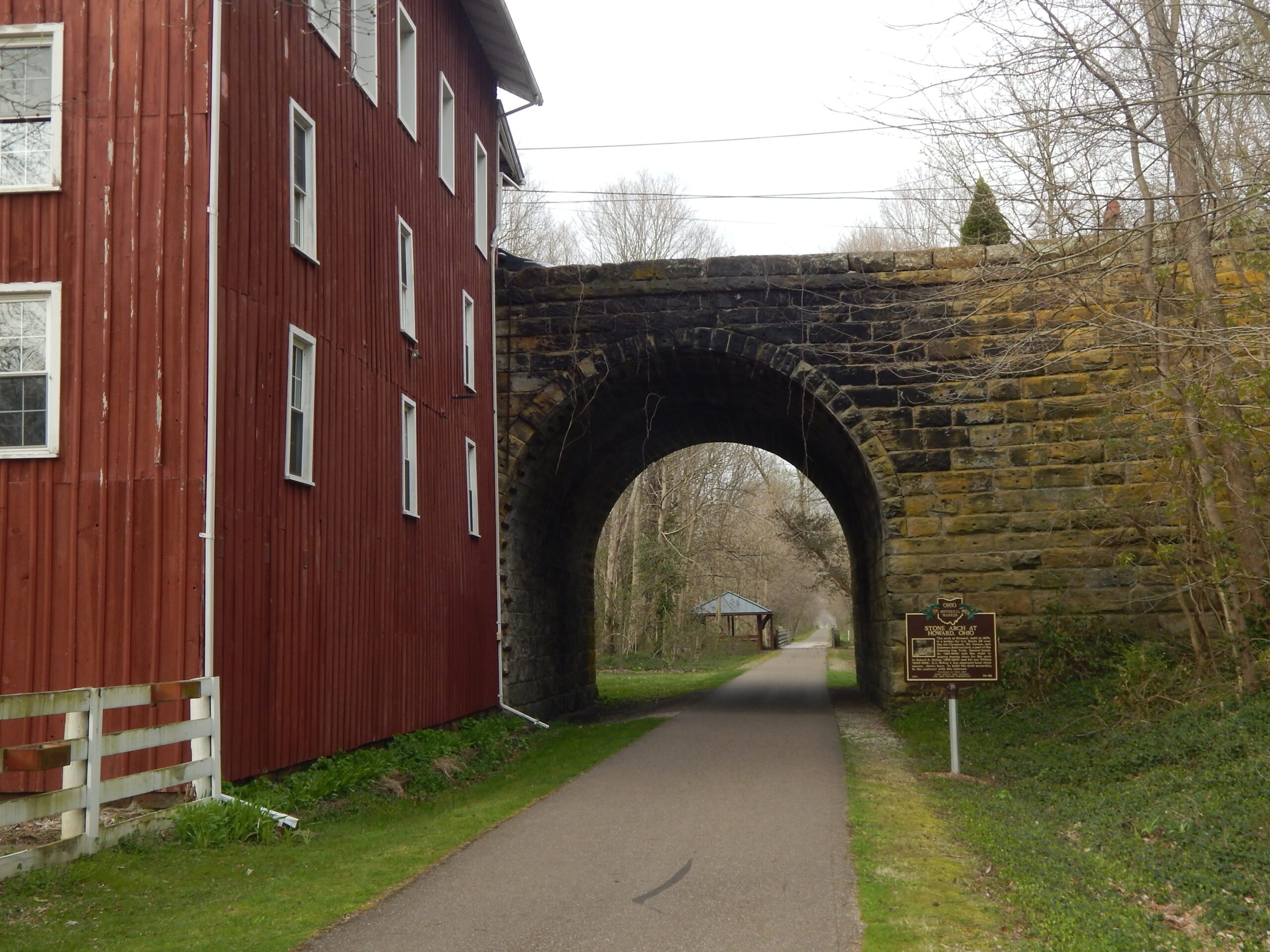
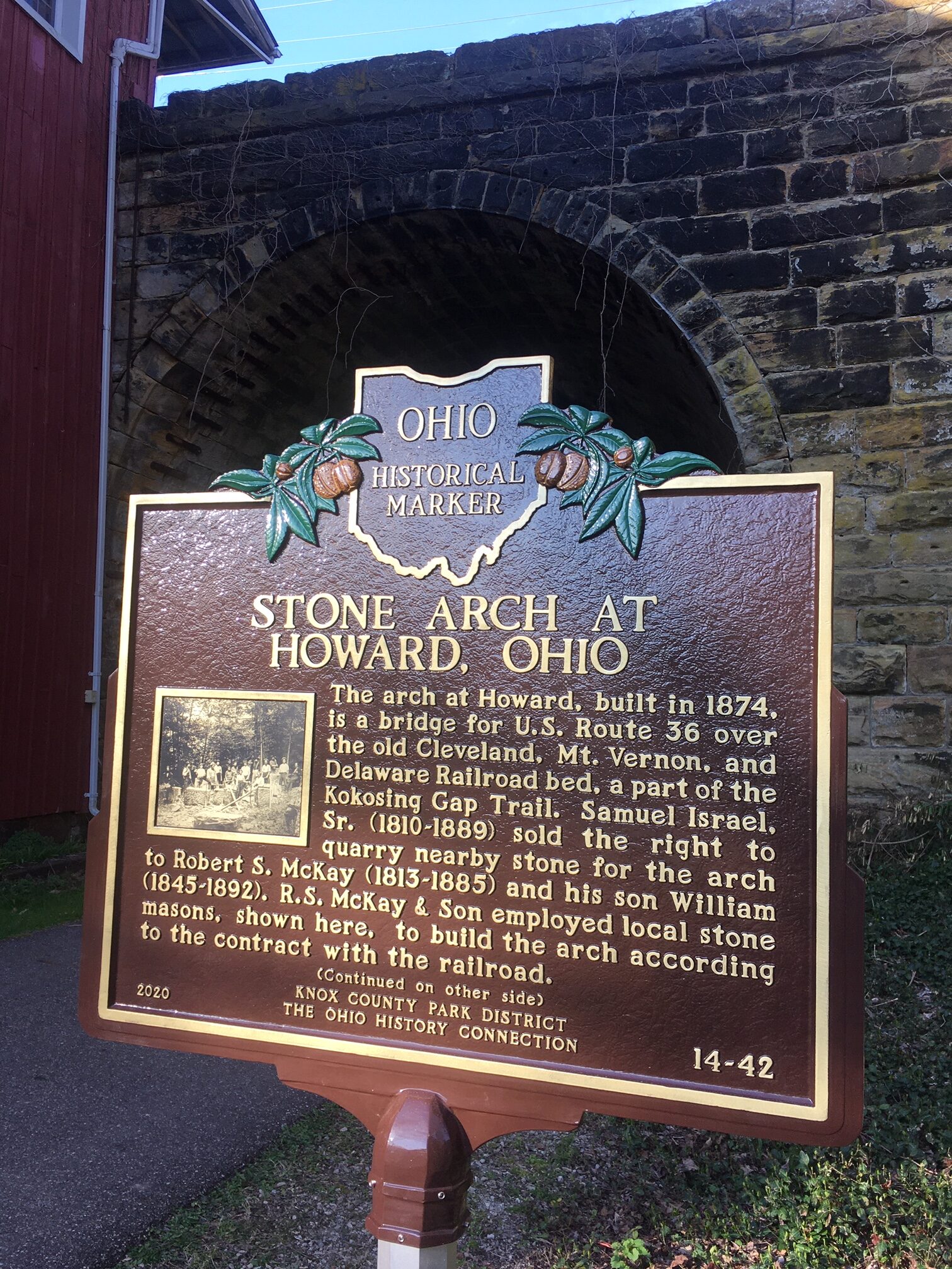
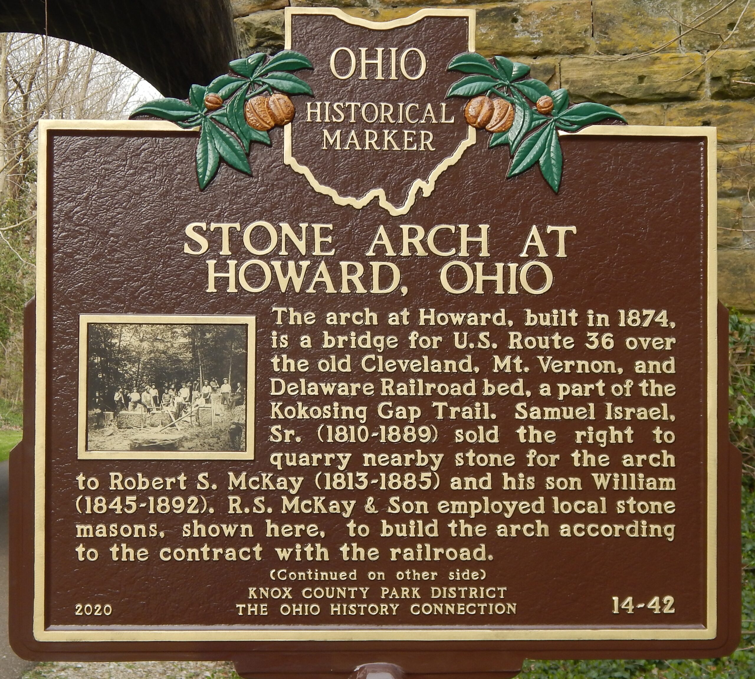
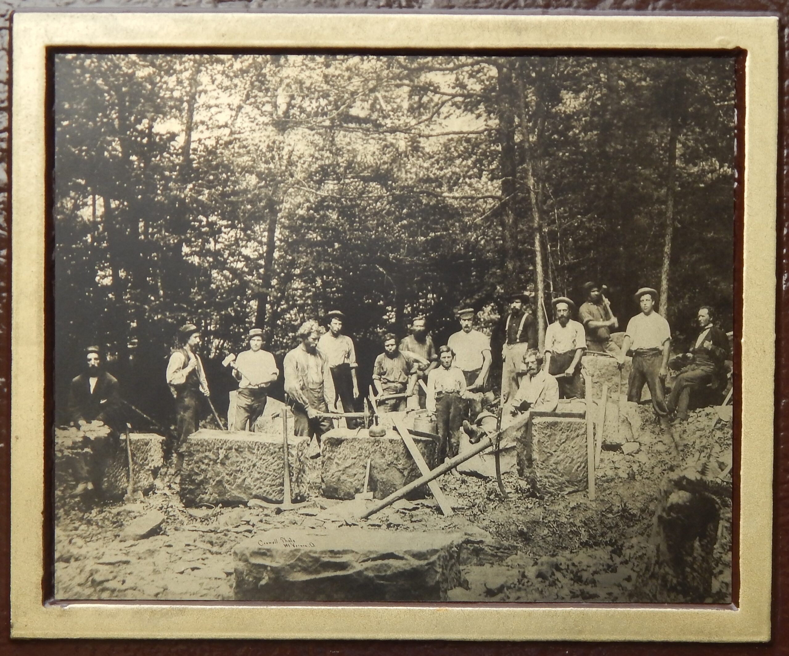
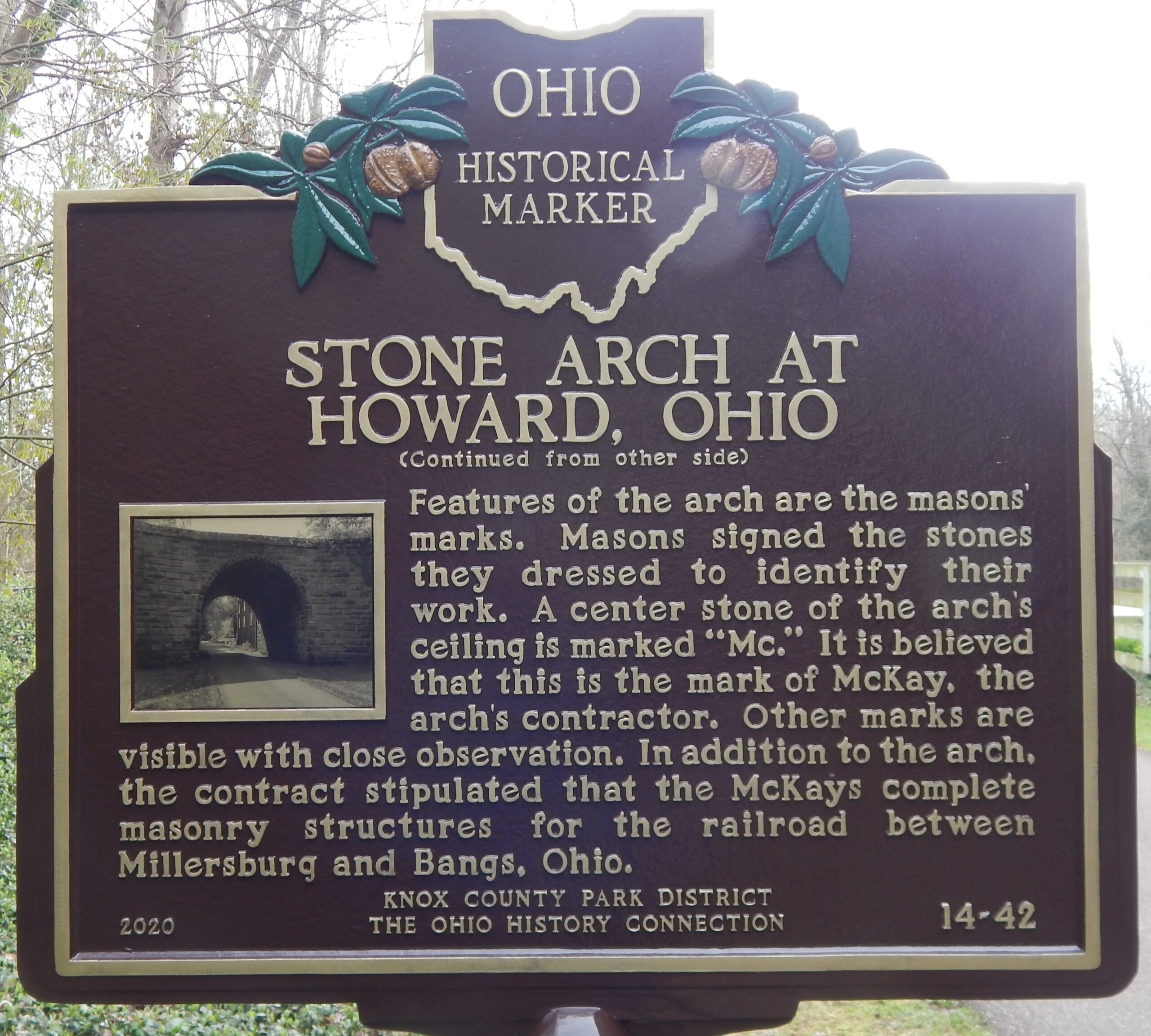
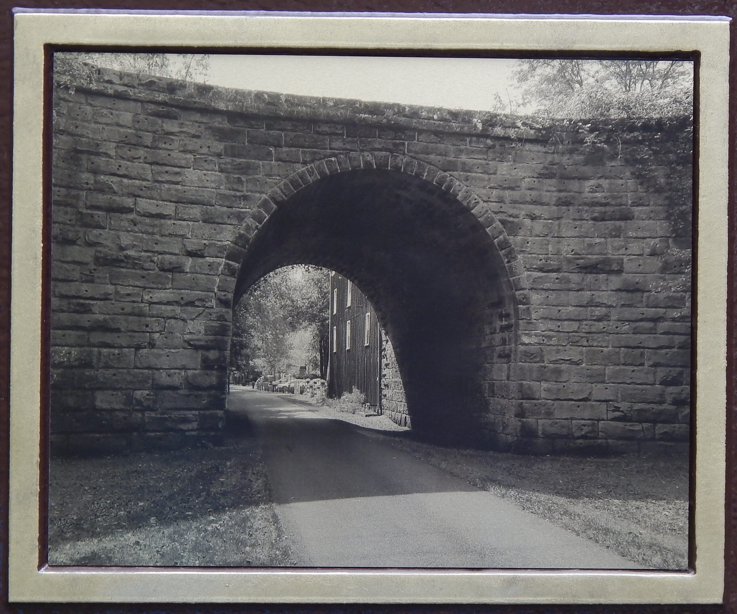
Side A: Stone Arch at Howard, Ohio. The arch at Howard, built in 1874, is a bridge for U.S. Route 36 over the old Cleveland, Mt. Vernon, and Delaware Railroad bed, a part of the Kokosing Gap Trail. Samuel Israel, Sr. (1810-1889) sold the right to quarry nearby stone for the arch to Robert S. McKay (1813-1885) and his son William (1845-1892). R.S. McKay & Son employed local stone masons, shown here, to build the arch according to the contract with the railroad. (Continued on other side)
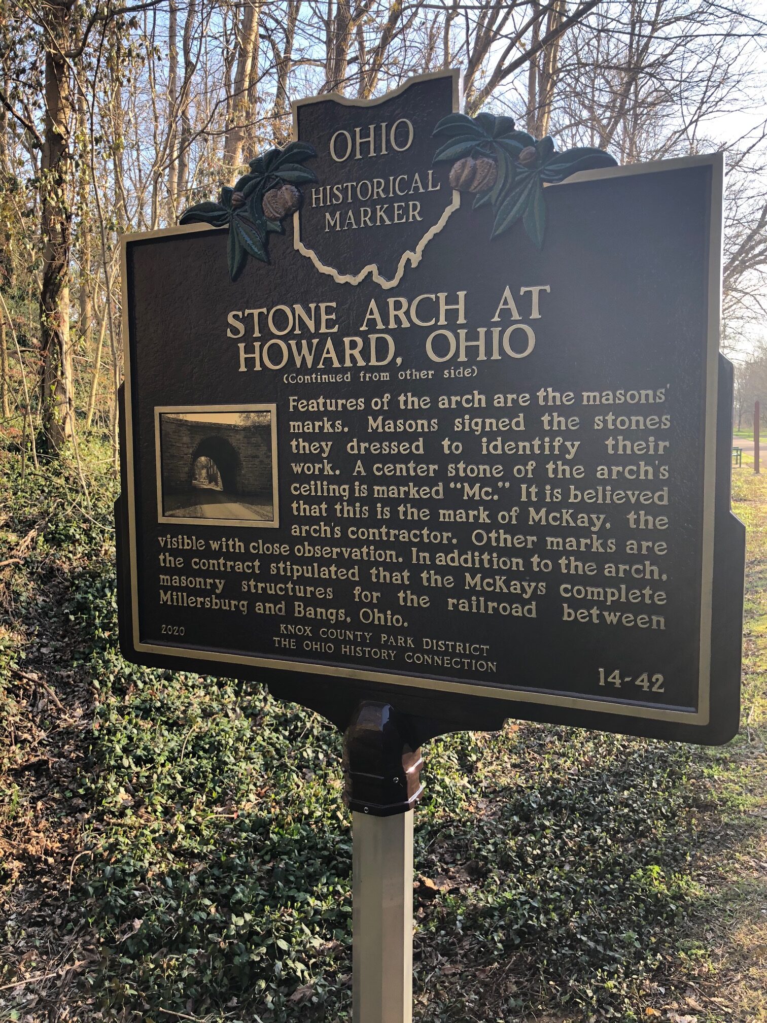
Side B: (Continued from other side) Features of the arch are the masons’ marks. Masons signed the stones they dressed to identify their work. A center stone of the arch’s ceiling is marked “Mc.” It is believed that this is the mark of McKay, the arch’s contractor. Other marks are visible with close observation. In addition to the arch, the contract stipulated that the McKays complete masonry structures for the railroad between Millersburg and Bangs, Ohio.