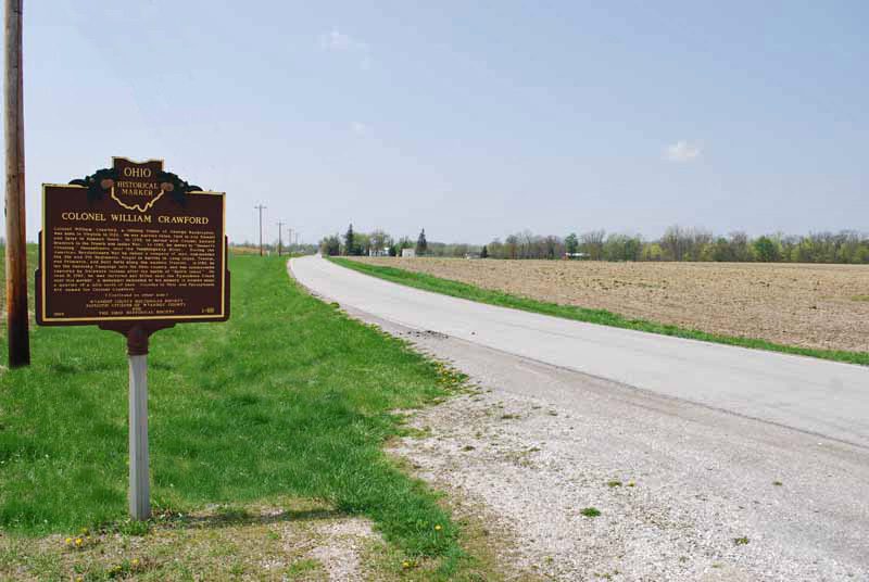
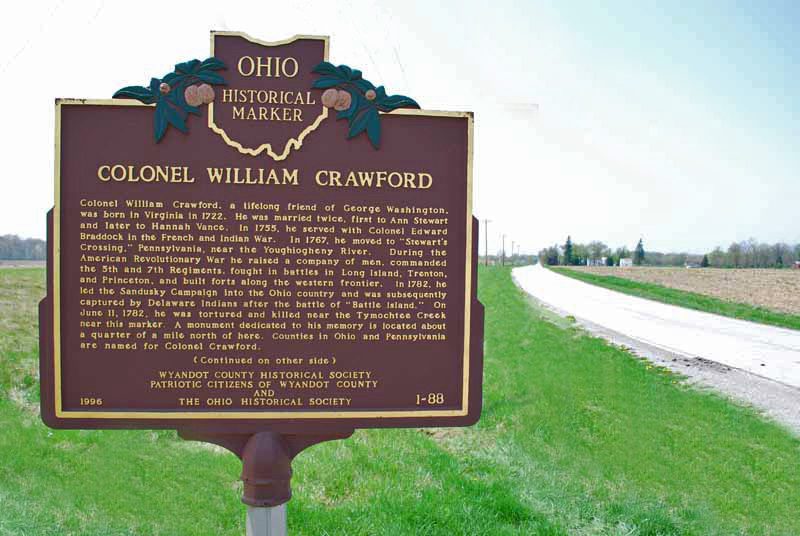
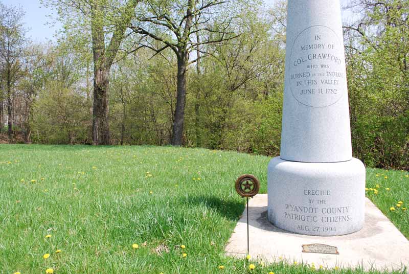
Side A: Colonel William Crawford, a lifelong friend of George Washington, was born in Virginia in 1722. He was married twice, first to Ann Stewart and later to Hannah Vance. In 1755, he served with Colonel Edward Braddock in the French and Indian war. In 1767, he moved to “Stewart’s Crossing,” Pennsylvania, near the Youghiogheny River. During the Revolutionary War he raised a company of men, commanded the 5th and 7th Regiments, fought in battles in Long Island, Trenton, and Princeton, and built forts along the western frontier. In 1782, he led the Sandusky Campaign into the Ohio country and was subsequently captured by Delaware Indians after the battle of “Battle Island.” On June 11, 1782, he was tortured and killed near the Tymochtee Creek near this marker. A monument dedicated to his memory is located about a quarter mile north of here. Counties in Ohio and Pennsylvania are named for Colonel Crawford.
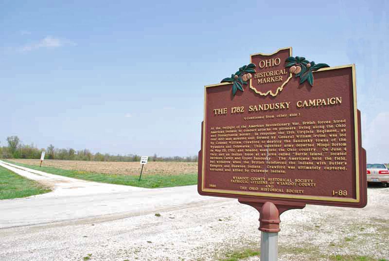
Side B: At the twilight of the American Revolutionary War, British forces hired American Indians to conduct attacks on pioneers living along the Ohio and Pennsylvania border. In response the 13th Virginia Regiment, an over 400-man mounted unit formed by General William Irvine, was led by Colonel William Crawford to destroy the Sandusky towns of the Wyandots and Delawares. This volunteer army departed Mingo Bottom on May 25, 1782, and headed west into the Ohio country. On June 4 they met an Indian force at an area called “Battle Island,” located between Carey and Upper Sandusky. The Americans held the field, but withdrew when the British reinforced the Indians with Butler’s Rangers and Shawnee Indians. Crawford was ultimately captured, tortured, and killed by Delaware Indians.
Sponsors: Wyandot County Historical Society, Patriotic Citizens of Wyandot County, and The Ohio Historical Society