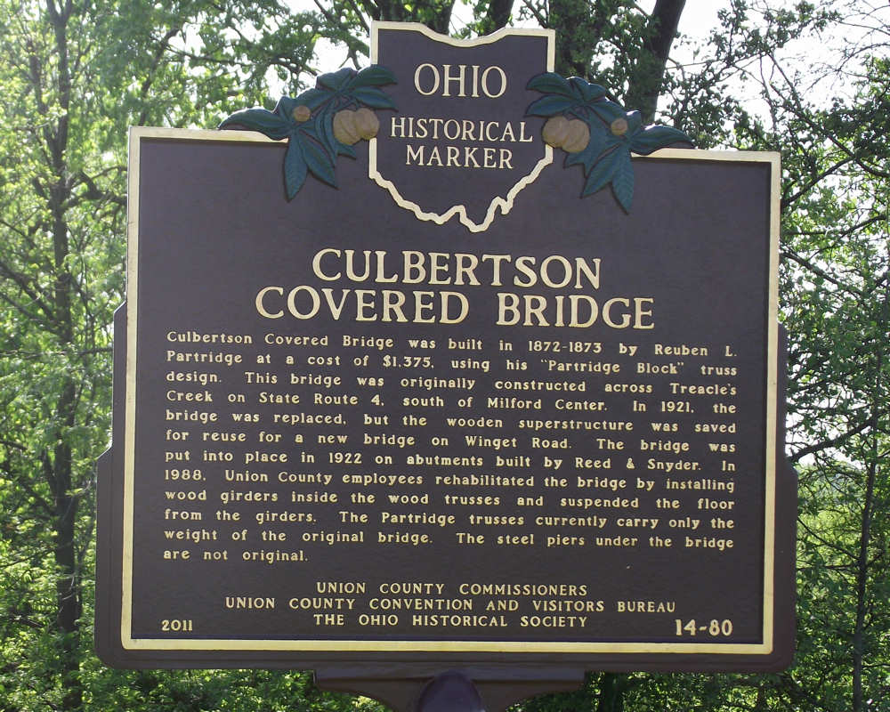
Side A: Culbertson Covered Bridge was built in 1872-1873 by Reuben L. Partridge at a cost of $1,375, using his “Partridge Block” truss design. This bridge was originally constructed across Treacle’s Creek on State Route 4, south of Milford Center. In 1921, the bridge was replaced, but the wooden superstructure was saved for reuse for a new bridge on Winget Road. The bridge was put into place in 1922 on abutments built by Reed & Snyder. In 1988, Union County employees rehabilitated the bridge by installing wood girders inside the wood trusses and suspended the floor from the girders. The Partridge trusses currently carry only the weight of the original bridge. The steel piers under the bridge are not original.
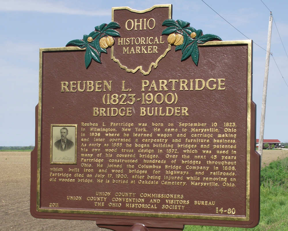
Side B: Reuben L. Partridge was born on September 10, 1823, in Wilmington, New York. He came to Marysville, Ohio in 1836 where he learned wagon and carriage making and later operated a carpentry and furniture business. As early as 1855 he began building bridges and patented his own wood truss design in 1872, which was used in many of his covered bridges. Over the next 45 years Partridge constructed hundreds of bridges throughout Ohio. He joined the Columbus Bridge Company in 1886, which built iron and wood bridges for highways and railroads. Partridge died on July 17, 1900, after being injured while removing an old wooden bridge. He is buried at Oakdale Cemetery, Marysville, Ohio.
Sponsors: Union County Commissioners, Union County Convention and Visitors Bureau, and The Ohio Historical Society