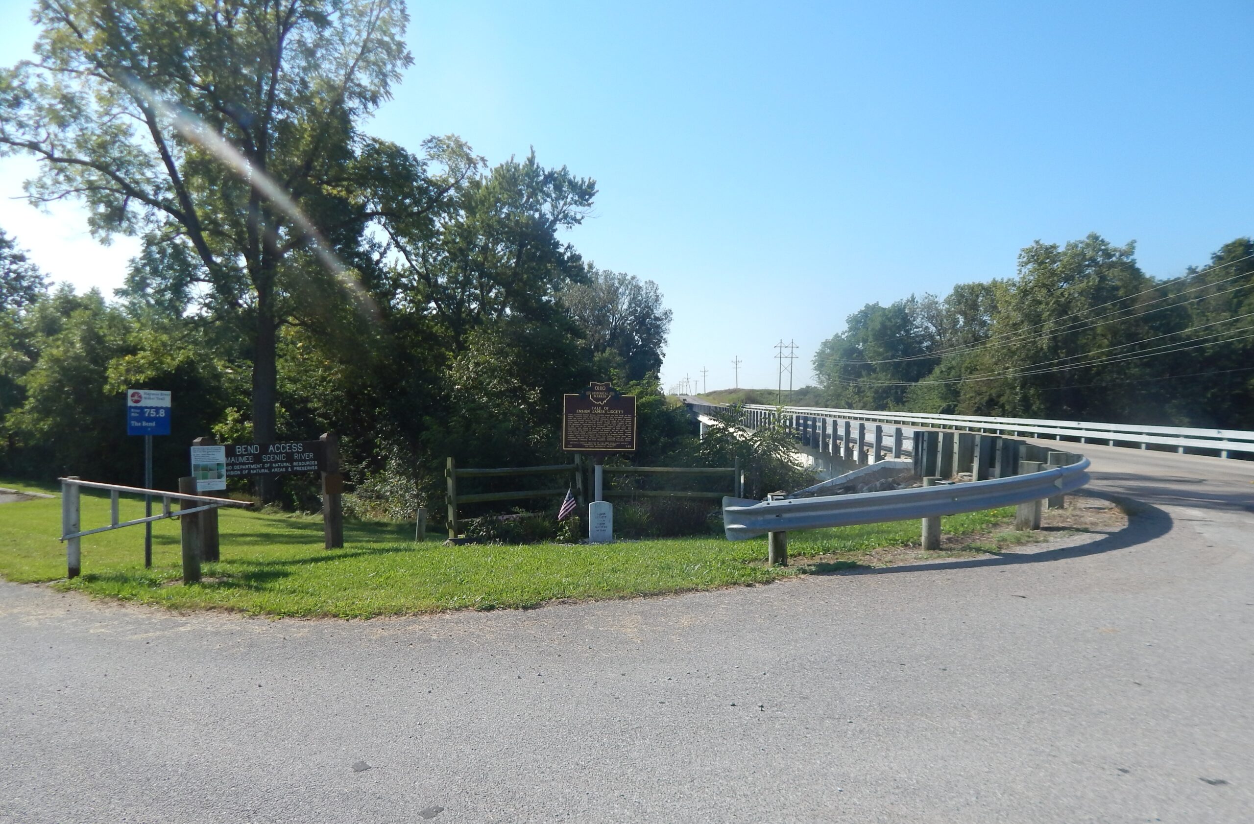
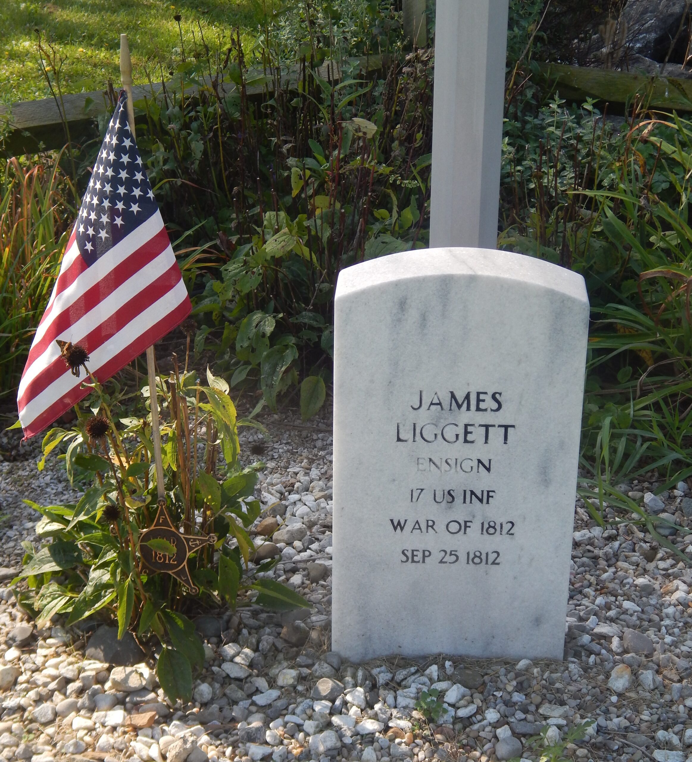
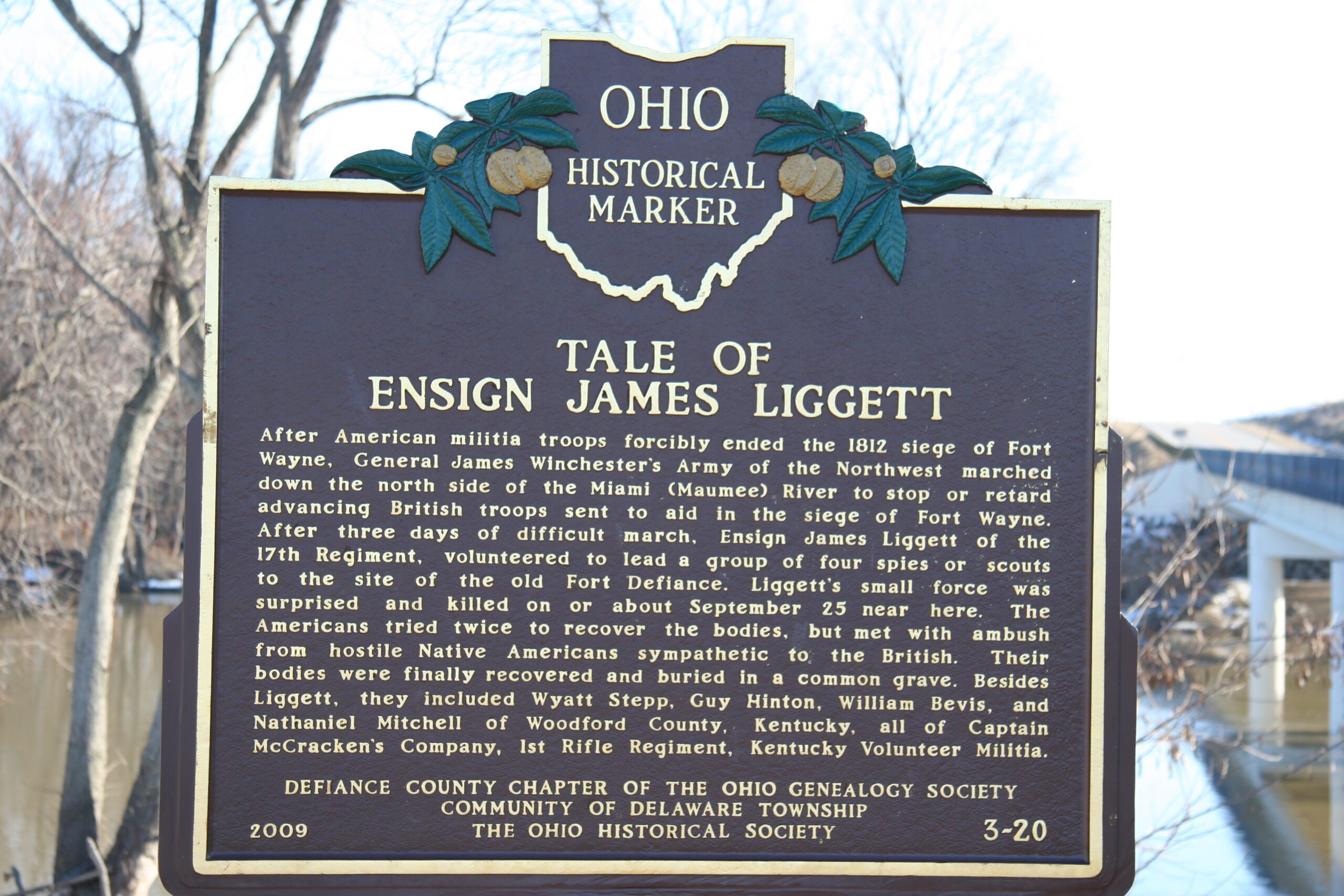
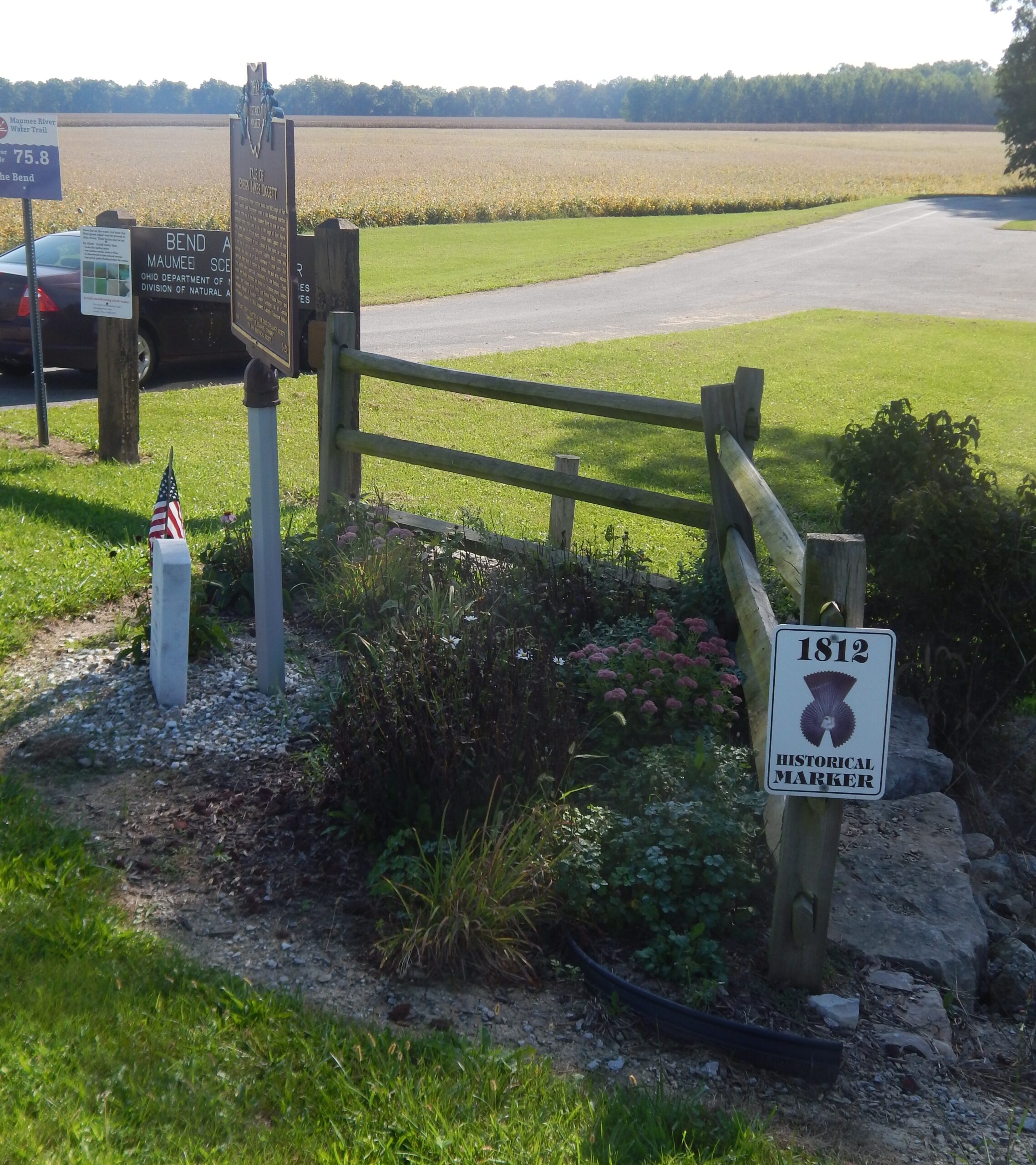
Side A: After American militia troops forcibly ended the 1812 siege of Fort Wayne, General James Winchester’s Army of the Northwest marched down the north side of the Miami [Maumee] River to stop or retard advancing British troops sent to aid in the siege of Fort Wayne. After three days of difficult march, Ensign James Liggett of the 17th Regiment, volunteered to lead a group of four spies or scouts to the site of the old Fort Defiance. Liggett’s small force was surprised and killed on or about September 25 near here. The Americans tried twice to recover the bodies, but met with ambush from hostile Native Americans sympathetic to the British. Their bodies were finally recovered and buried in a common grave. Besides Liggett, they included Wyatt Stepp, Guy Hinton, William Bevis, and Nathaniel Mitchell of Woodford County, Kentucky, all of Captain McCracken’s Company, 1st Rifle Regiment, Kentucky Volunteer Militia.
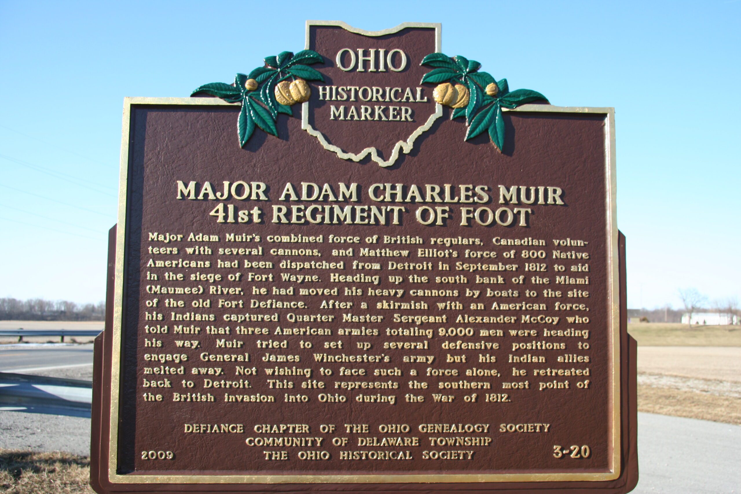
Side B: Major Adam Muir’s combined force of British regulars, Canadian volunteers with several cannons, and Matthew Elliot’s force of 800 Native Americans had been dispatched from Detroit in September 1812 to aid in the siege of Fort Wayne. Heading up the south bank of the Miami [Maumee] River, he had moved his heavy cannons by boats to the site of the old Fort Defiance. After a skirmish with an American force, his Indians captured Quarter Master Sergeant Alexander McCoy who told Muir that three American armies totaling 9,000 men were heading his way. Muir tried to set up several defensive positions to engage General James Winchester’s army but his Indian allies melted away. Not wishing to face such a force alone, he retreated back to Detroit. This site represents the southern most point of the British invasion into Ohio during the War of 1812.
Sponsors: Defiance County Chapter of the Ohio Genealogy Society, Community of Delaware Township, and The Ohio Historical Society