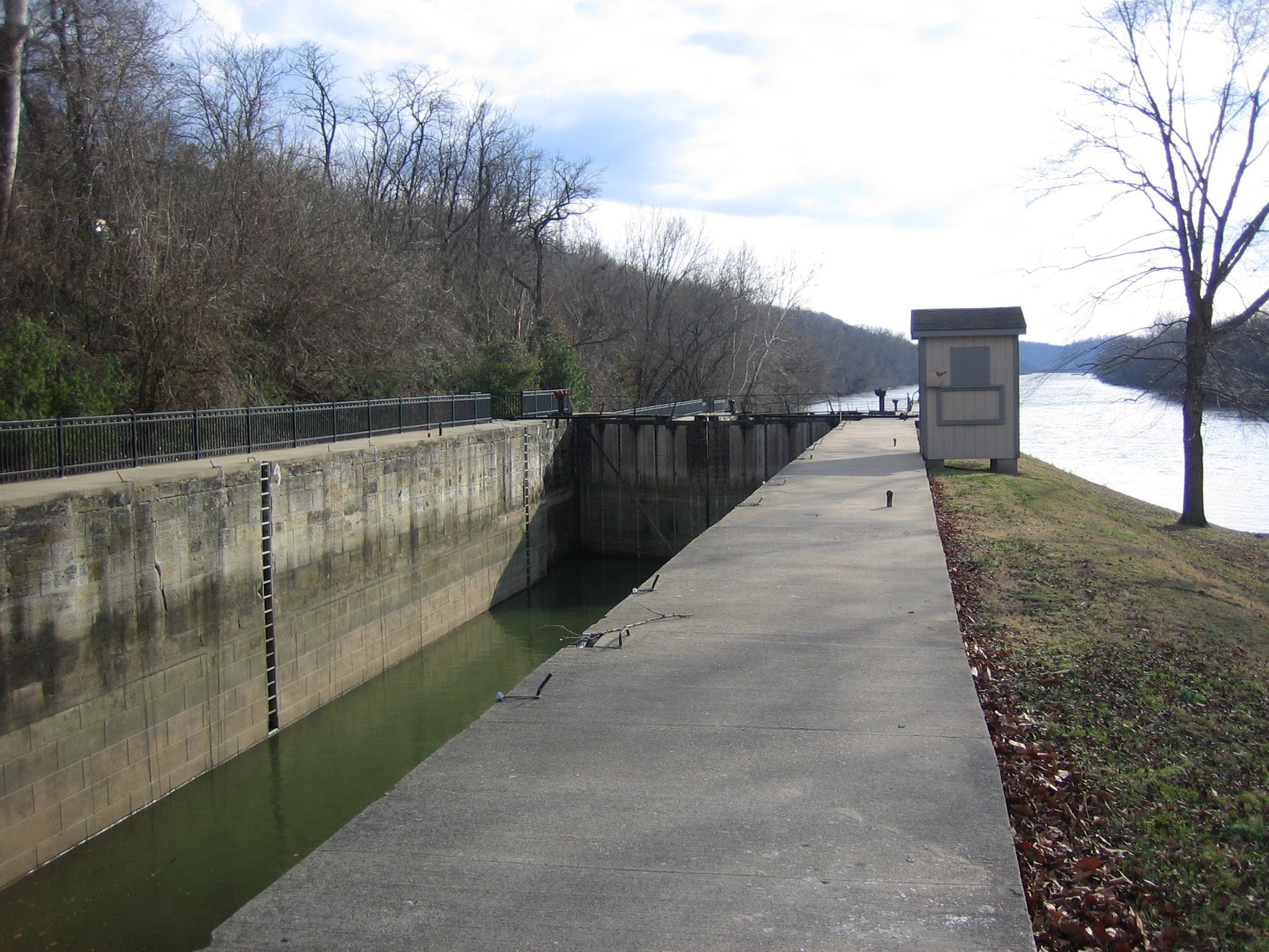
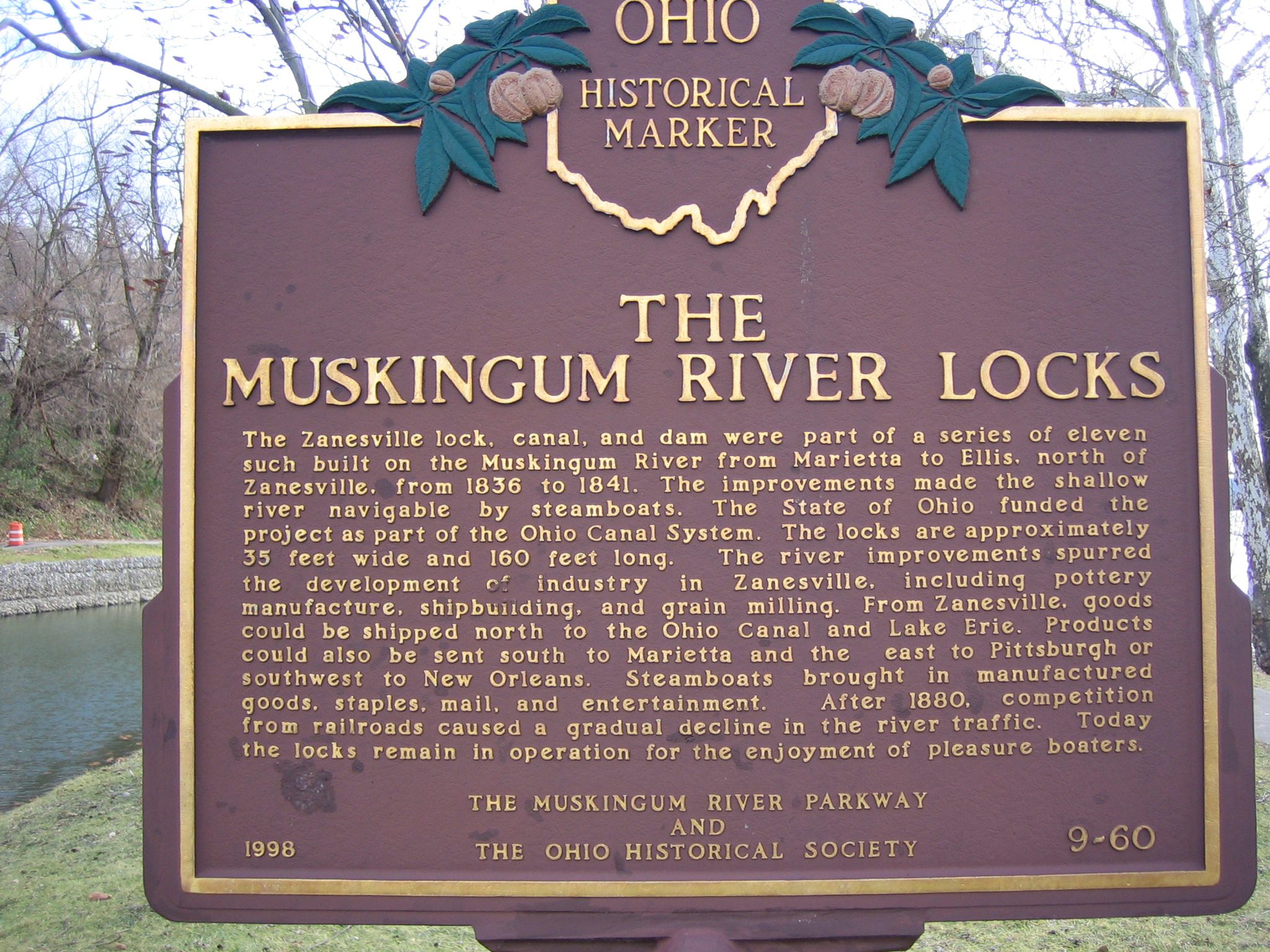
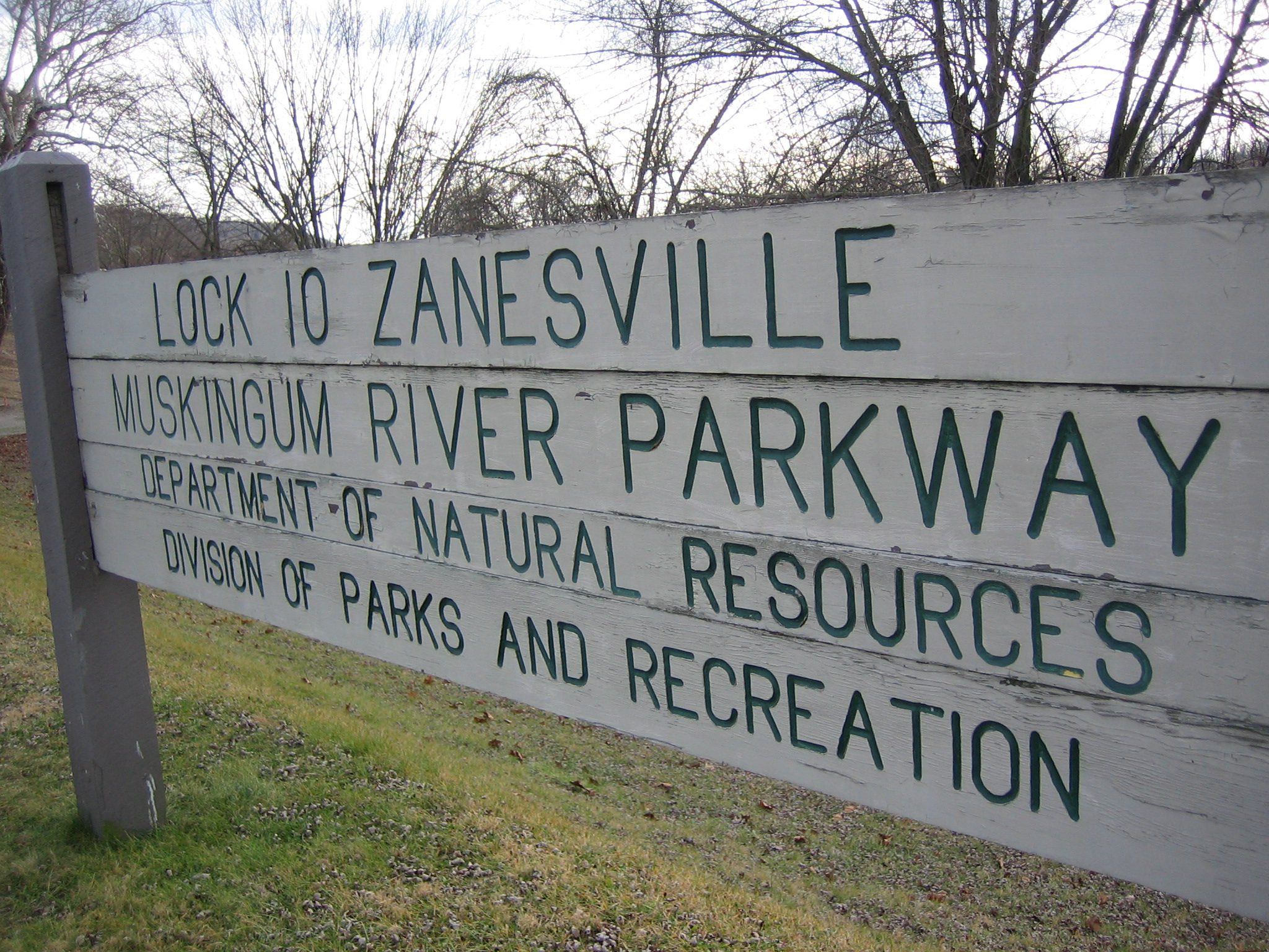
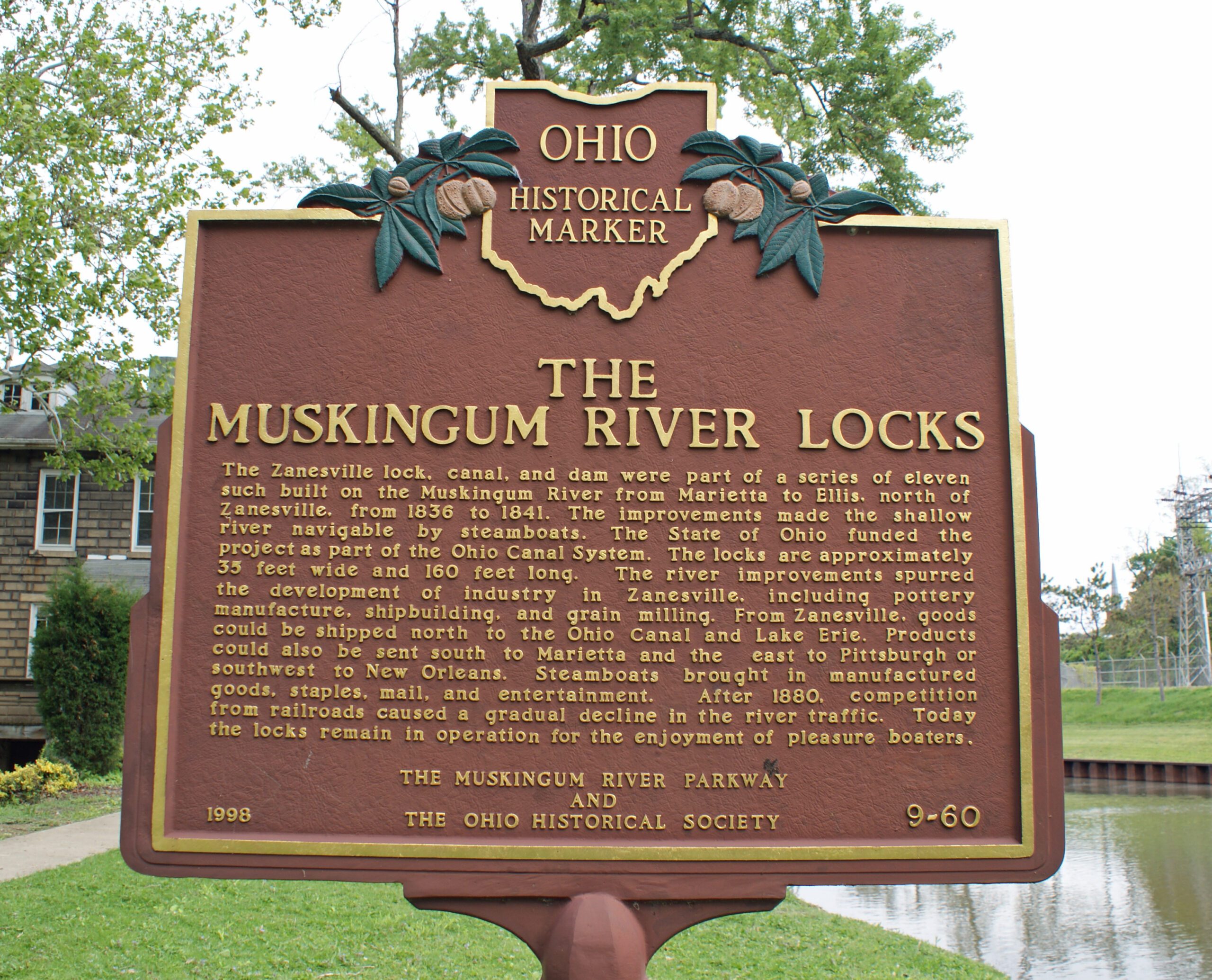
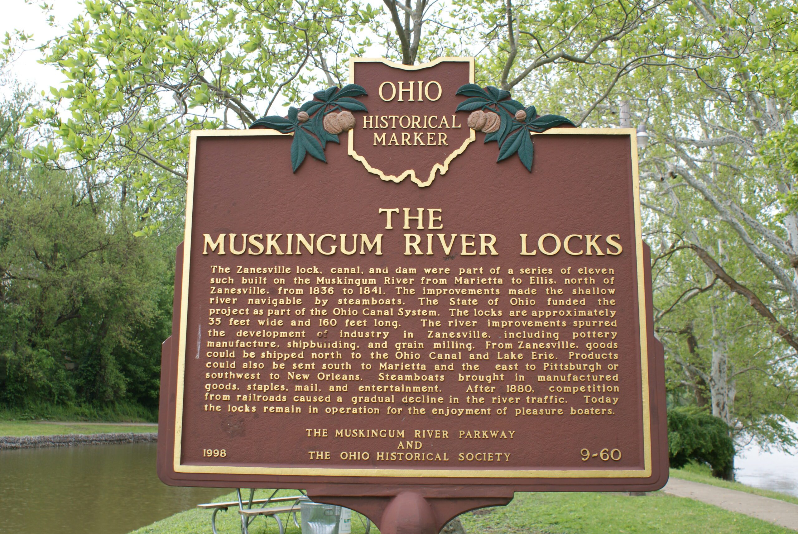
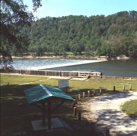
Side A: The Zanesville lock, canal, and dam were part of a series of eleven such built on the Muskingum River from Marietta to Ellis, north of Zanesville, from 1836 to 1841. The improvements made the shallow river navigable by steamboats. The State of Ohio funded the project as part of the Ohio Canal System. The locks are approximately 35 feet wide and 160 feet long. The river improvements spurred the development of industry in Zanesville, including pottery manufacture, shipbuilding, and grain milling. From Zanesville, goods could be shipped north to the Ohio Canal and Lake Erie. Products could also be sent south to Marietta and then east to Pittsburgh or southwest to New Orleans. Steamboats brought in manufactured goods, staples, mail, and entertainment. After 1880, competition from railroads caused a gradual decline in the river traffic. Today the locks remain in operation for the enjoyment of pleasure boaters.