Side A: The first road to traverse Sandusky County through the Black Swamp was little more than a muddy path connecting Lower Sandusky (Fremont( and Perrysburg with Woodville. The arduous task of clearing the 120-foot-wide road through the swampy forest was completed within four years. By 1842, the work of stoning the road and draining adjacent lands was completed. Tolls were collected to maintain the road, and it became known as the Maumee and Western Reserve Turnpike. After 1888 it became a toll-free road and today is State Route 20.
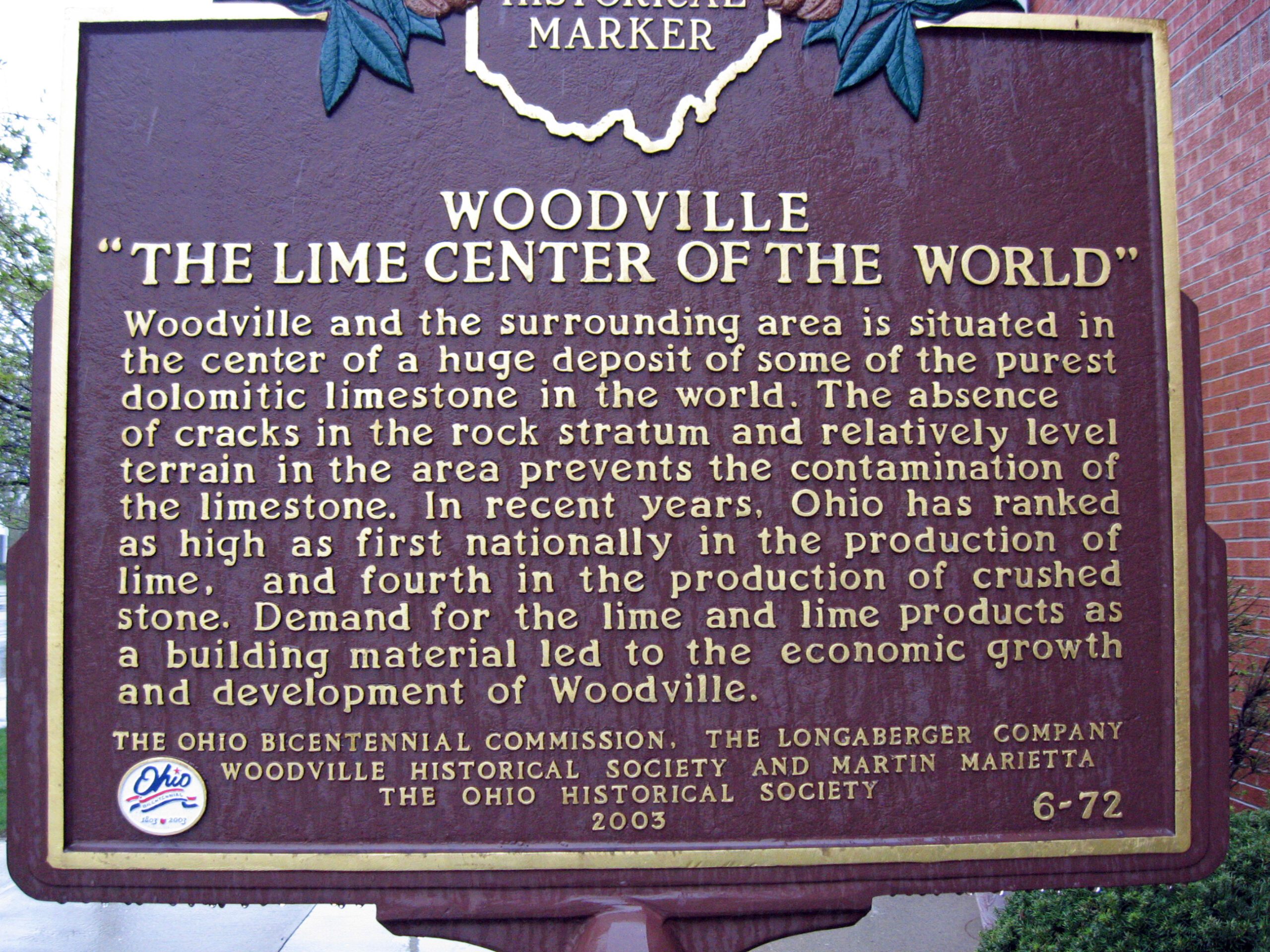
Side B: Woodville and the surrounding area is situated in the center of a huge deposit of some of the purest dolomitic limestone in the world. The absence of cracks in the rock stratum and relatively level terrain in the area prevents the contamination of the limestone. In recent years, Ohio has ranked as high as first nationally in the production of lime, and fourth in the production of crushed stone. Demand for the lime and lime products as a building material led to the economic growth and development of Woodville.
Sponsors: Ohio Bicentennial Commission, The Longaberger Company, Woodville Historical Society, and The Ohio Historical Society