Below is a complete listing of all Ohio Historical Markers. To find a detailed marker listing including text, photographs, and locations, click on a county below. Our listing is updated by the markers program as new markers are installed and older markers are reported damaged or missing.
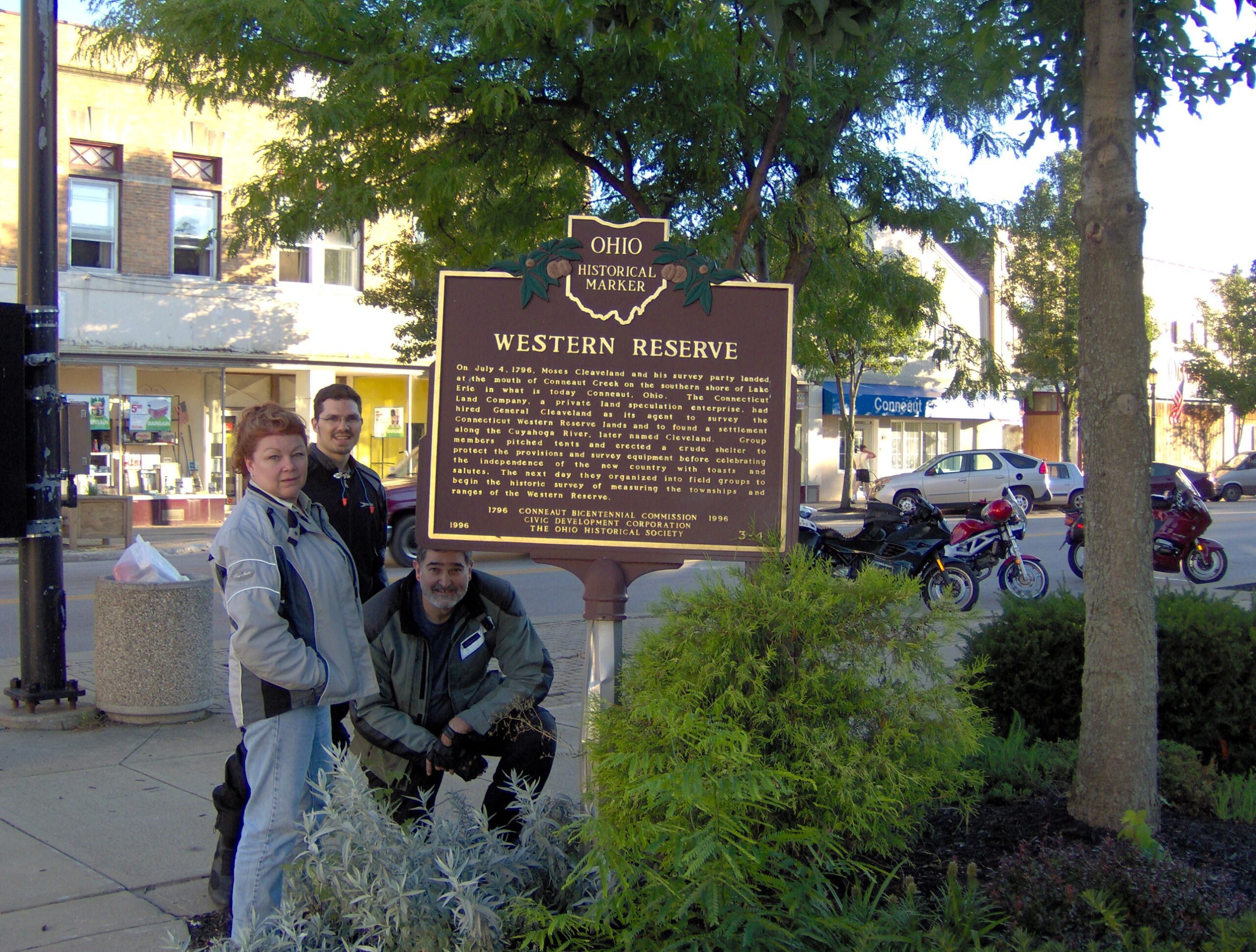
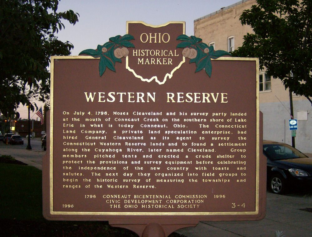
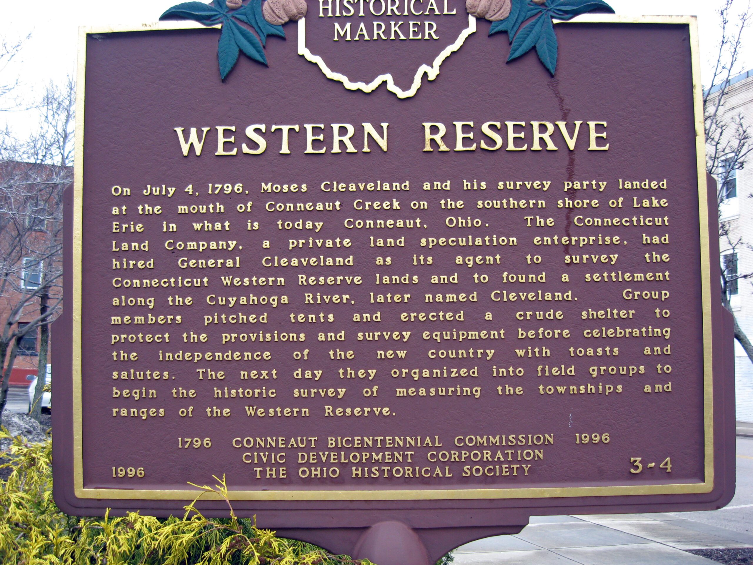
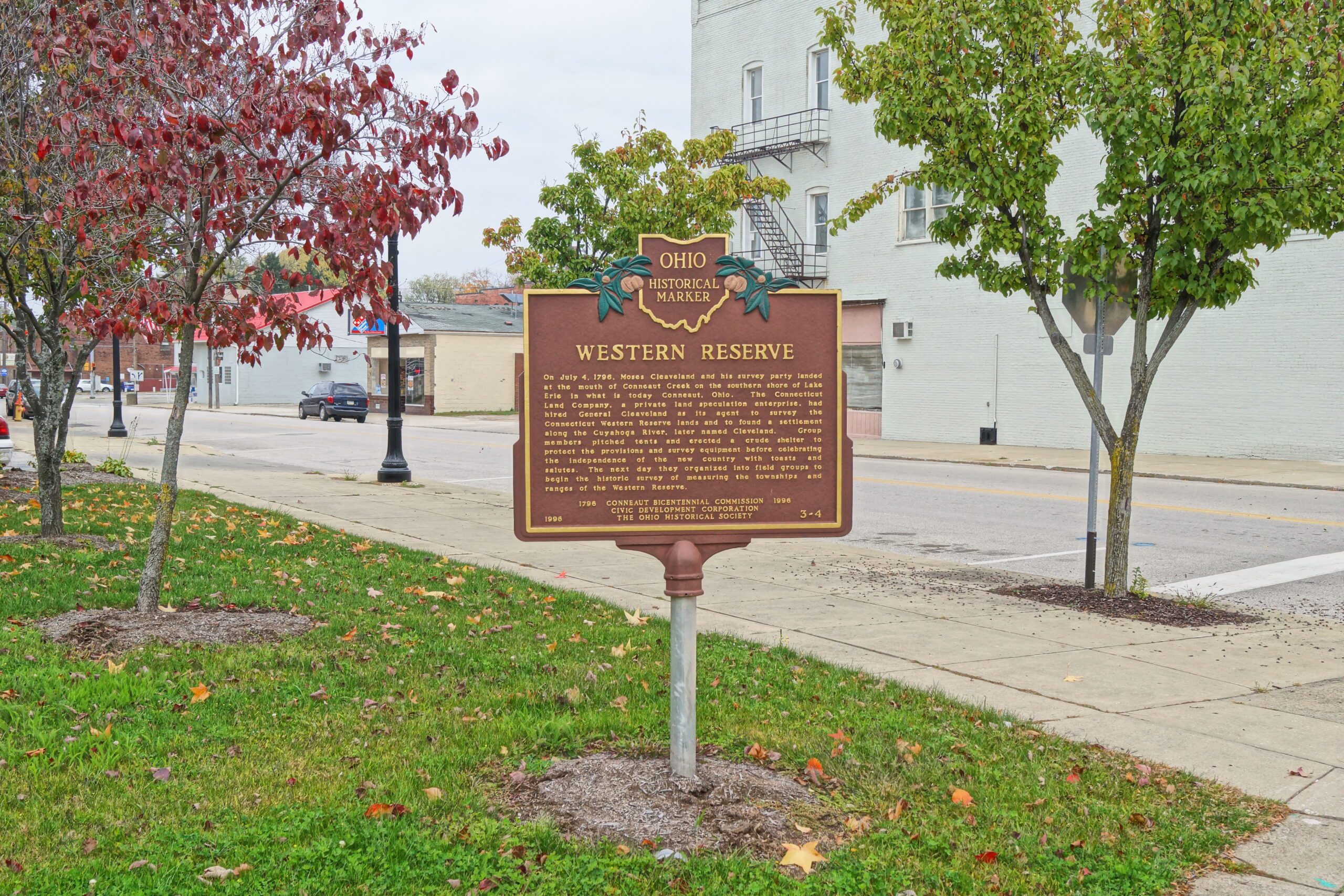
Side A: On July 4, 1796, Moses Cleaveland and his survey party landed at the mouth of Conneaut Creek on the southern shore of Lake Erie in what is today Conneaut, Ohio. The Connecticut Land Company, a private land speculation enterprise, had hired General Cleaveland as its agent to survey the Connecticut Western Reserve lands and to found a settlement along the Cuyahoga River, later named Cleveland. Group members pitched tents and erected a crude shelter to protect the provisions and survey equipment before celebrating the independence of the new country with toasts and salutes. The next day they organized into field groups to begin the historic survey of measuring the townships and ranges of the Western Reserve.