Below is a complete listing of all Ohio Historical Markers. To find a detailed marker listing including text, photographs, and locations, click on a county below. Our listing is updated by the markers program as new markers are installed and older markers are reported damaged or missing.
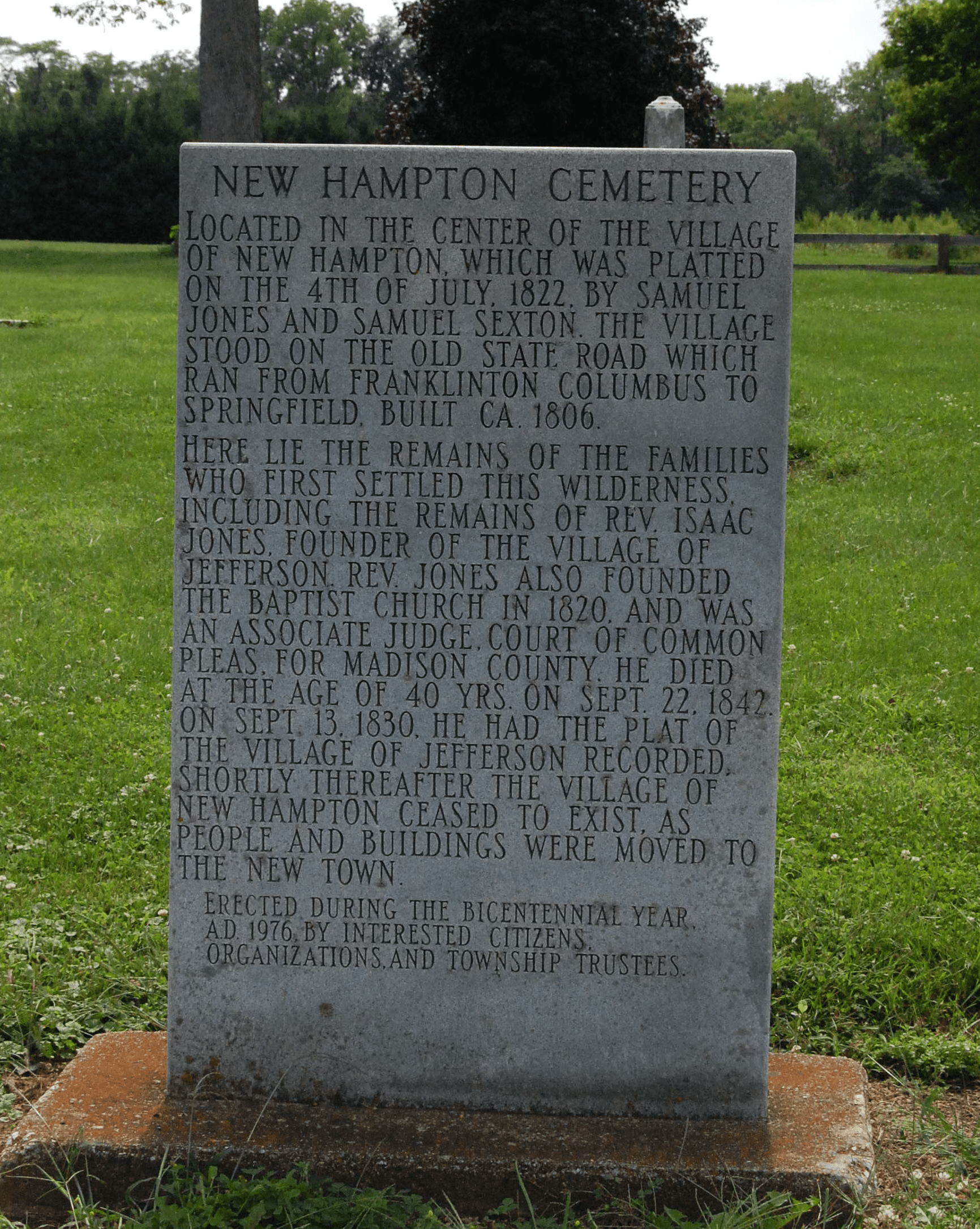
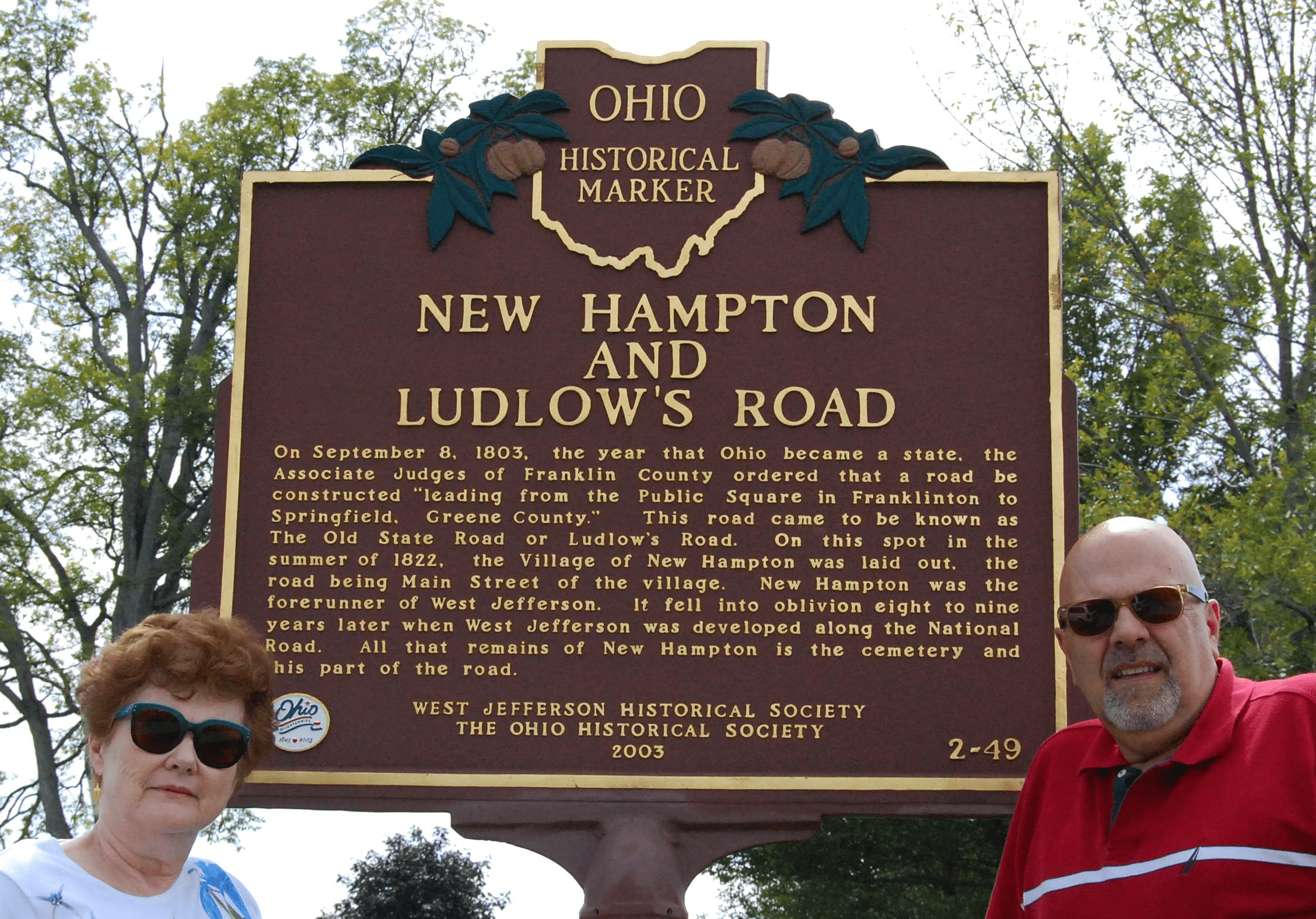
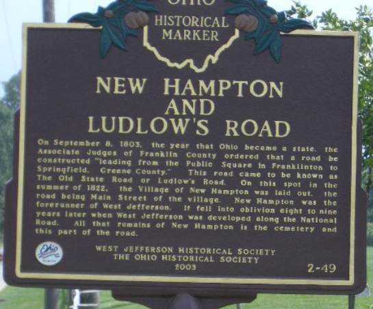
Side A: On September 8, 1803, the year that Ohio became a state, the Associate Judges of Franklin County ordered that a road be constructed “leading from the Public Square in Franklinton to Springfield, Greene County.” This road came to be known as The Old State Road or Ludlow’s Road. On this spot in the summer of 1822, the Village of New Hampton was laid out, the road being Main Street of the village. New Hampton was the forerunner of West Jefferson. It fell into oblivion eight to nine years later when West Jefferson was developed along the National Road. All that remains of New Hampton is the cemetery and this part of the road.