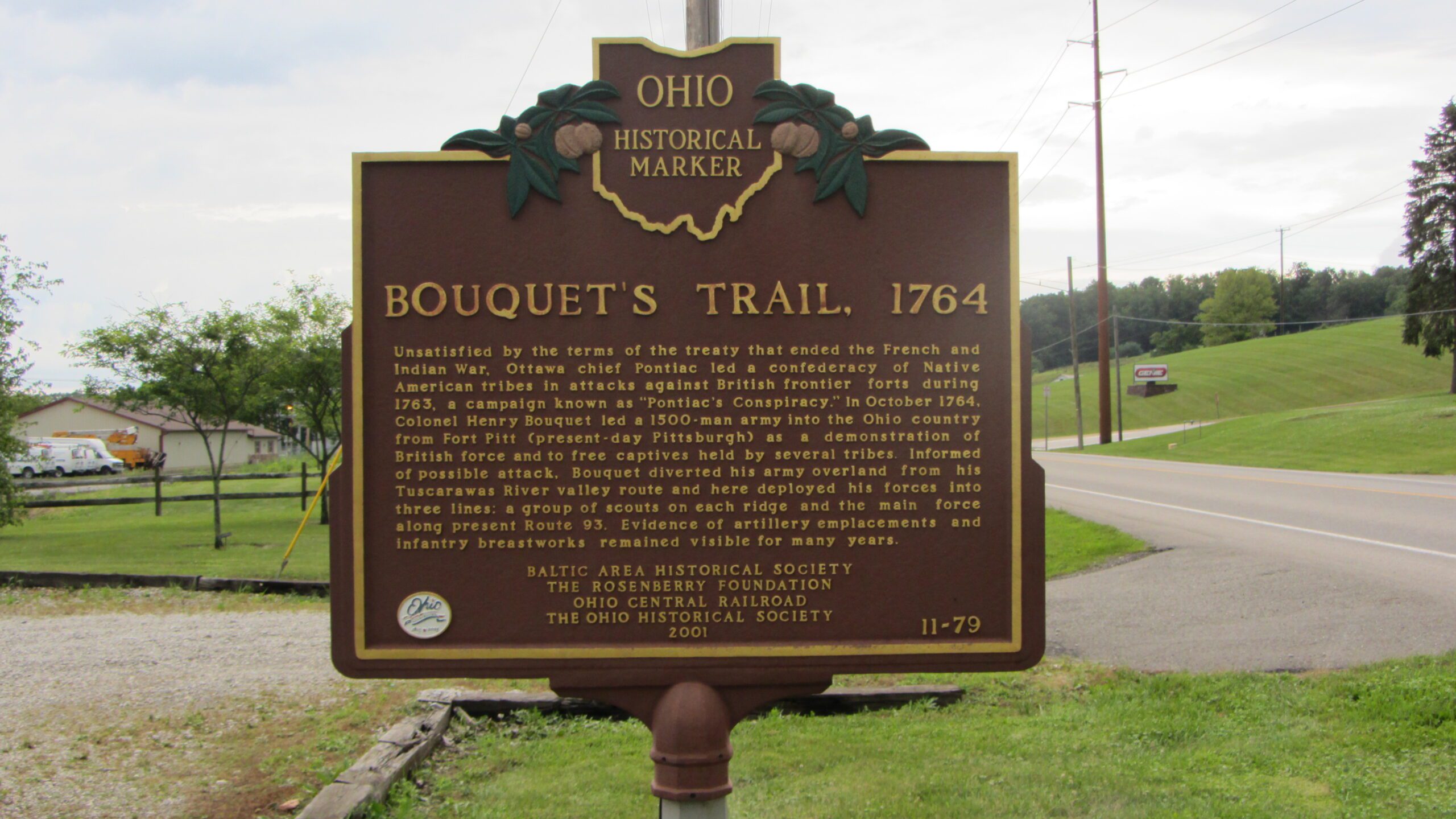
Side A: Unsatisfied by the terms of the treaty that ended the French and Indian War, Ottawa chief Pontiac led a confederacy of Native American tribes in attacks against British frontier forts during 1763, a campaign known as “Pontiac’s Conspiracy.” In October 1764, Colonel Henry Bouquet led a 1500-man army into the Ohio country from Fort Pitt (present-day Pittsburgh) as a demonstration of British force and to free captives held by several tribes. Informed of possible attack, Bouquet diverted his army overland from his Tuscarawas River valley route and here deployed his forces into three lines: a group of scouts on each ridge and the main force along present Route 93. Evidence of artillery emplacements and infantry breastworks remained visible for many years.
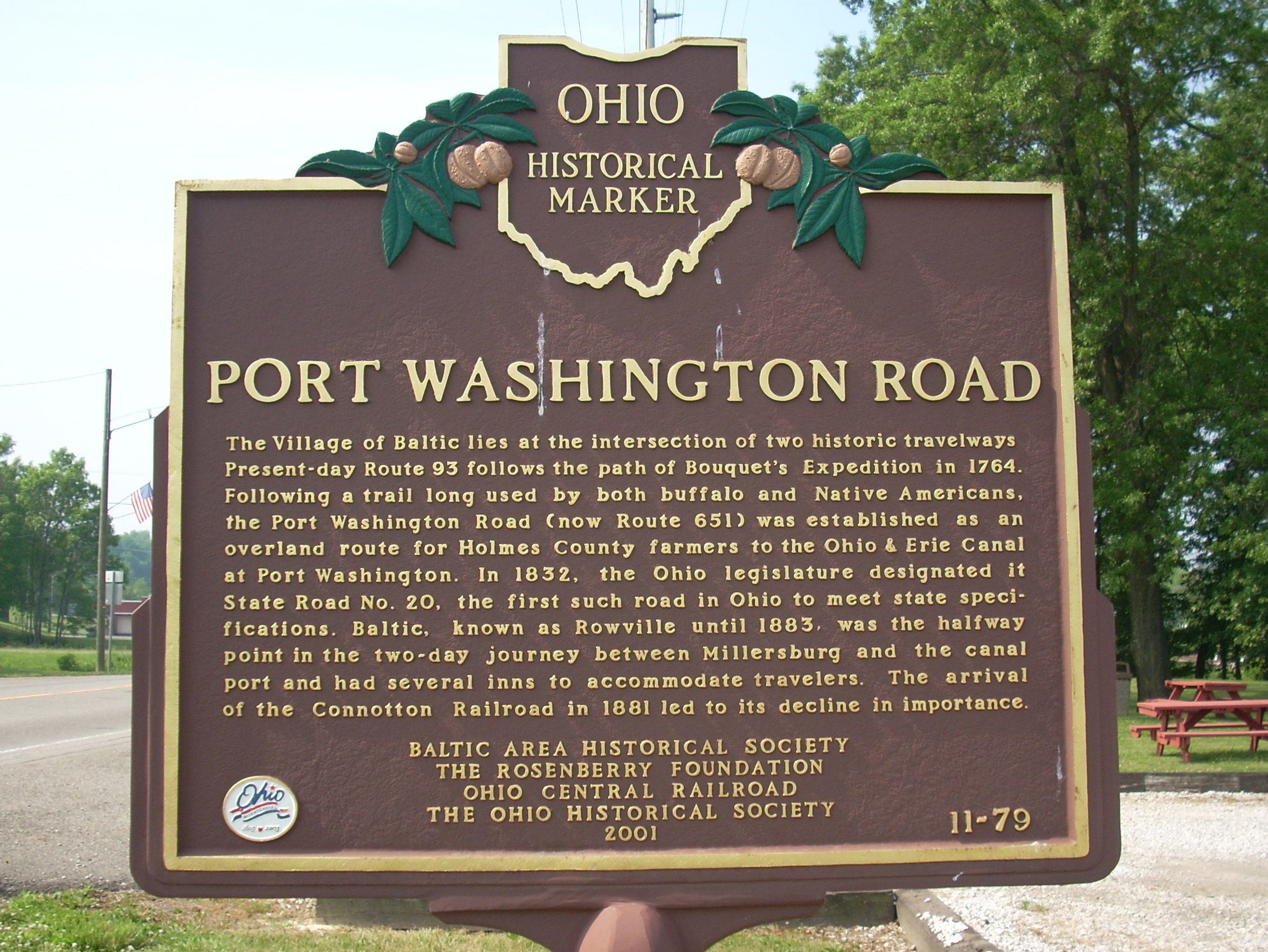
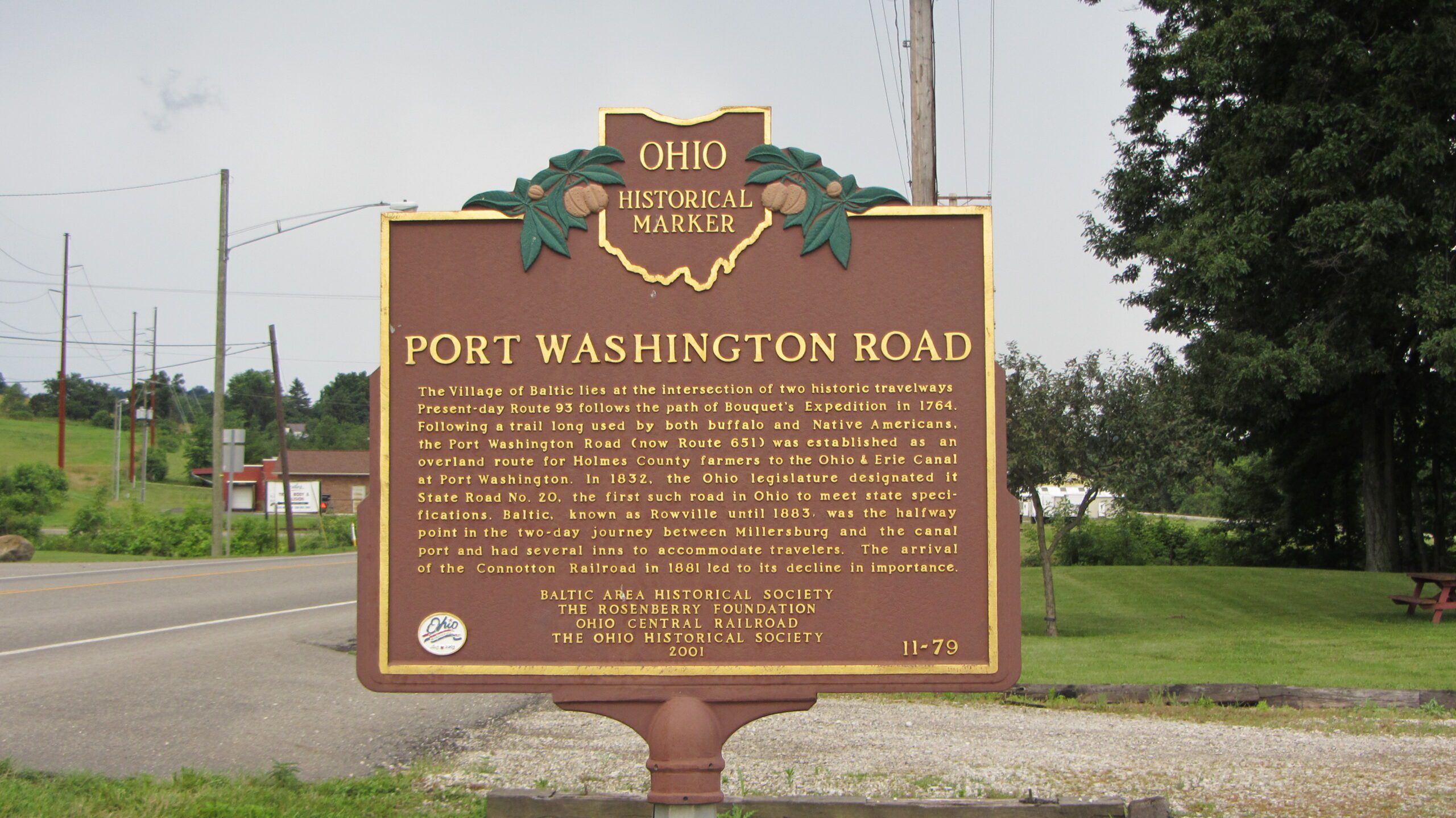
Side B: The Village of Baltic lies at the intersection of two historic travelways. Present-day Route 93 follows the path of Bouquet’s Expedition in 1764. Following a trail long used by both buffalo and Native Americans, the Port Washington Road (now Route 651) was established as an overland route for Holmes County farmers to the Ohio & Erie Canal at Port Washington. In 1832, the Ohio legislature designated it State Road No. 20, the first such road in Ohio to meet state specifications. Baltic, known as Rowville until 1883, was the halfway point in the two-day journey between Millersburg and the canal port and had several inns to accommodate travelers. The arrival of the Connotton Railroad in 1881 led to its decline in importance.
Sponsors: Baltic Area Historical Society, The Rosenberry Foundation, Ohio Central Railroad, and The Ohio Historical Society