Below is a complete listing of all Ohio Historical Markers. To find a detailed marker listing including text, photographs, and locations, click on a county below. Our listing is updated by the markers program as new markers are installed and older markers are reported damaged or missing.
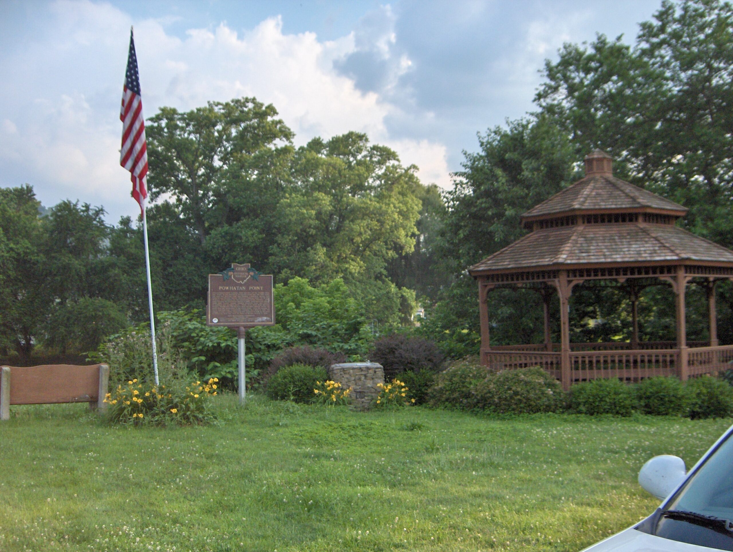
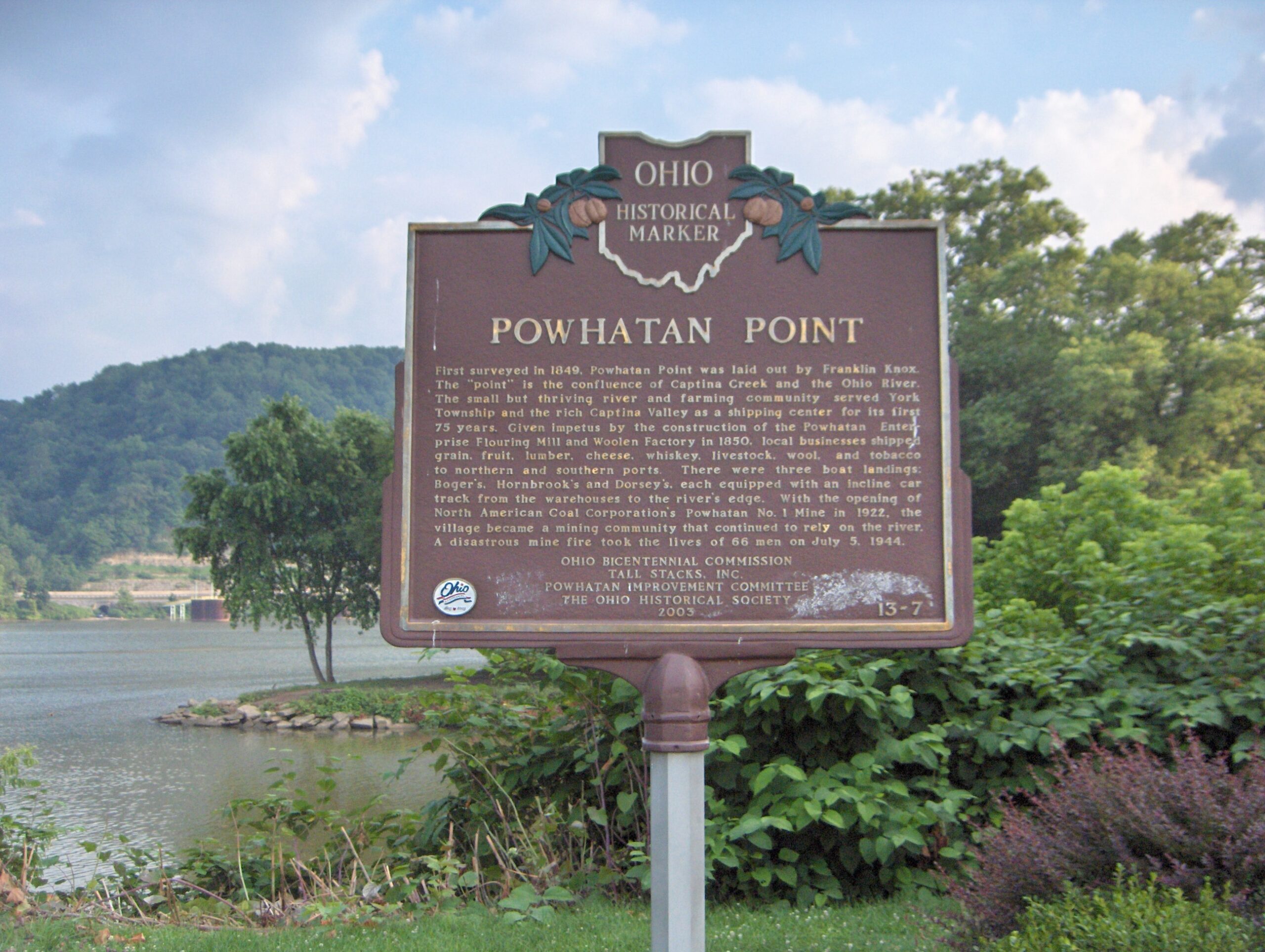
Side A: First surveyed in 1849, Powhatan Point was laid out by Franklin Knox. The “point” is the confluence of Captina Creek and the Ohio River. The small but thriving river and farming community served York Township and the rich Captina Valley as a shipping center for its first 75 years. Given impetus by the construction of the Powhatan Enterprise Flouring Mill and Woolen Factory in 1850, local businesses shipped grain, fruit, lumber, cheese, whiskey, livestock, wool, and tobacco to northern and southern ports. There were three boat landings: Boger’s, Hornbrook’s and Dorsey’s, each equipped with an incline car track from the warehouses to the river’s edge. With the opening of North American Coal Corporation’s Powhatan No. 1 Mine in 1922, the village became a mining community that continued to rely on the river. A disastrous mine fire took the lives of 66 men on July 5, 1944.