Below is a complete listing of all Ohio Historical Markers. To find a detailed marker listing including text, photographs, and locations, click on a county below. Our listing is updated by the markers program as new markers are installed and older markers are reported damaged or missing.
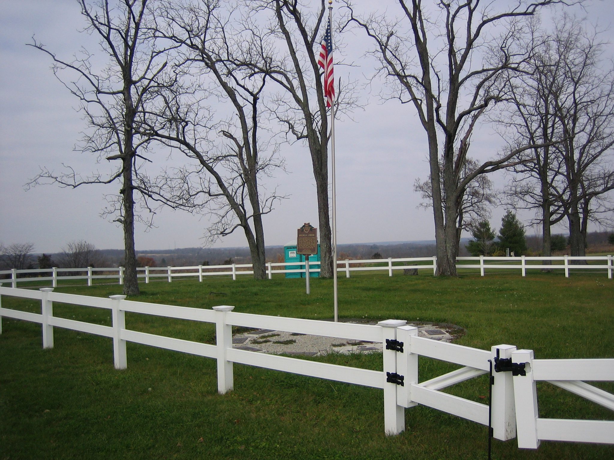
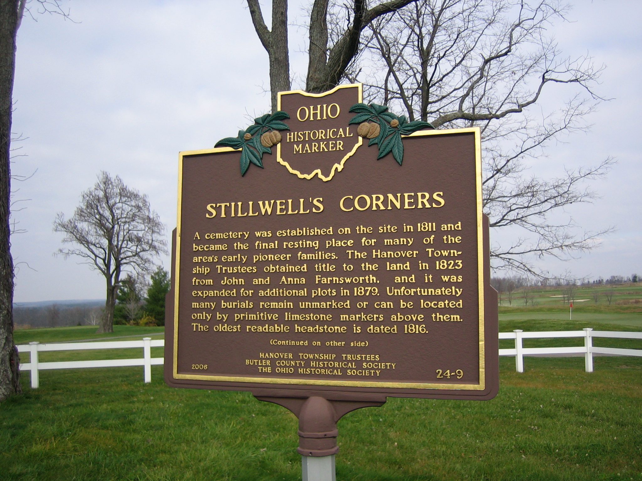
Side A: A cemetery was established on the site in 1811 and became the final resting place for many of the area’s early pioneer families. The Hanover Township Trustees obtained title to the land in 1823 from John and Anna Farnsworth, and it was expanded for additional plots in 1879. Unfortunately many burials remain unmarked or can be located only by primitive limestone markers above them. The oldest readable headstone is dated 1816. (continued on the other side)
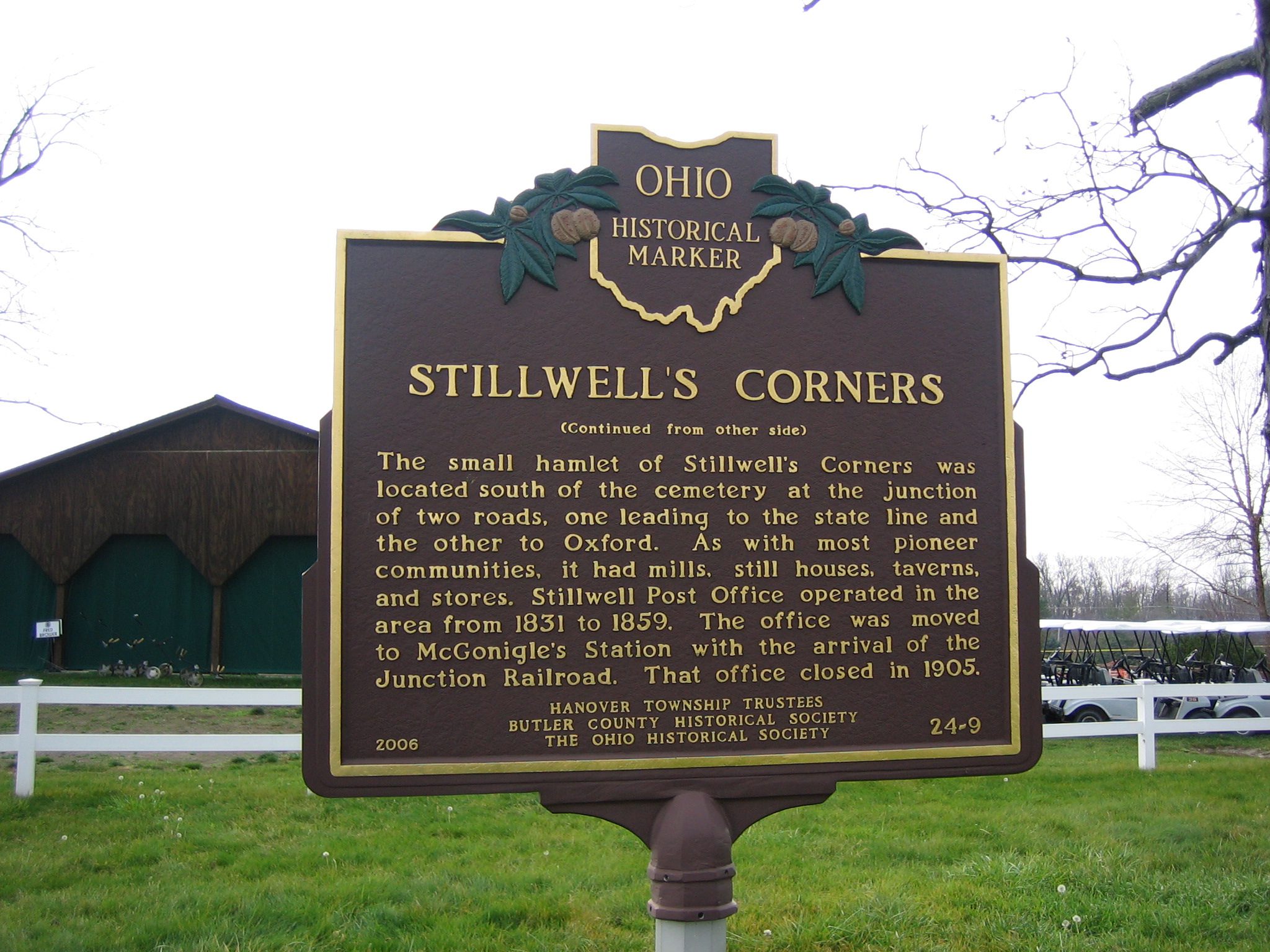
Side B: (continued from the other side) The small hamlet of Stillwell’s Corners was located south of the cemetery at the junction of two roads, one leading to the state line and the other to Oxford. As with most pioneer communities, it had mills, still houses, taverns, and stores. Stillwell Post Office operated in the area from 1831 to 1859. The office was moved to McGonigle’s Station with the arrival of the Junction Railroad. That office closed in 1905.