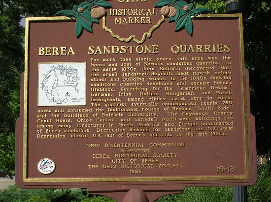
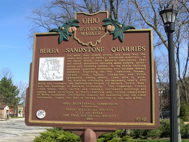
Side A: For more than ninety years, this area was the heart and soul of Berea’s sandstone quarries. In the early 1830s, John Baldwin discovered that the area’s sandstone deposits made superb grindstones and building stones. In the 1840s, thriving sandstone quarries developed and became Berea’s lifeblood. Searching for the “American Dream,” German, Irish, Italian, Hungarian, and Polish immigrants, among others, came here to work. The quarries eventually encompassed nearly 250 acres and consumed the fashionable houses of Berea’s “South Side” and the buildings of Baldwin University. The Cuyahoga County Court House, Ohio’s Capitol, and Canada’s parliament buildings are among many structures in North America and Europe constructed of Berea sandstone. Decreasing demand for sandstone and the Great Depression closed the last of Berea’s quarries in the mid-1930s.
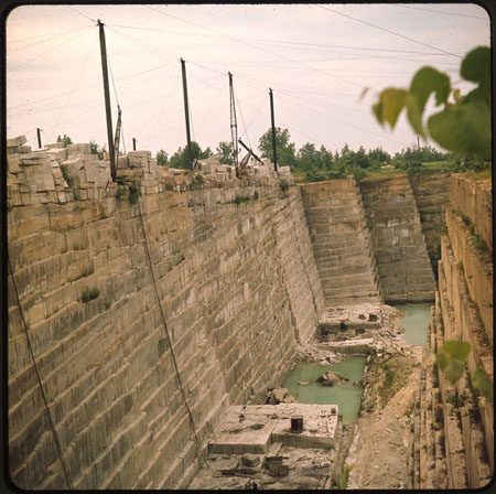
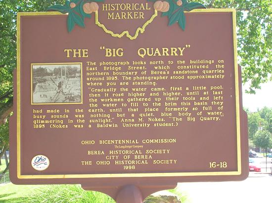
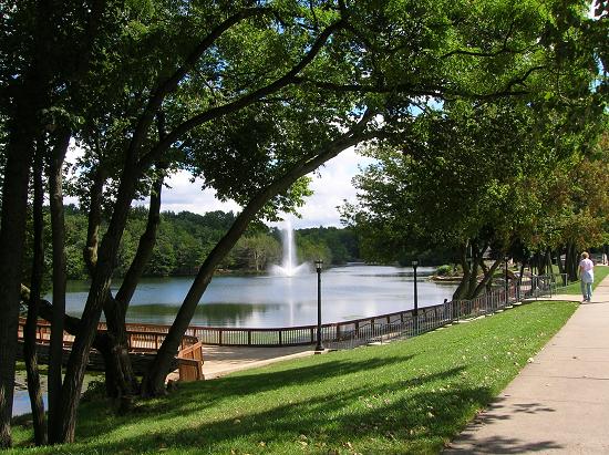
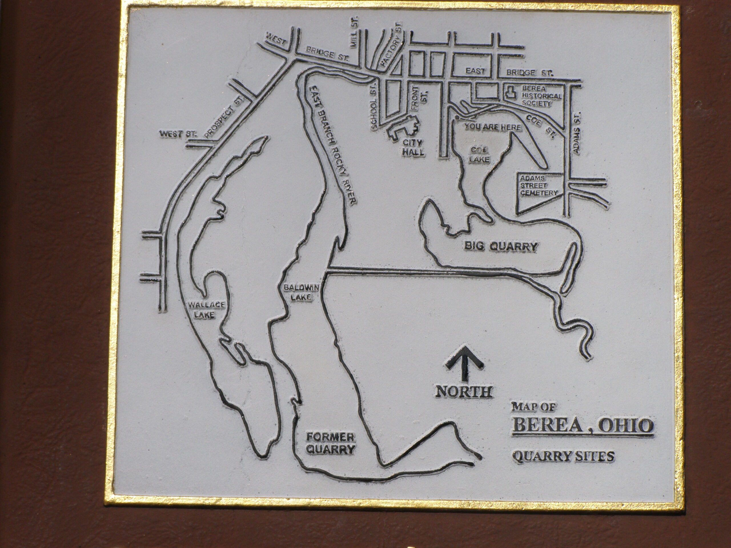
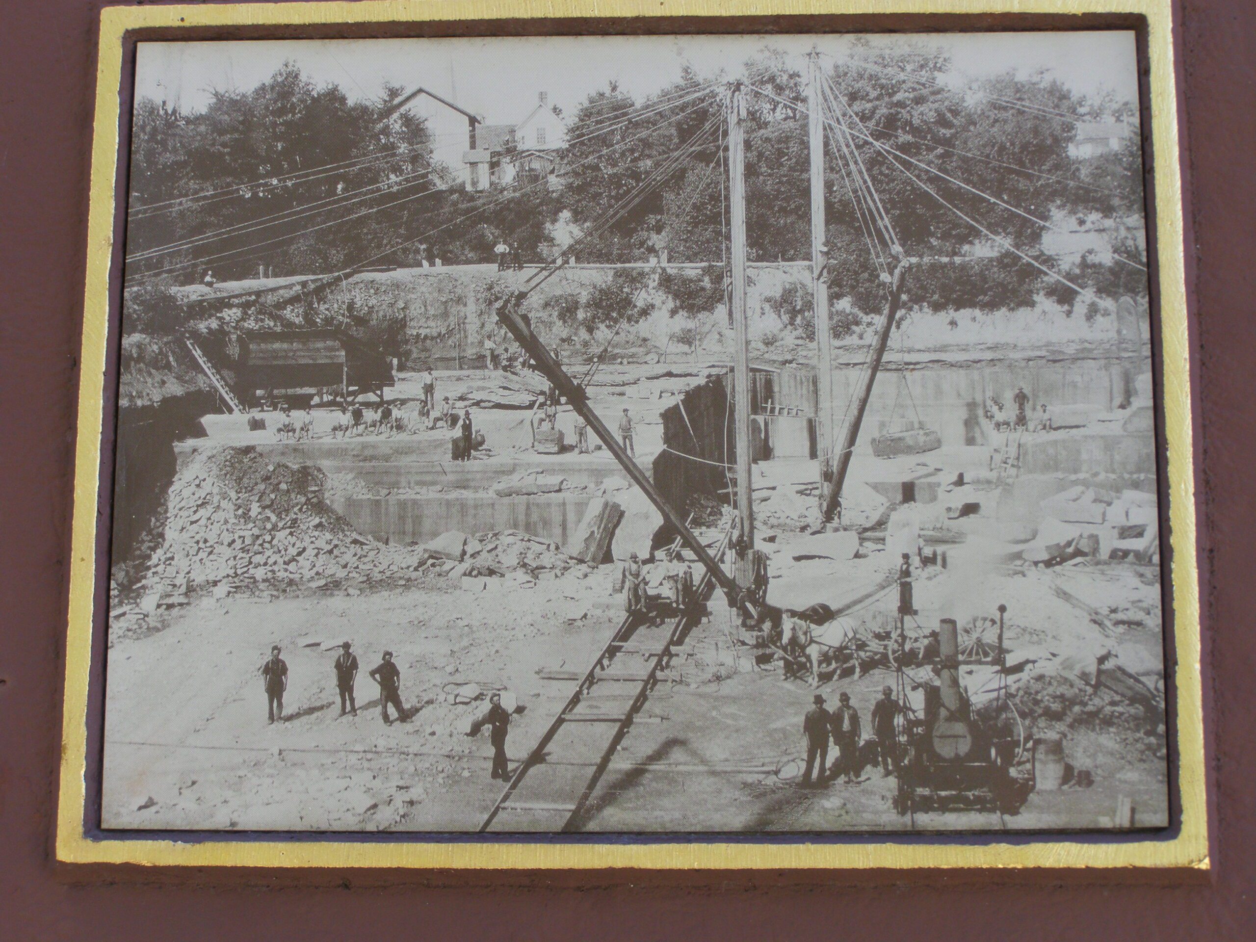
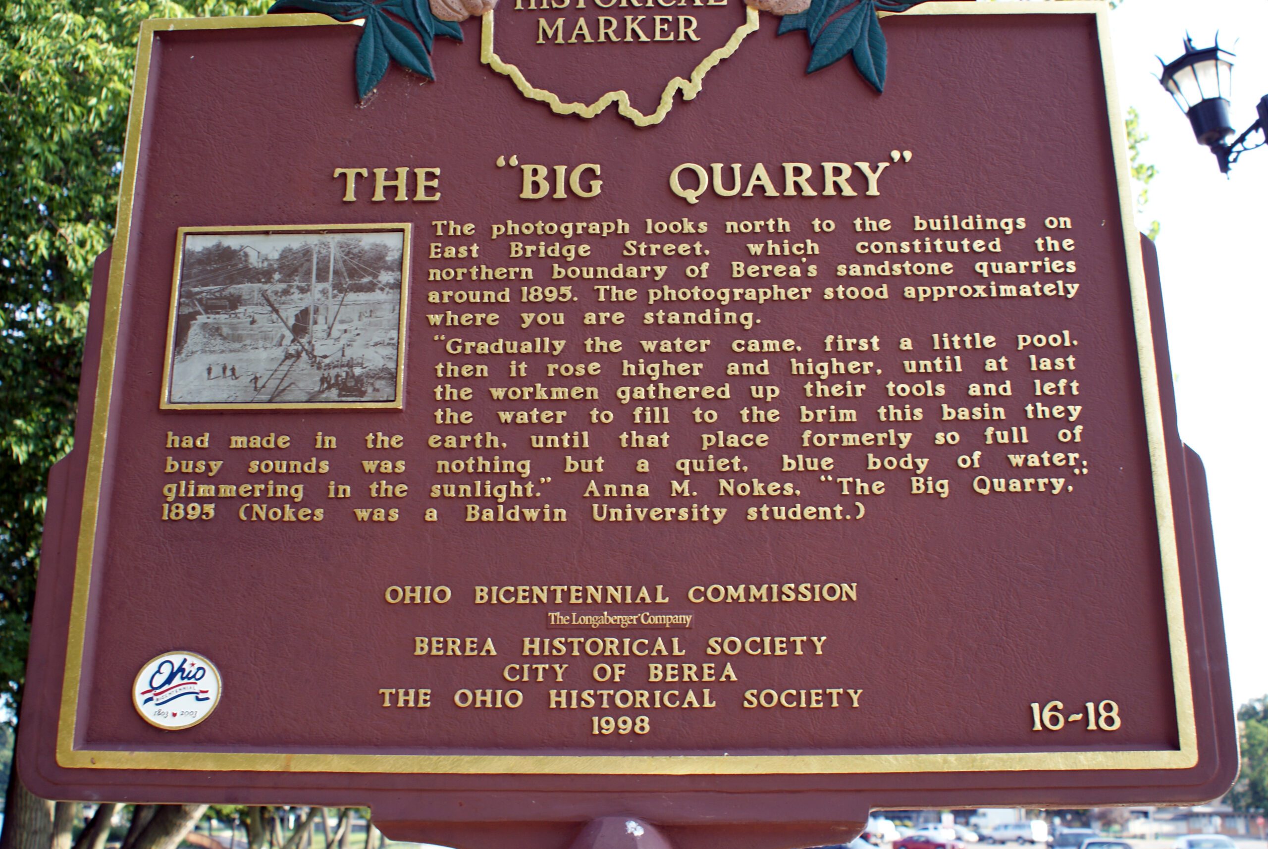
Side B: The photograph looks north to the buildings on East Bridge Street, which constituted the northern boundary of Berea’s sandstone quarries around 1895. The photographer stood approximately where you are standing. “Gradually the water came, first a little pool, then it rose higher and higher, until at last the workmen gathered up their tools and left the water to fill to the brim this basin they had made in the earth, until that place formerly so full of busy sounds was nothing but a quiet, blue body of water, glimmering in the sunlight.” Anna M. Nokes, “The Big Quarry,” 1895 (Nokes was a Baldwin University student.)
Sponsors: Ohio Bicentennial Commission, The Longaberger Company, Berea Historical Society, City of Berea, and The Ohio Historical Society