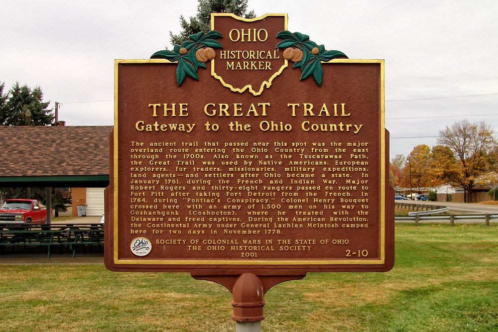
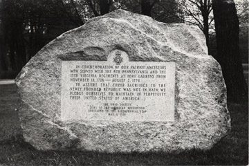
Side A: The ancient trail that passed near this spot was the major overland route entering the Ohio Country from the east through the 1700s. Also known as the Tuscarawas Path, the Great Trail was used by Native Americans, European explorers, fur traders, missionaries, military expeditions, land agents-and settlers after Ohio became a state. In January 1761, during the French and Indian War, Major Robert Rogers and thirty-eight rangers passed en route to Fort Pitt after taking Fort Detroit from the French. In 1764, during “Pontiac’s Conspiracy,” Colonel Henry Bouquet crossed here with an army of 1,500 men on his way to Goshachgunk (Coshocton), where he treated with the Delaware and freed captives. During the American Revolution, the Continental Army under General Lachlan McIntosh camped here for two days in November 1778.
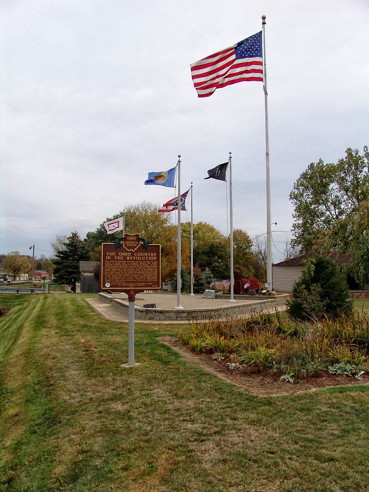
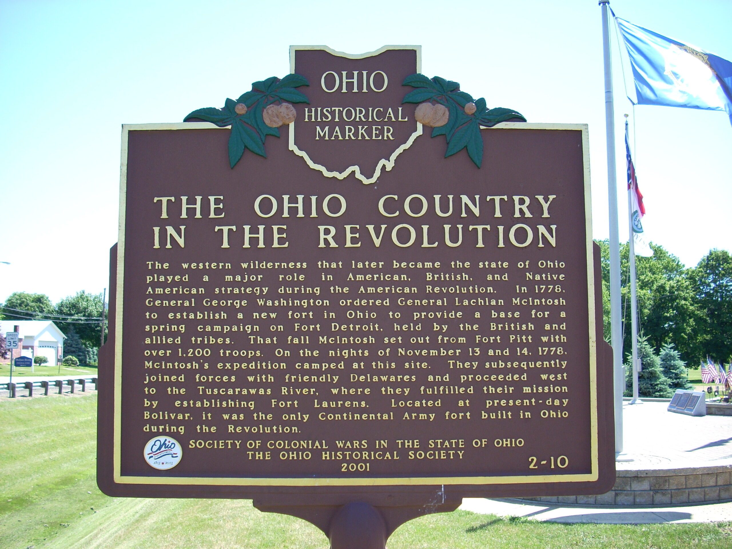
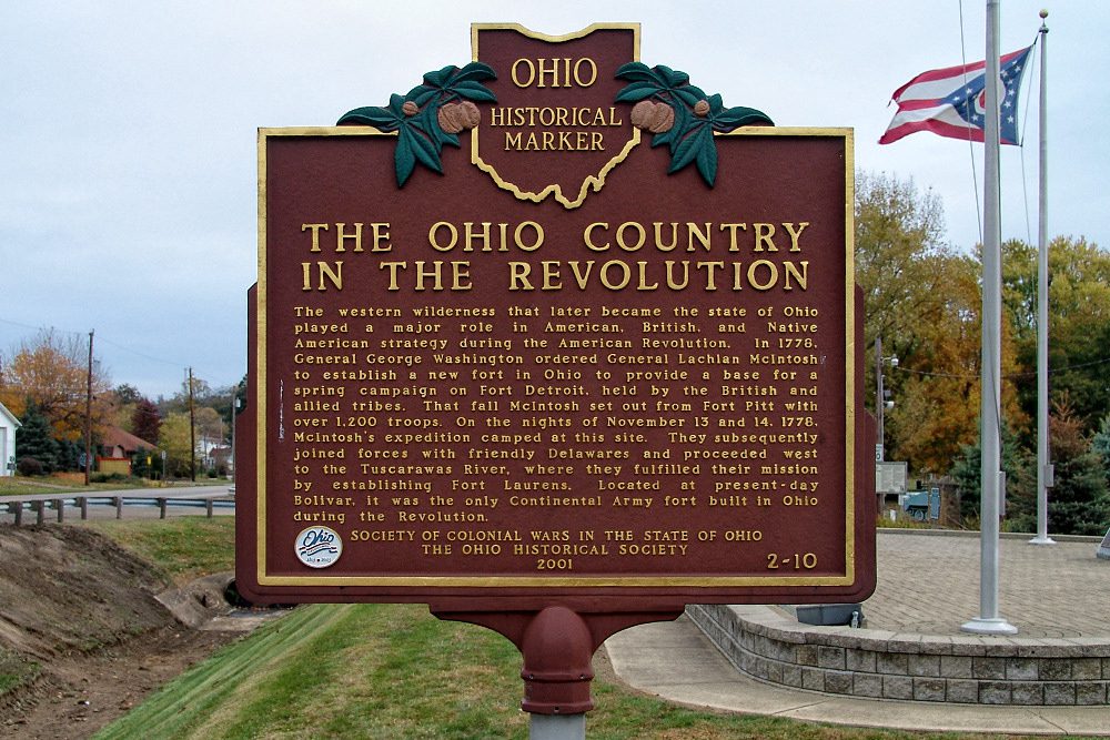
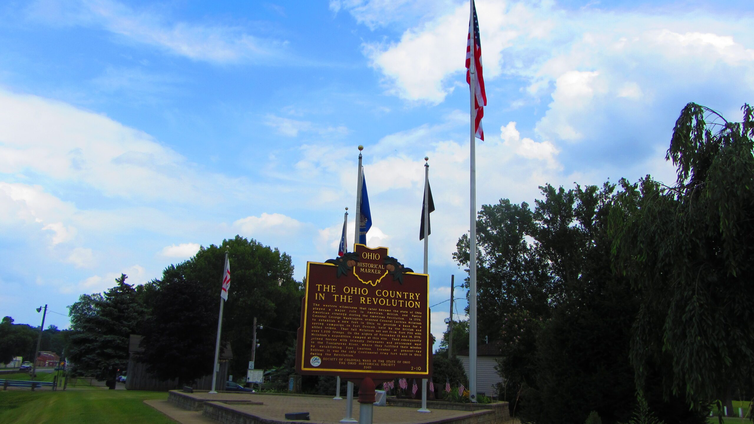
Side B: The western wilderness that later became the state of Ohio played a major role in American, British, and Native American strategy during the American Revolution. In 1778, General George Washington ordered General Lachlan McIntosh to establish a new fort in Ohio to provide a base for a spring campaign on Fort Detroit, held by the British and allied tribes. That fall McIntosh set out from Fort Pitt with over 1,200 troops. On the nights of November 13 and 14, 1778, McIntosh’s expedition camped at this site. They subsequently joined forces with friendly Delawares and proceeded west to the Tuscarawas River, where they fulfilled their mission by establishing Fort Laurens. Located at present-day Bolivar, it was the only Continental Army fort built in Ohio during the Revolution.