Below is a complete listing of all Ohio Historical Markers. To find a detailed marker listing including text, photographs, and locations, click on a county below. Our listing is updated by the markers program as new markers are installed and older markers are reported damaged or missing.
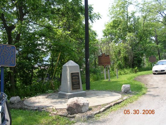
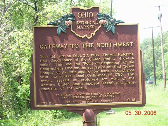
Side A: Near this site on Sept. 30, 1785, Thomas Hutchins, first Geographer of the United States, drove a stake: This was the “Point of Beginning” of the Geographer’s Line for the survey of the first “Seven Ranges” of six-mile square townships in compliance with the Federal Land Ordinance of 1785. This survey served as a prototype for most of the western United States (except Texas) and many countries of the world.