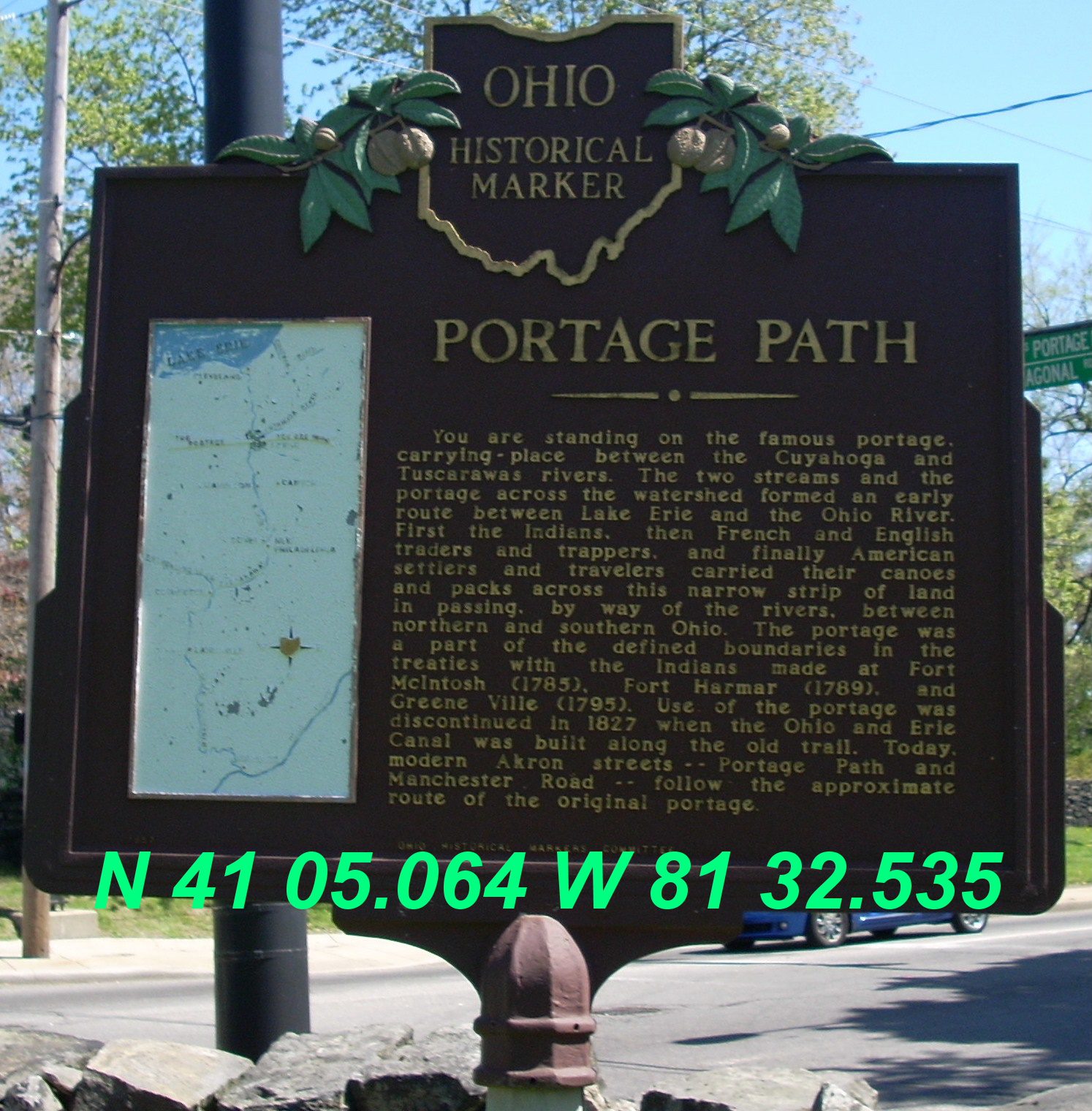
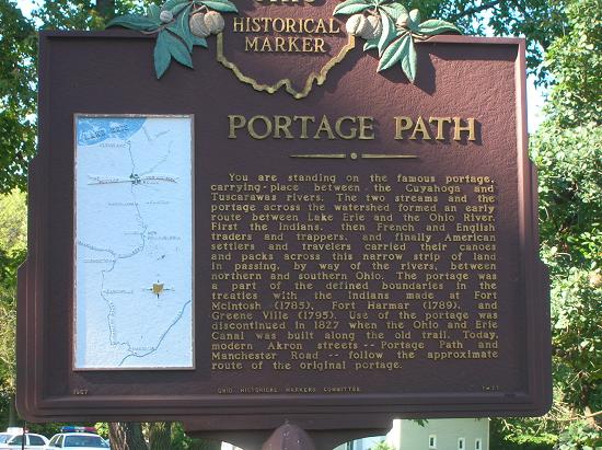
Side A: You are standing on the famous portage, carrying-place between the Cuyahoga and Tuscarawas rivers. The two streams and the portage across the watershed formed an early route between Lake Erie and the Ohio River. First the Indians, then French and English traders and trappers, and finally American settlers and travelers carried their canoes and packs across this narrow strip of land in passing, by way of the rivers, between northern and southern Ohio. The portage was a part of the defined boundaries in the treaties with the Indians made at Fort McIntosh (1785), Fort Harmar (1789), and Green Ville (1795). Use of the portage was discontinued in 1827 when the Ohio and Erie Canal was built along the old trail. Today, modern Akron streets–Portage Path and Manchester Road–follow the approximate route of the original portage.