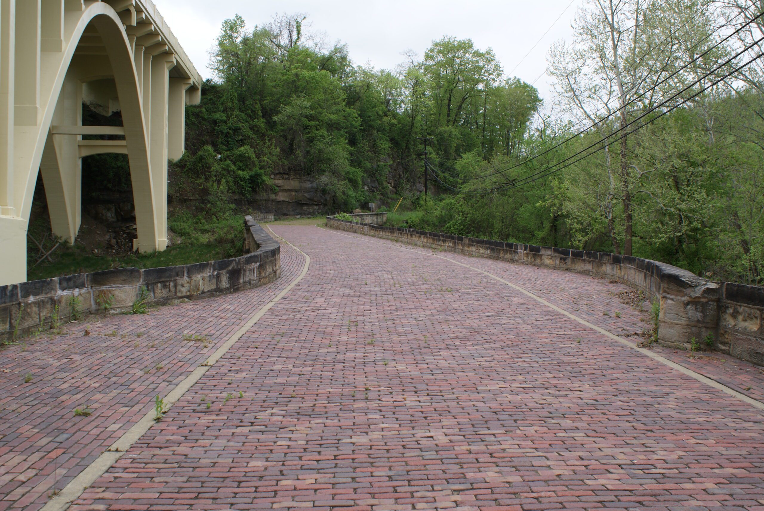
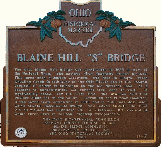
Side A: The first Blaine Hill Bridge was constructed in 1828 as part of the National Road, the nation’s first federally funded highway. This three-arch S-shaped structure, 345 feet in length, spans Wheeling Creek (a tributary of the Ohio River) and is the longest original “S” bridge in existence on the old National Road. At a gradient of approximately 6.3 percent from east to west, it significantly eased, for the first time, the arduous 500-foot western climb out of the valley. Crumbling and in poor condition, it was saved from demolition in 1999 and in 2001 was designated Ohio’s official Bicentennial Bridge. Now tucked between the 1933 U.S. 40 viaduct and Interstate 70, it illustrates the earliest of Ohio’s three eras in national highway transportation.
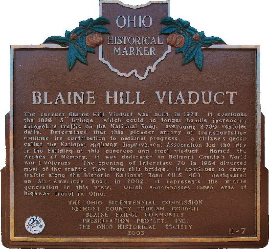
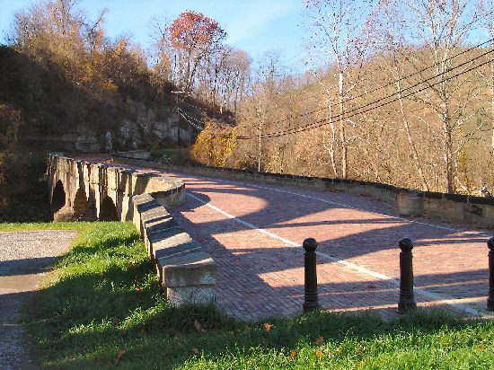
Side B: The current Blaine Hill Viaduct was built in 1933. It overlooks the 1828 “S” bridge, which could no longer handle increasing automobile traffic on the National Road, averaging 2,700 vehicles daily. Determined that this pioneer artery of transportation continue its contribution to national progress, a citizen’s group called the National Highway Improvement Association led the way in the building of this concrete and steel viaduct. Named the Arches of Memory, it was dedicated to Belmont County’s World War I Veterans. The opening of Interstate 70 in 1964 diverted most of the traffic flow from this bridge. It continues to carry traffic along the historic National Road (U.S. 40), designated an All-American Road in 2002. It represents the middle generation in this view, which encompasses three eras of highway travel in Ohio.
Sponsors: Ohio Bicentennial Commission, Belmont County Tourism Council, Blaine Bridge Community Preservation Project, Inc. and The Ohio Historical Society