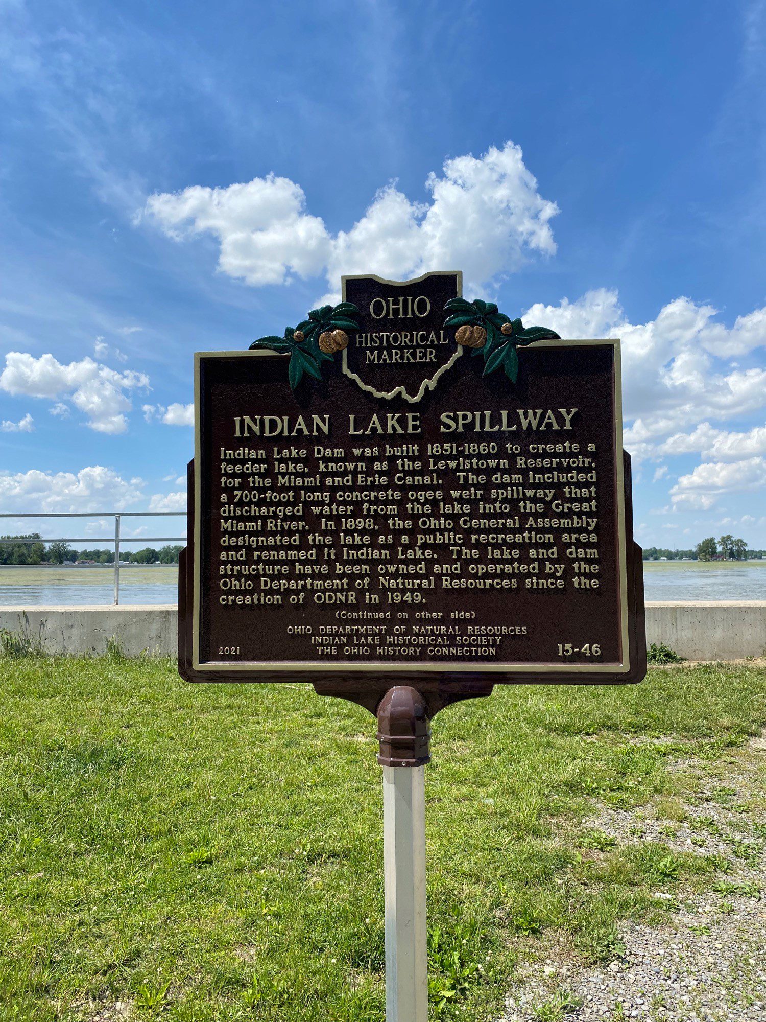
Side A: Indian Lake Dam was built 1851-1860 to create a feeder lake, known as the Lewistown Reservoir, for the Miami and Erie Canal. The dam included a 700-foot long concrete ogee weir spillway that discharged water from the lake into the Great Miami River. In 1898, the Ohio General Assembly designated the lake as a public recreation area and renamed it Indian Lake. The lake and dam structure have been owned and operated by the Ohio Department of Natural Resources since the creation of ODNR in 1949. (Continued on other side)
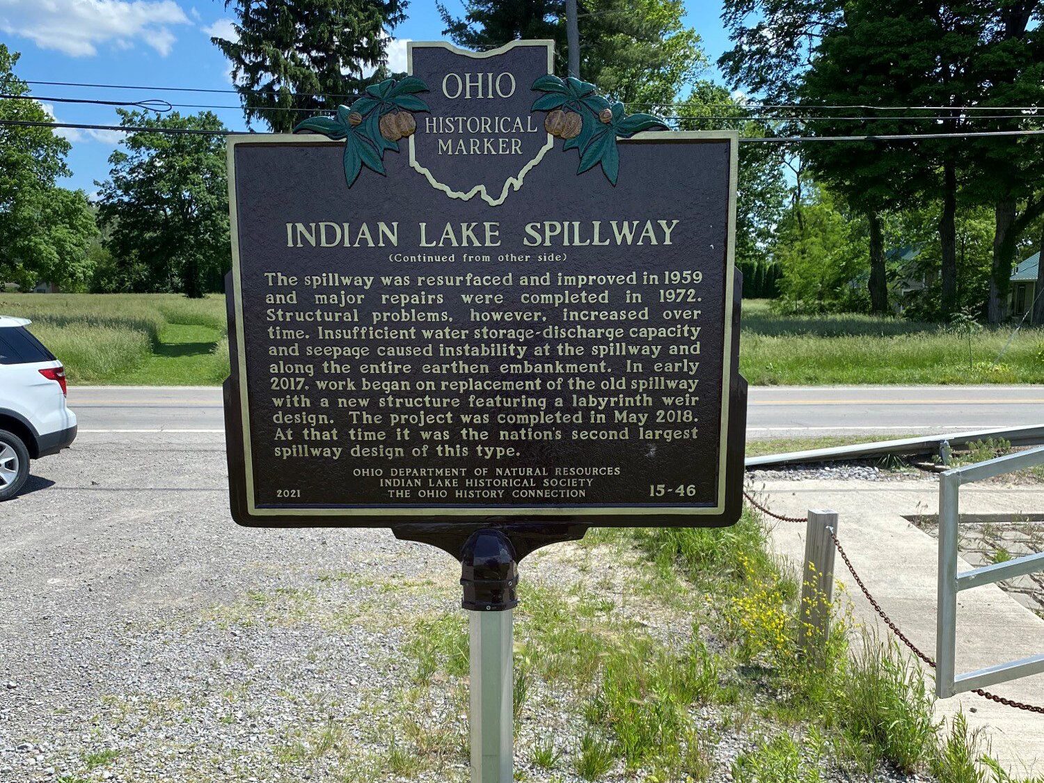
Side B: (Continued from other side) The spillway was resurfaced and improved in 1959 and major repairs were completed in 1972. Structural problems, however, increased over time. Insufficient water storage-discharge capacity and seepage caused instability at the spillway and along the entire earthen embankment. In early 2017, work began on replacement of the old spillway with a new structure featuring a labyrinth weir design. The project was completed in May 2018. At that time it was the nation’s second largest spillway design of this type.