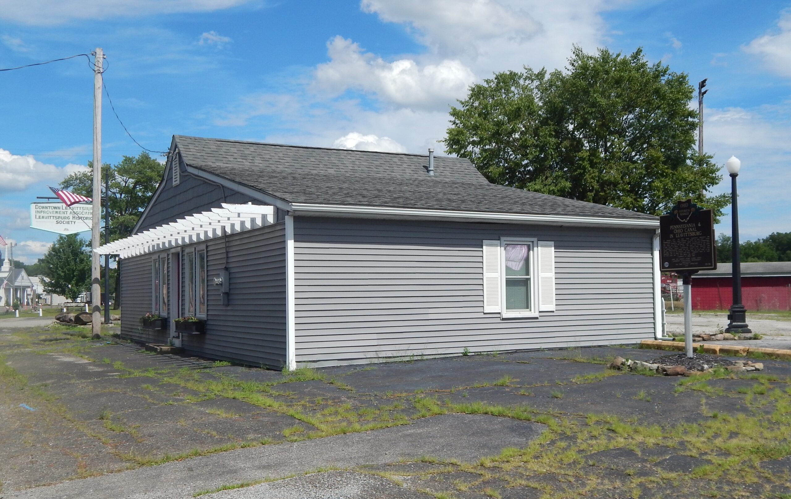
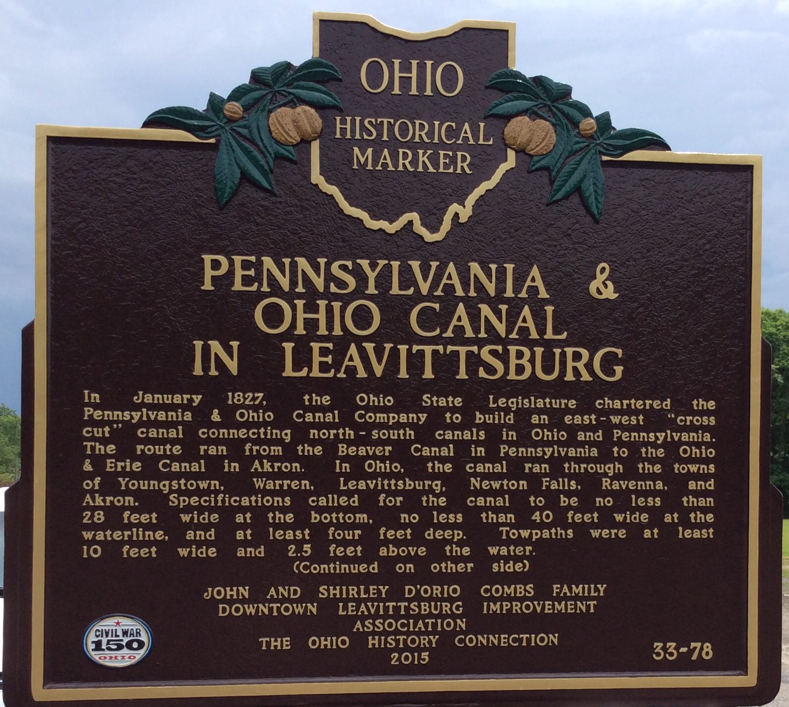
Side A: In January 1827, the Ohio State Legislature chartered the Pennsylvania & Ohio Canal Company to build an east-west “cross cut” canal connecting north-south canals in Ohio and Pennsylvania. The route ran from the Beaver Canal in Pennsylvania to the Ohio & Erie Canal in Akron. In Ohio, the canal ran through the towns of Youngstown, Warren, Leavittsburg, Newton Falls, Ravenna, and Akron. Specifications called for the canal to be no less than 28 feet wide at the botton, no less than 40 feet wide at the waterline, and at least four feet deep. Towpaths were at least 10 feet wide and 2.5 feet above the water. (Continued on other side)
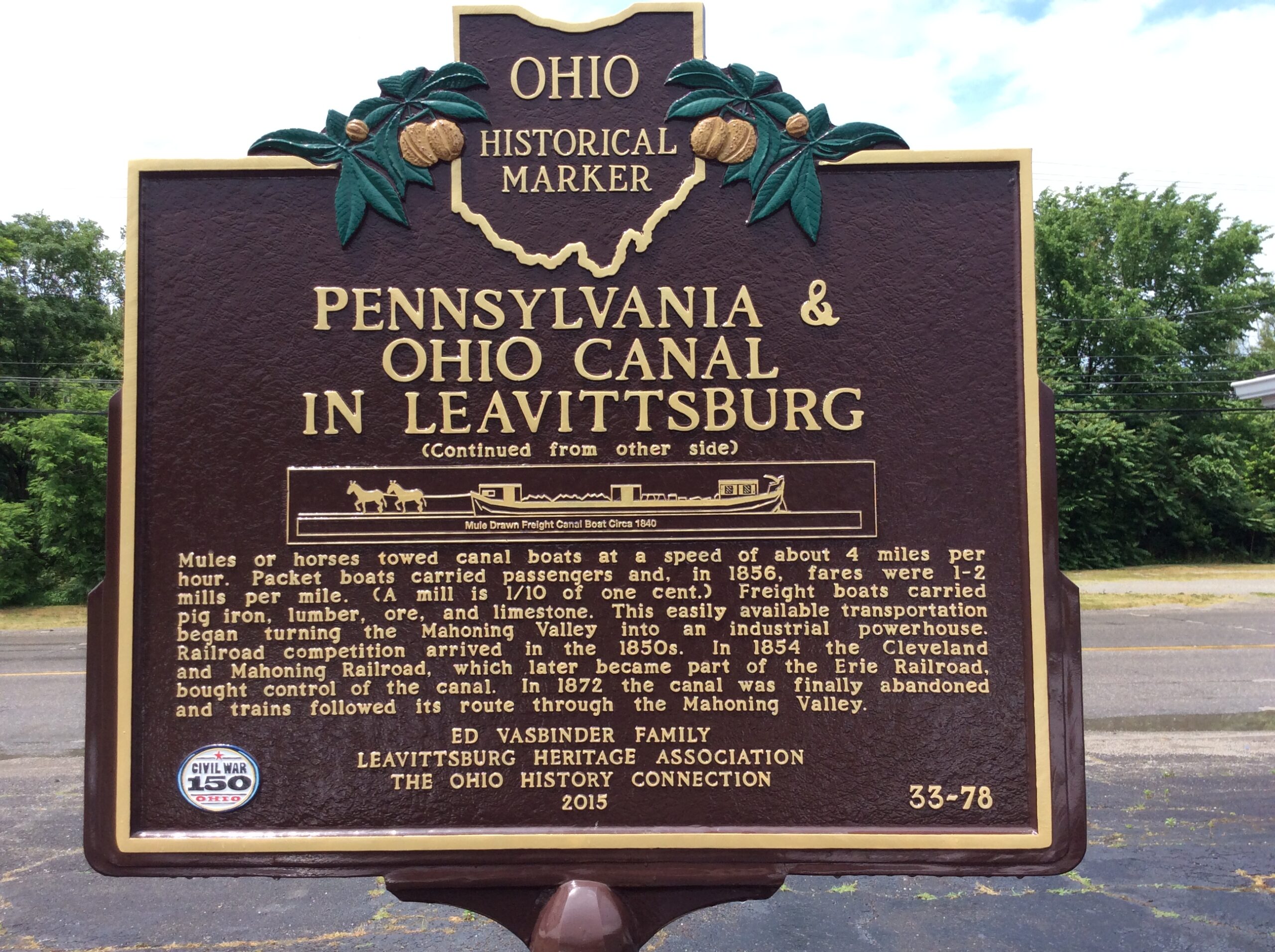
Side B: (Continued from other side) Mules or horses towed canal boats at a speed of about 4 miles per hour. Packet boats carried passengers and, in 1856, fares were 1-2 mills per mile (a mill is 1/10 of one cent). Freight boats carried pig iron, lumber, ore, and limestone. This easily available transportation began turning the Mahoning Valley into an industrial powerhouse. Railroad competition arrived in the 1850s. In 1854 the Cleveland and Mahoning Railroad, which later became part of the Erie Railroad, bought control of the canal. In 1872 the canal was finally abandoned and trains followed its route through the Mahoning Valley.
Sponsors: John and Shirley D’Orio Combs Family, Downtown Leavittsburg Improvement Association, Ed Vasbinder Family, Leavittsburg Heritage Association, and The Ohio History Connection