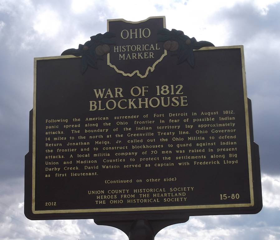
Side A: Following the American surrender of Fort Detroit in August 1812, panic spread along the Ohio frontier in fear of possible Indian attacks. The boundary of the Indian territory lay approximately 14 miles to the north at the Greenville Treaty line. Ohio Governor Return Jonathan Meigs, Jr. called out the Ohio Militia to defend the frontier and to construct blockhouses to guard against Indian attacks. A local militia company of 70 men was raised in present Union and Madison Counties to protect the settlements along Big Darby Creek. David Watson served as captain with Frederick Lloyd as first lieutenant.
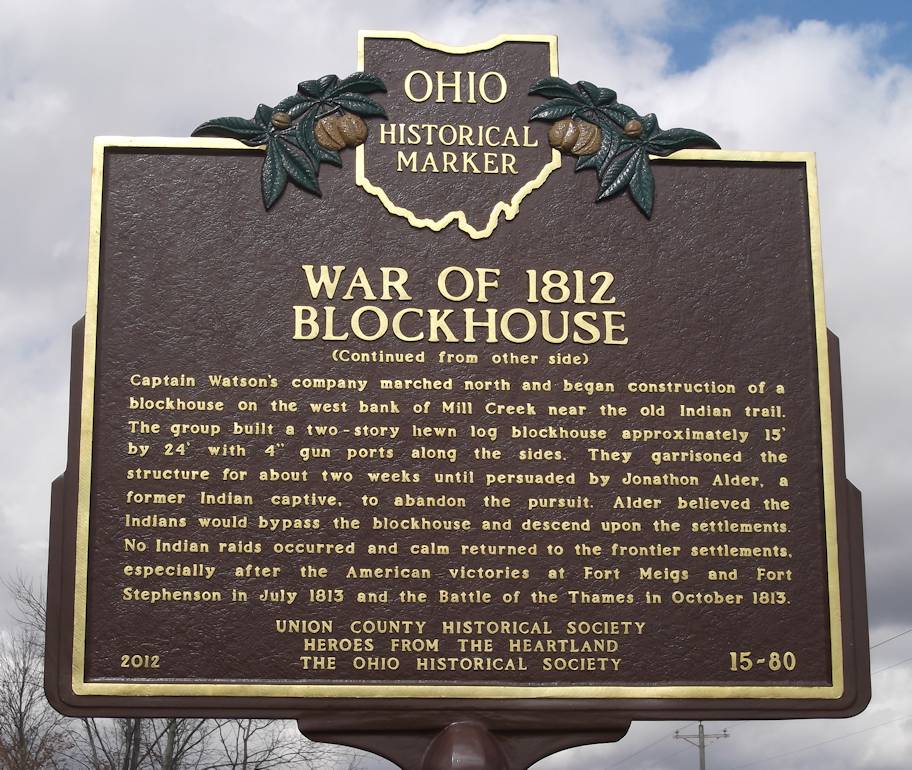
Side B: Captain Watson’s company marched north and began construction of a blockhouse on the west bank of Mill Creek near the old Indian trail. The group built a two-story hewn log blockhouse approximately 15′ by 24′ with 4″ gun ports along the sides. They garrisoned the structure for about two weeks until persuaded by Jonathon Alder, a former Indian captive, to abandon the pursuit. Alder believed the Indians would bypass the blockhouse and descend upon the settlements. No Indian raids occurred and calm returned to the frontier settlements, especially after the American victories at Fort Meigs and Fort Stephenson in July 1813 and the Battle of the Thames in October 1813.