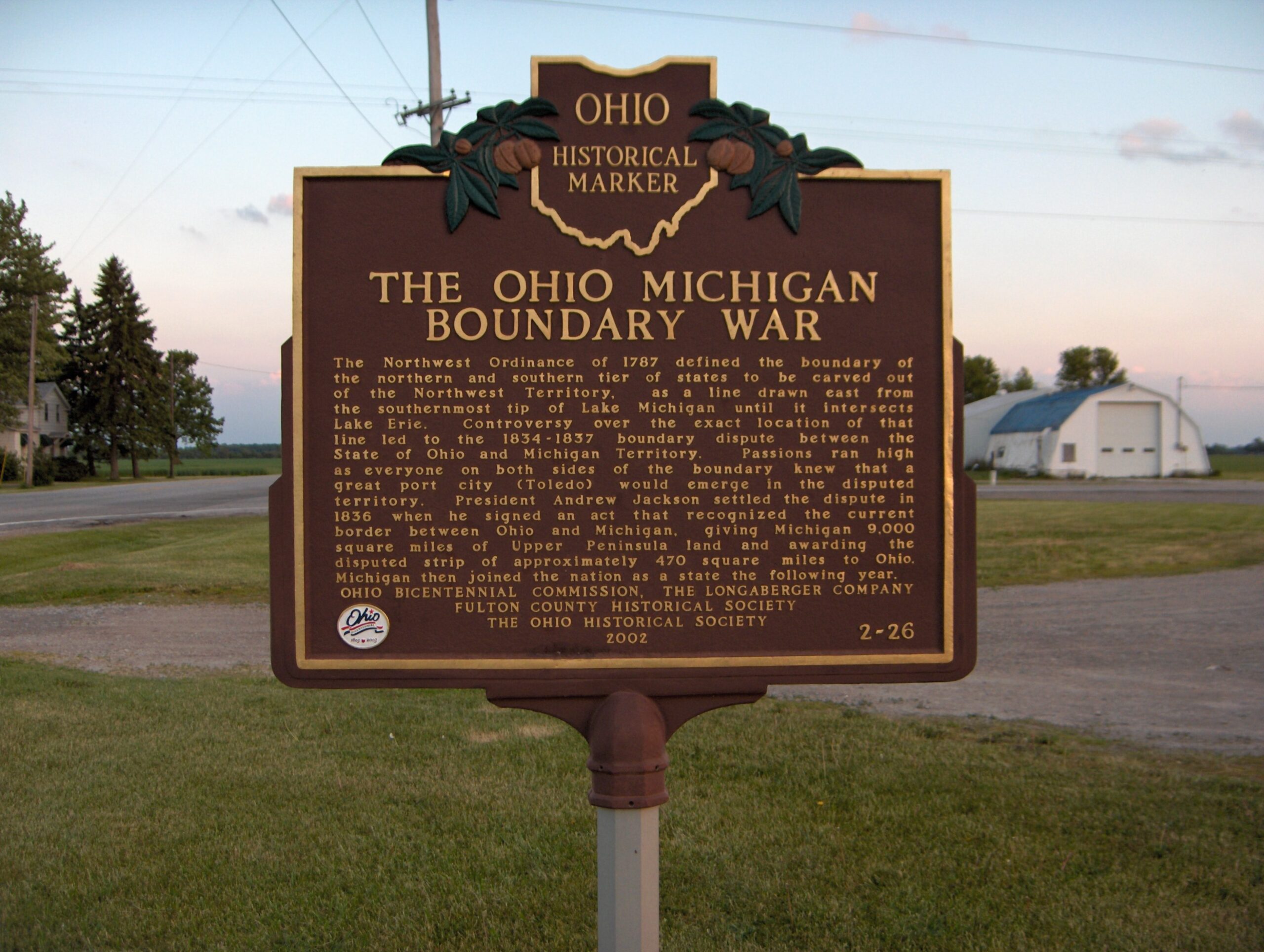
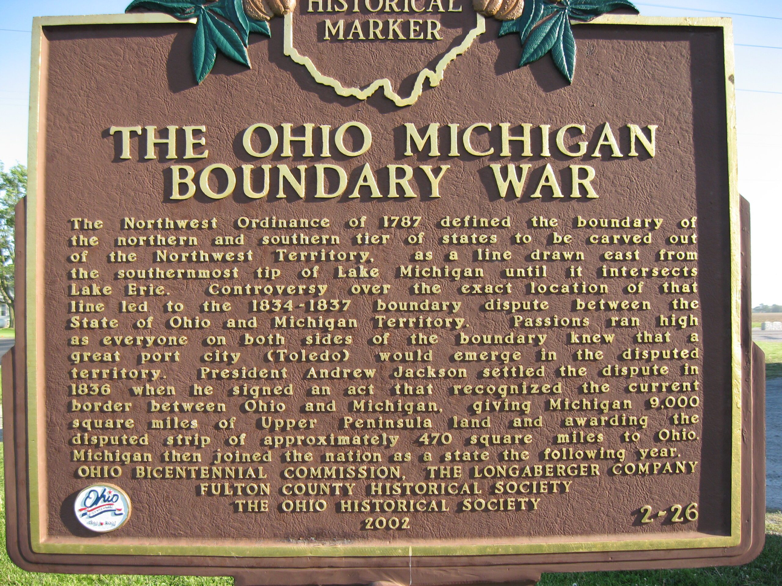
Side A: The Northwest Ordinance of 1787 defined the boundary of the northern and southern tier of states to be carved out of the Northwest Territory, as a line drawn east from the southernmost tip of Lake Michigan until it intersects Lake Erie. Controversy over the exact location of that line led to the 1834-1837 boundary dispute between the State of Ohio and Michigan Territory. Passions ran high as everyone on both sides of the boundary knew that a great port city (Toledo) would emerge in the disputed territory. President Andrew Jackson settled the dispute in 1836 when he signed an act that recognized the current border between Ohio and Michigan, giving Michigan 9,000 square miles of Upper Peninsula land and awarding the disputed strip of approximately 470 square miles to Ohio. Michigan then joined the nation as a state the following year.
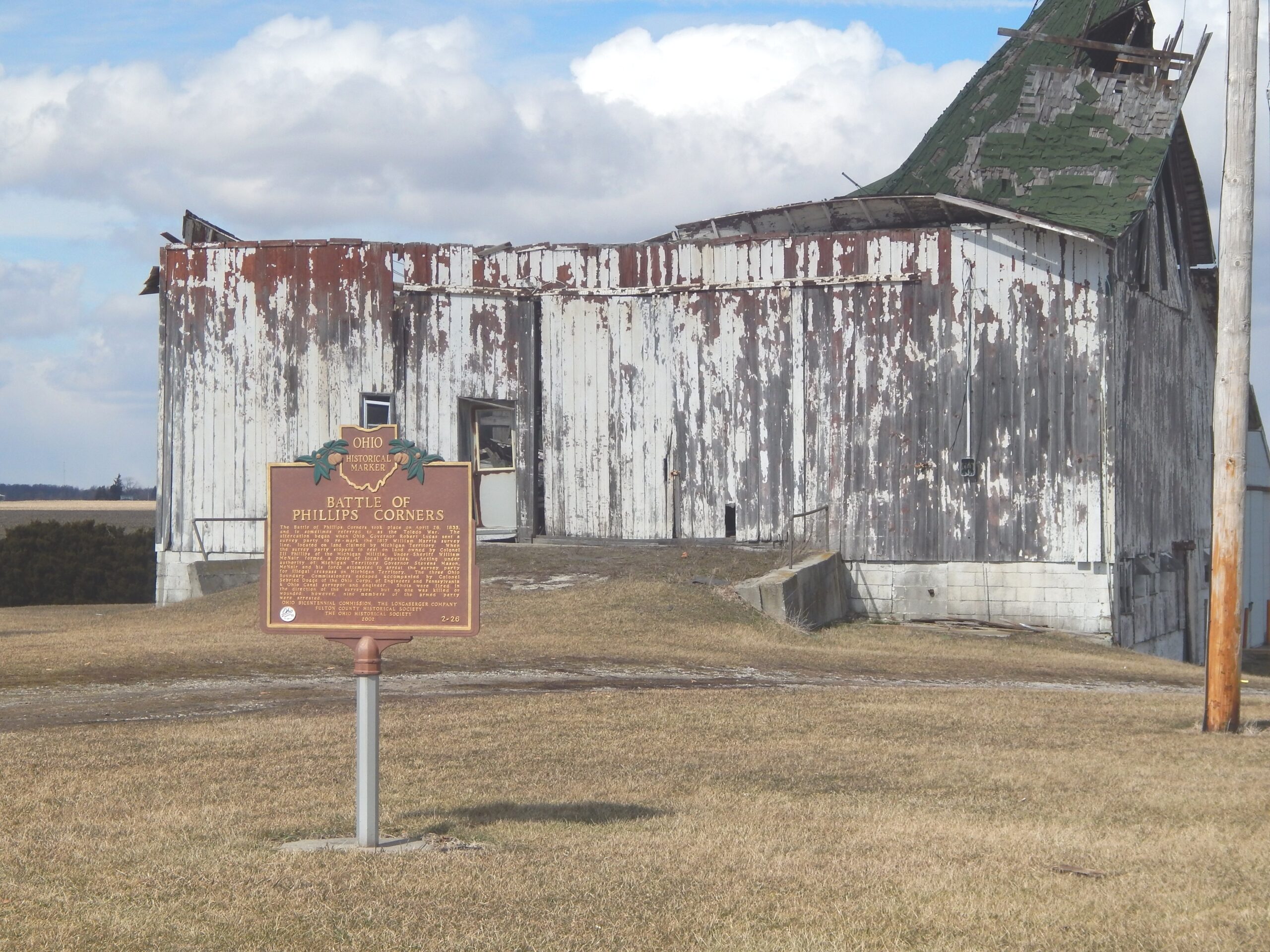
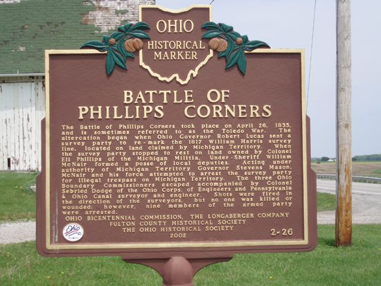
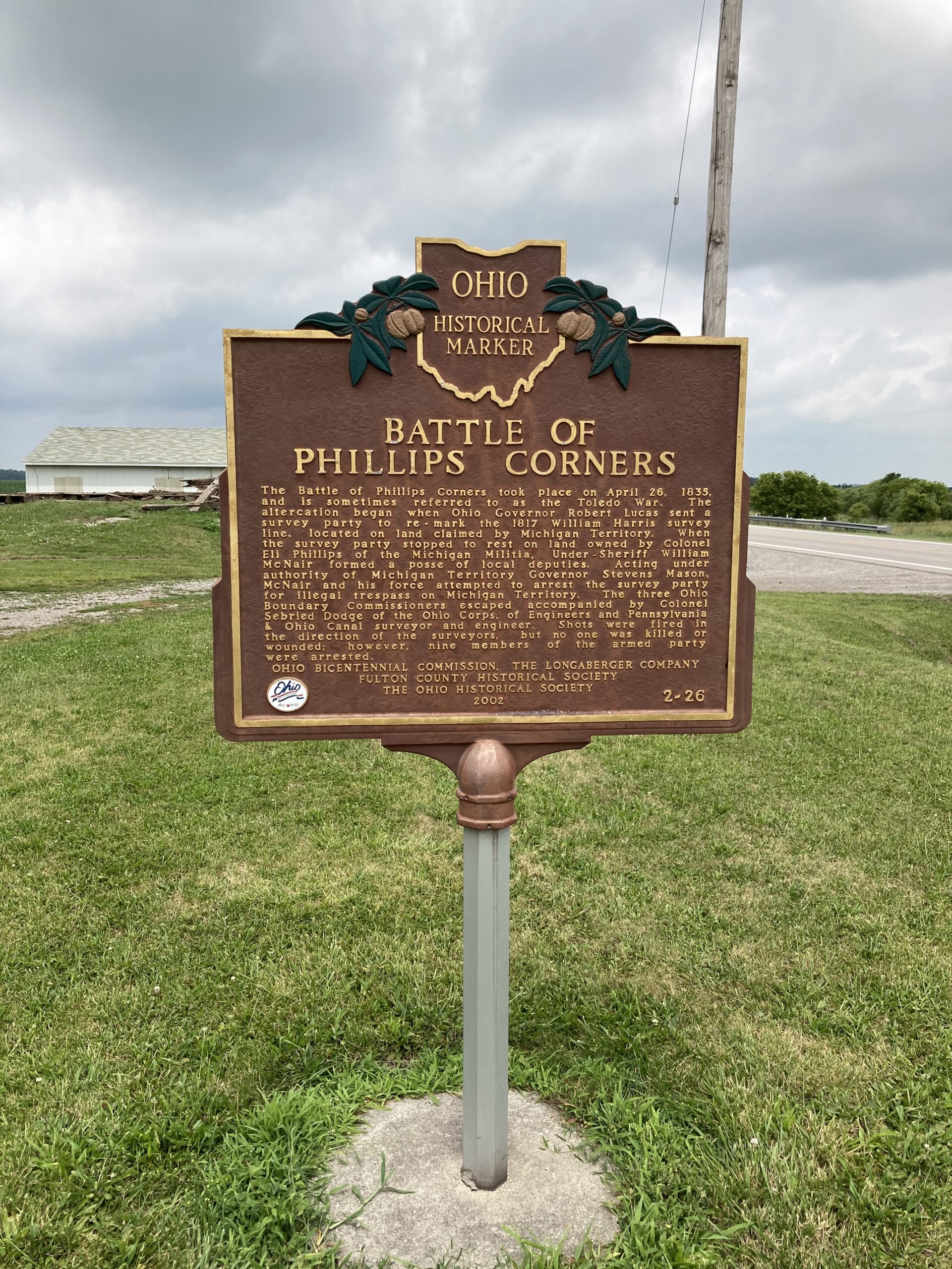
Side B: The Battle of Phillips Corners took place on April 26, 1835, and is sometimes referred to as the Toledo War. The altercation began when Ohio Governor Robert Lucas sent a survey party to re-mark the 1817 William Harris survey line, located on land claimed by Michigan Territory. When the survey party stopped to rest on land owned by Colonel Eli Phillips of the Michigan Militia, Under-Sheriff William McNair formed a posse of local deputies. Acting under authority of Michigan Territory Governor Stevens Mason, McNair and his force attempted to arrest the survey party for illegal trespass on Michigan Territory. The three Ohio Boundary Commissioners escaped accompanied by Colonel Sebried Dodge of the Ohio Corps. of Engineers and Pennsylvania & Ohio Canal surveyor and engineer. Shots were fired in the direction of the surveyors, but no one was killed or wounded; however, nine members of the armed party were arrested.
Sponsors: Ohio Bicentennial Commission, The Longaberger Company, Fulton County Historical Society, and The Ohio Historical Society