Below is a complete listing of all Ohio Historical Markers. To find a detailed marker listing including text, photographs, and locations, click on a county below. Our listing is updated by the markers program as new markers are installed and older markers are reported damaged or missing.
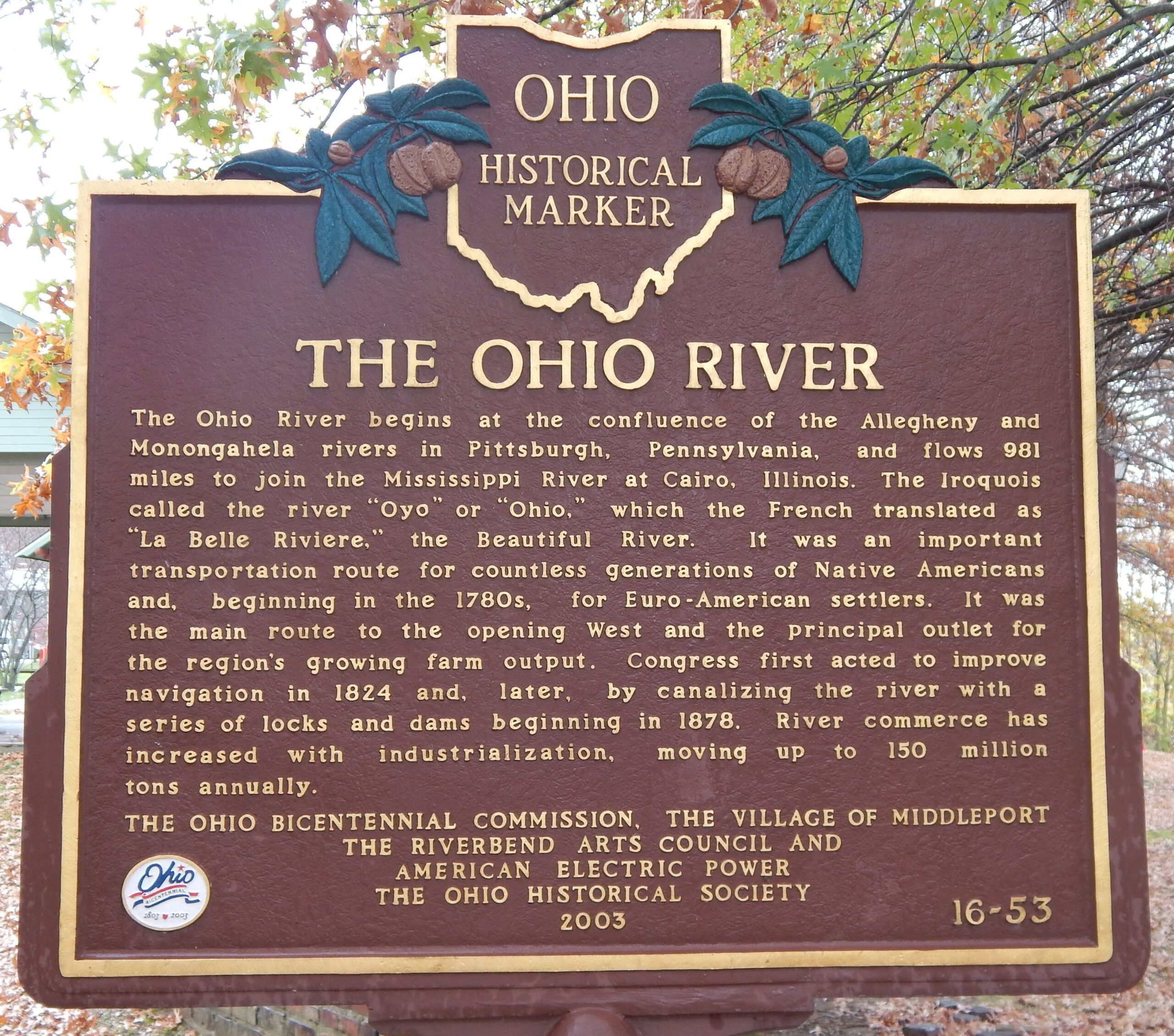
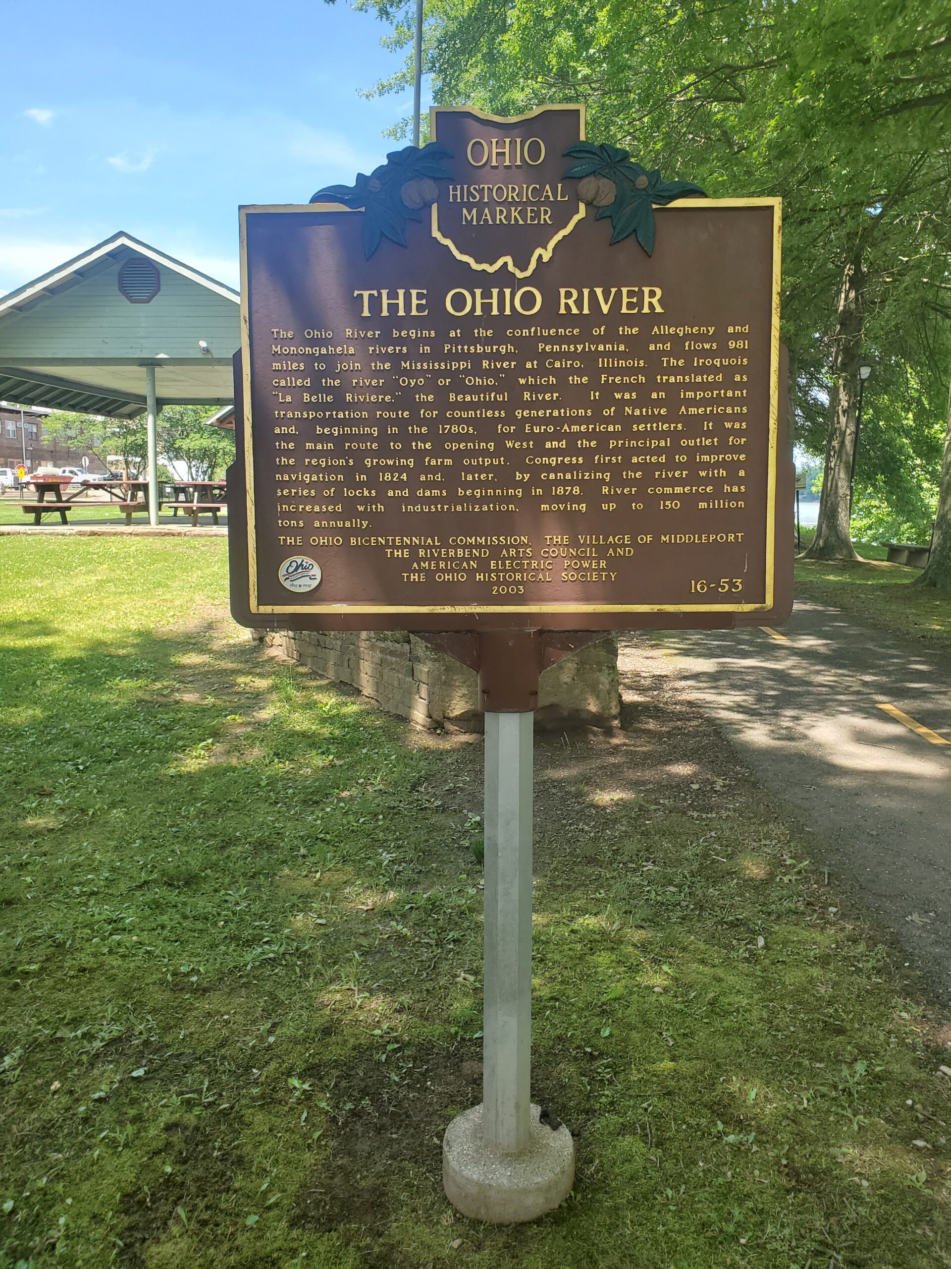
Side A: The Ohio River begins at the confluence of the Allegheny and Monongahela rivers in Pittsburgh, Pennsylvania, and flows 981 miles to join the Mississippi River at Cairo, Illinois. The Iroquois called the river “Oyo” or “Ohio,” which the French translated as “La Belle Riviere,” the Beautiful River. It was an important transportation route for countless generations of Native Americans and, beginning in the 1780s, for Euro-American settlers. It was the main route to the opening West and the principal outlet for the region’s growing farm output. Congress first acted to improve navigation in 1824 and, later, by canalizing the river with a series of locks and dams beginning in 1878. River commerce has increased with industrialization, moving up to 150 million tons annually.
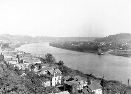
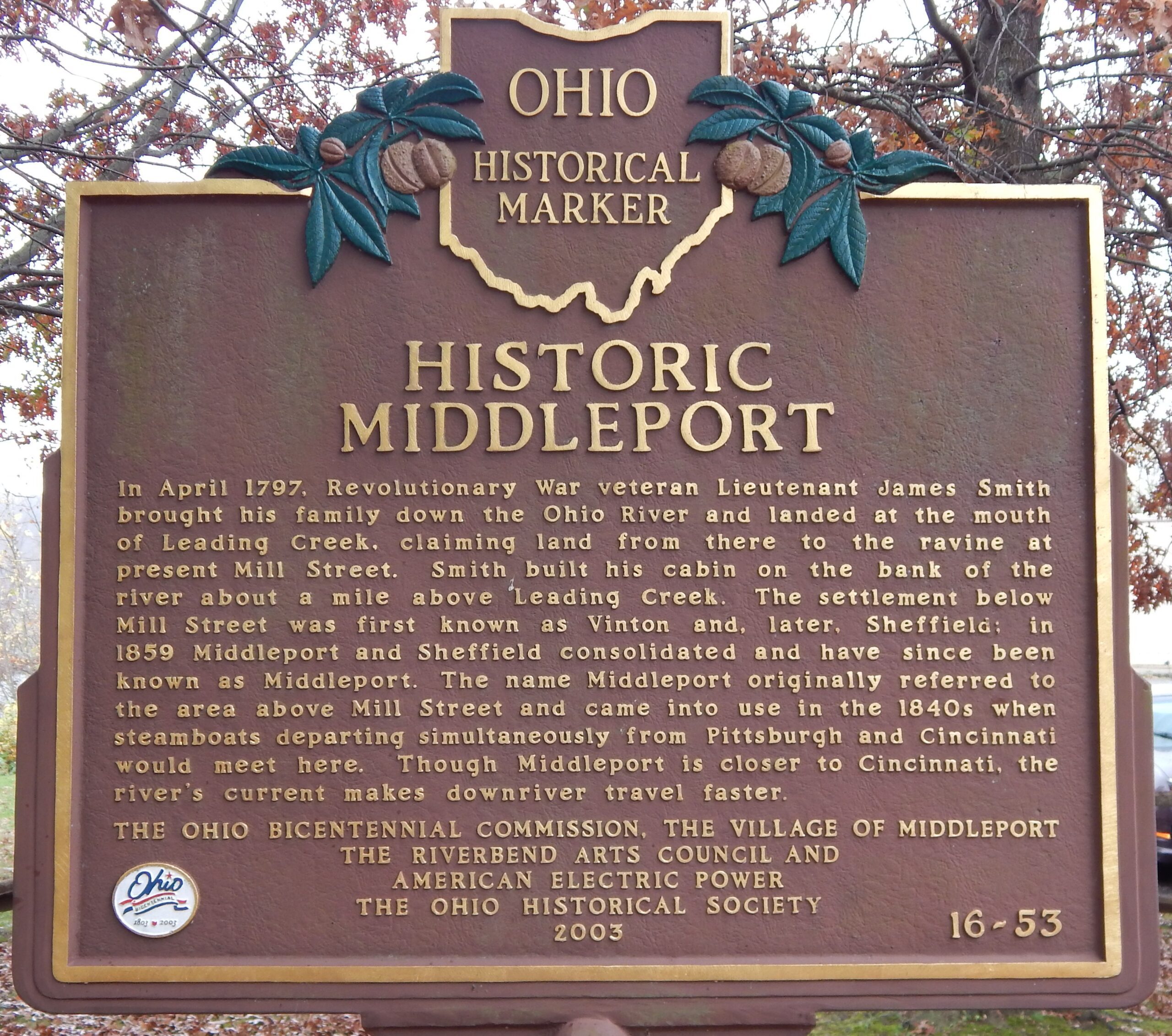
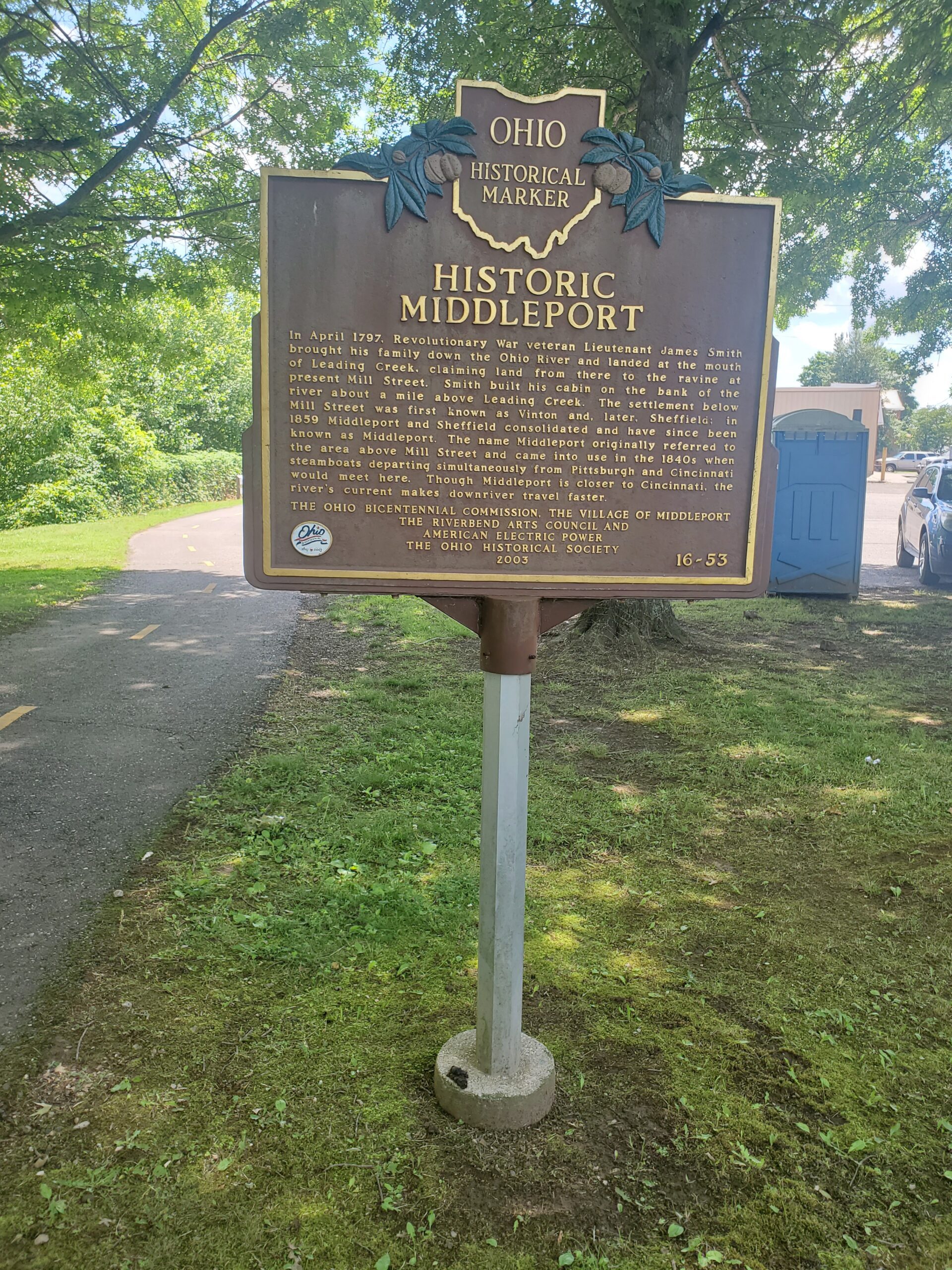
Side B: In April 1797, Revolutionary War veteran Lieutenant James Smith brought his family down the Ohio River and landed at the mouth of Leading Creek, claiming land from there to the ravine at present Mill Street. Smith built his cabin on the bank of the river about a mile above Leading Creek. The settlement below Mill Street was first known as Vinton and, later, Sheffield; in 1859 Middleport and Sheffield consolidated and have since been known as Middleport. The name Middleport originally referred to the area above Mill Street and came into use in the 1840s when steamboats departing simultaneously from Pittsburgh and Cincinnati would meet here. Though Middleport is closer to Cincinnati, the river’s current makes downriver travel faster.
Sponsors: Ohio Bicentennial Commission, The Village of Middleport, The Riverbend Arts Council, American Electric Power, and The Ohio Historical Society
Address: Dave Diles Park on Mill Street, at the river,
Middleport,
OH,
45760
Location: NE corner of S 2nd Street and Mill Street