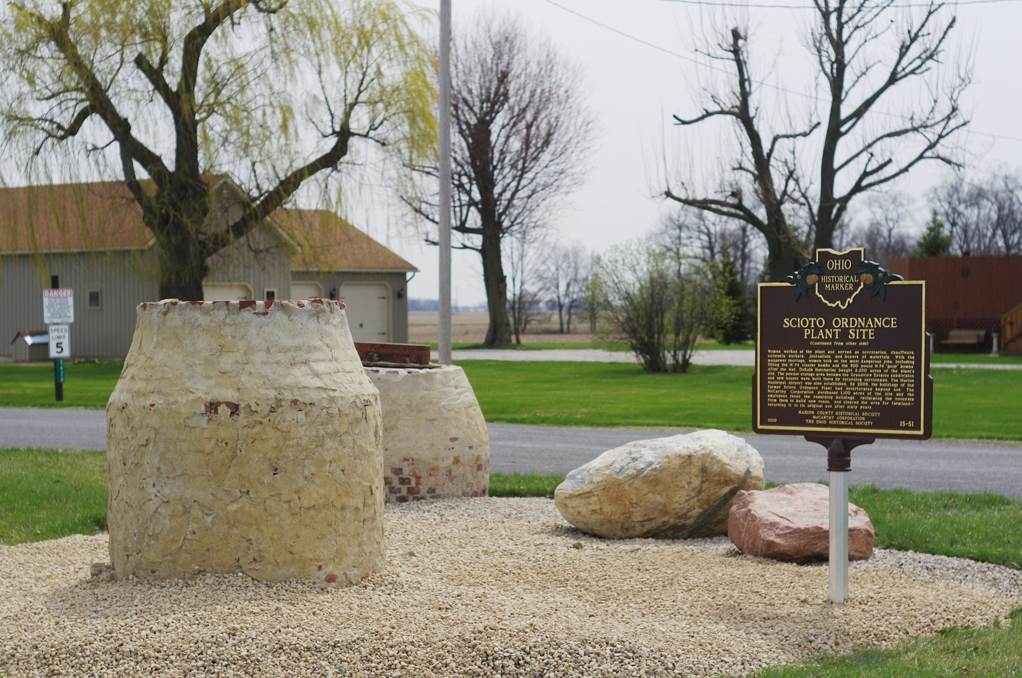
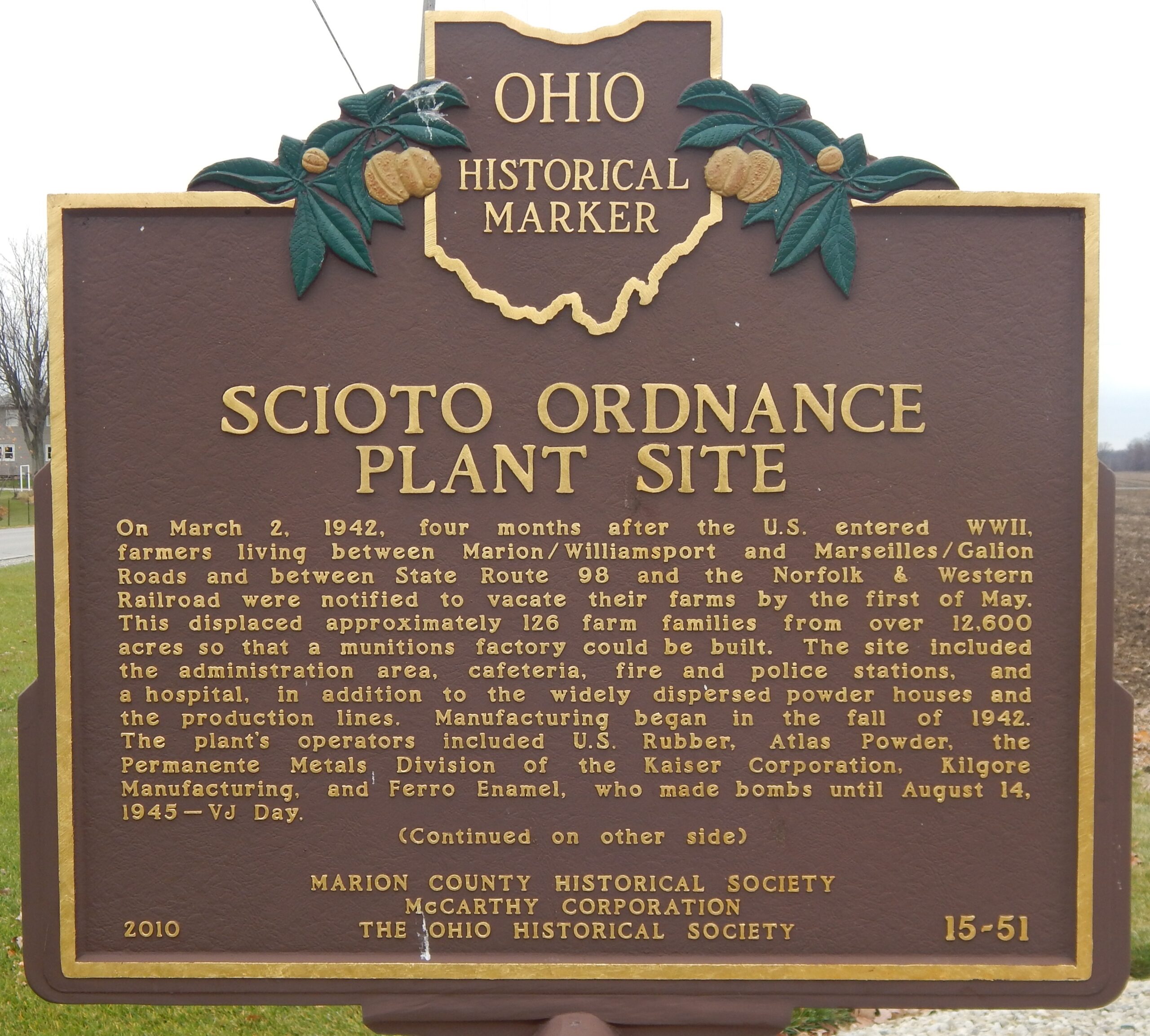
Side A: On March 2, 1942, four months after the U.S. entered WWII, farmers living between Marion-Williamsport and Marseilles-Galion Roads and between State Route 98 and the Norfolk & Western Railroad were notified to vacate their farms by the first of May. This displaced approximately 126 farm families from over 12,600 acres so that a munitions factory could be built. The site included the administration area, cafeteria, fire and police stations, and a hospital, in addition to the widely dispersed powder houses and the production lines. Manufacturing began in the fall of 1942. The plant’s operators included U.S. Rubber, Atlas Powder, the Permanente Metals Division of the Kaiser Corporation, Kilgore Manufacturing, and Ferro Enamel, who made bombs until August 14, 1945 — VJ Day. (Continued other side)
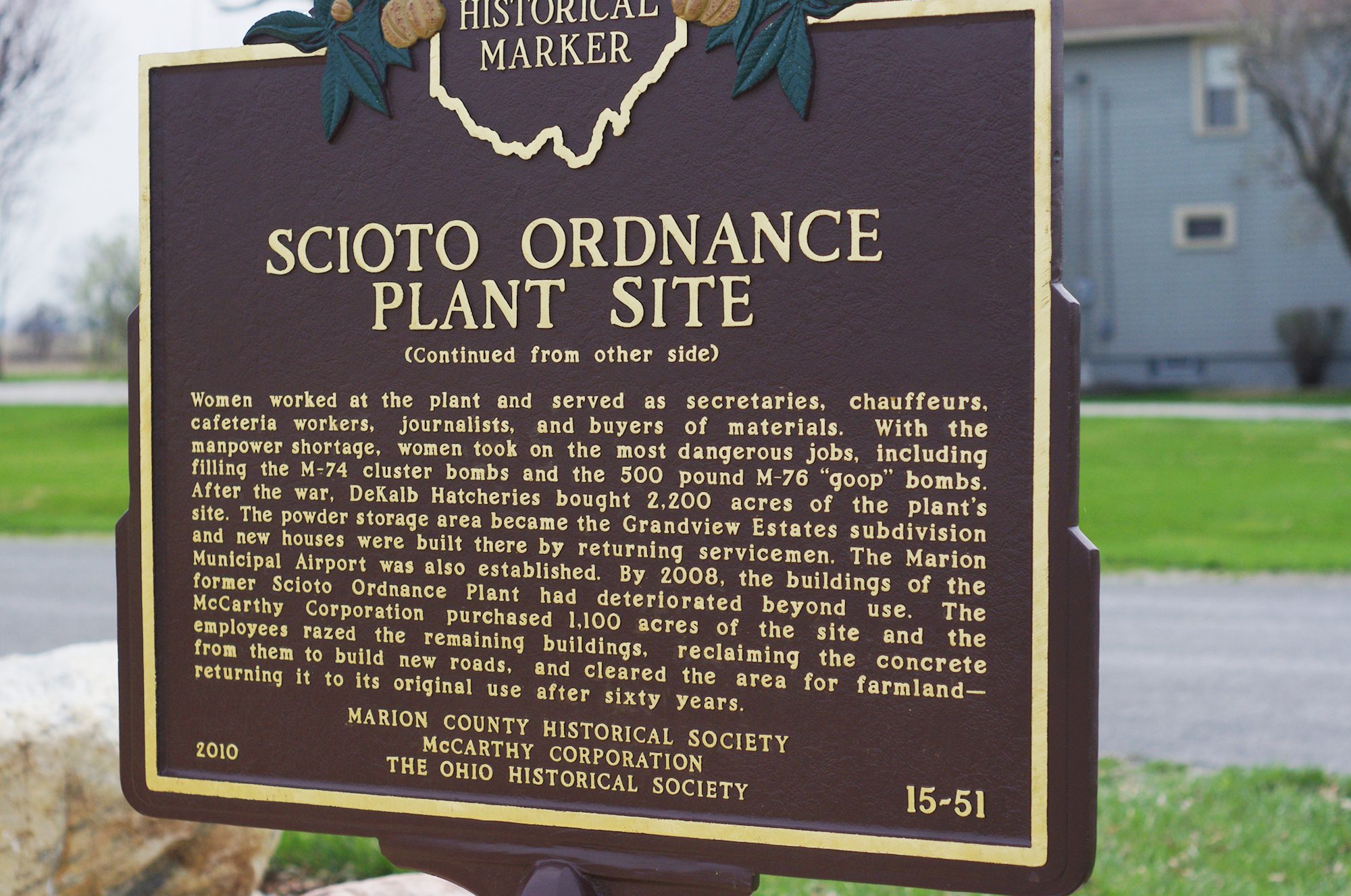
Side B: (Continued from other side) Women worked at the plant and served as secretaries, chauffeurs, cafeteria workers, journalists, and buyers of materials. With the manpower shortage, women took on the most dangerous jobs, including filling the M-74 cluster bombs and the 500 pound M-76 “goop” bombs. After the war, DeKalb Hatcheries bought 2,200 acres of the plant’s site. The powder storage area became the Grandview Estates subdivision and new houses were built there by returning servicemen. The Marion Municipal Airport was also established. By 2008, the buildings of the former Scioto Ordnance Plant had deteriorated beyond use. Charles H. McCarthy purchased 1,100 acres of the site and he and his employees razed the remaining buildings, reclaiming the concrete from them to build new roads, and cleared the area for farmland—returning it to its original use after sixty years.