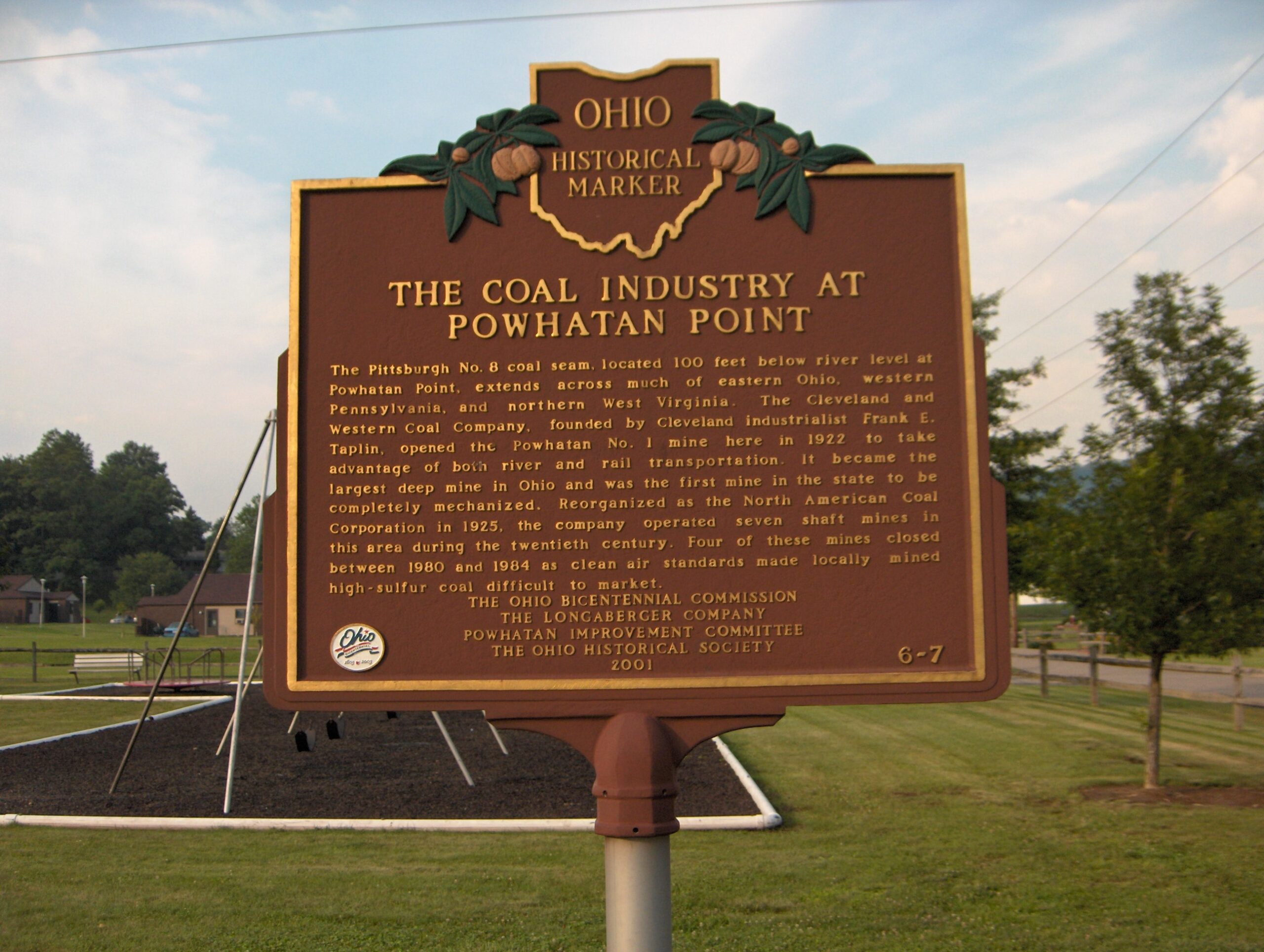
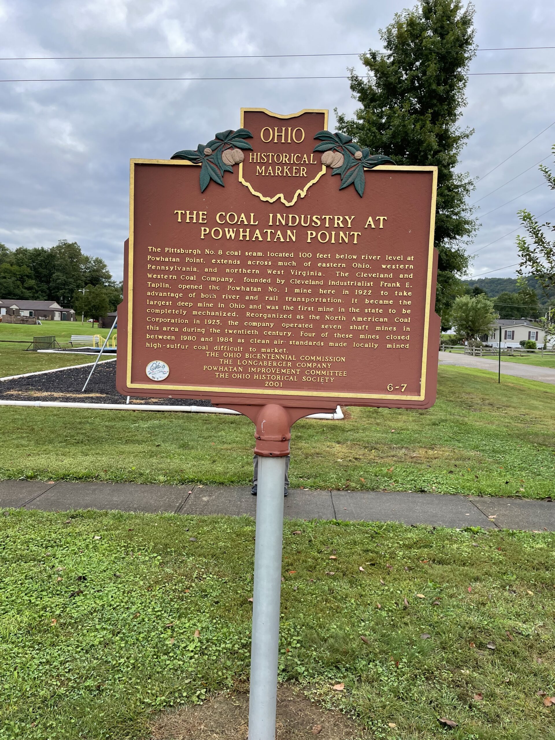
Side A: The Pittsburgh No. 8 coal seam, located 100 feet below river level at Powhatan Point, extends across much of eastern Ohio, western Pennsylvania, and northern West Virginia. The Cleveland and Western Coal Company, founded by Cleveland industrialist Frank E. Taplin, opened the Powhatan No. 1 mine here in 1922 to take advantage of both river and rail transportation. It became the largest deep mine in Ohio and was the first mine in the state to be completely mechanized. Reorganized as the North American Coal Corporation in 1925, the company operated seven shaft mines in this area during the twentieth century. Four of these mines closed between 1980 and 1984 as clean air standards made locally mined high-sulfur coal difficult to market.
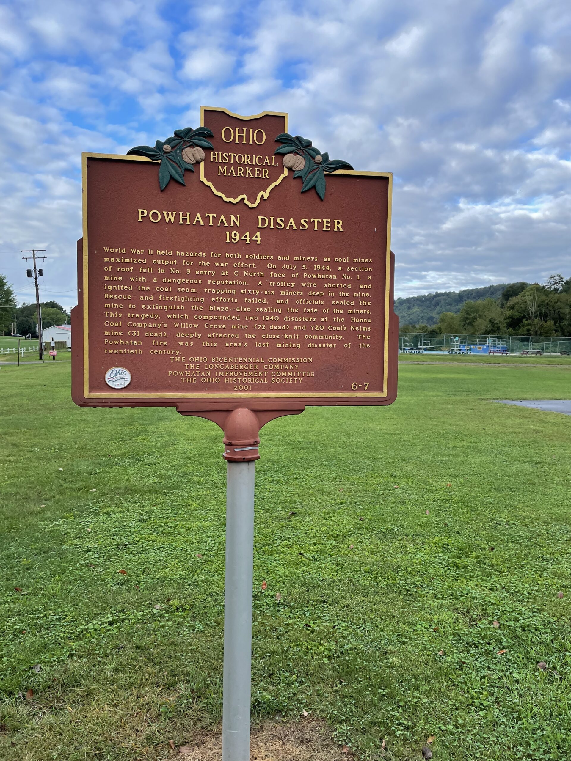
Side B: World War II held hazards for both soldiers and miners as coal mines maximized output for the war effort. On July 5, 1944, a section of roof fell in No. 3 entry at C North face of Powhatan No. 1, a mine with a dangerous reputation. A trolley wire shorted and ignited the coal seam, trapping sixty-six miners deep in the mine. Rescue and firefighting efforts failed, and officials sealed the mine to extinguish the blaze-also sealing the fate of the miners. This tragedy, which compounded two 1940 disasters at the Hanna Coal Company’s Willow Grove mine (72 dead) and Y&O Coal’s Nelms mine (31 dead), deeply affected the close-knit community. The Powhatan fire was this area’s last mining disaster of the twentieth century.
Sponsors: Ohio Bicentennial Commission, The Longaberger Company, Powhatan Improvement Committee, and The Ohio Historical Society