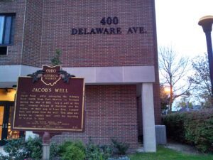
Jacob Foos, while surveying the Military Road north from Fort Morrow to Fremont during the War of 1812, dug a well at this site. General William H. Harrison and his troops, on their way to Lake Erie, camped here and drank from the well. This area was known as “Jacob’s Well” until the founding of Marion in 1822.
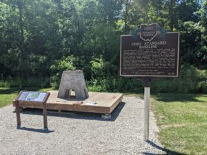
The Ohio Standard Baseline (OSB) was a geodetic baseline that provided highly accurate measurements of the earth and made possible extremely fine calibrations of surveying equipment. Several such baselines were established in Europe and South America during the mid-twentieth century, specifically designed to use a measurement device called the Vaisala Comparator, a precursor of modern laser light measurement systems. In 1953, Dr. T.J. Kukkamaki, then a professor in the Department of Geodetic Science at The Ohio State University, proposed establishing a baseline in Ohio that would be part of the worldwide efforts to accurately understand how the size and shape of the earth change over time. Built between 1965 and 1966, the resulting OSB consisted of a series of eight concrete pillars supporting mirrors and instruments, spaced along a 500 meter distance. (Continued on other side)
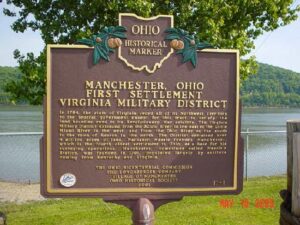
In 1784, the state of Virginia ceded all of its Northwest Territory to the federal government except for this tract to satisfy the land bounties owed to its Revolutionary War soldiers. The Virginia Military District extended from the Scioto River in the east to the Little Miami River in the west, and from the Ohio River on the south to the town of Kenton in the north. The District contained over 4 million acres of land. Nathaniel Massie founded Manchester, which is the fourth oldest settlement in Ohio, as a base for his surveying operations. Manchester, sometimes called Massie’s Station, was founded in 1791, populated largely by settlers coming from Kentucky and Virginia.
In April 1784, the Continental Congress adopted the Report of Government for the Western Territory, a broad plan drafted primarily by Thomas Jefferson for organizing the United States’ new western lands that were ceded by the states and purchased from Native Americans. One of the most far-reaching legislative acts in American history, the resulting Land Ordinance of 1785, passed on May 20th, established the public land system by which all federal land was surveyed and distributed. The Ordinance established a rectilinear survey system that divided land into townships of six miles square aligned by north-south and east-west baselines, and set aside certain lands for Revolutionary War veterans and for public schools.
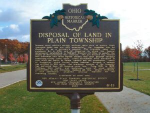
Because three distinct survey methods were used to survey Plain Township lands and are still meaningful, the township can be thought of as a surveyor’s museum. The township came into existence by a 1796 act of Congress in which the federal government established a Military District of Ohio to satisfy the claims of Revolutionary War veterans. The act divided the district into townships five miles square divided into four quarter-sections containing 4,000 acres each. These boundaries were surveyed in 1797 after the Battle of Fallen Timbers and the subsequent Treaty of Greenville, which forced Indian removal. Because a veteran was entitled to 100 acres, the southeast quarter of the township was surveyed into 40 hundred-acre lots. From 1801 to 1805, veterans, their heirs, and assignees, none of whom settled permanently in the township, claimed 24 lots. Abijah Holbrook, a land speculator, acquired veterans’ warrants for the remaining sixteen. (continued on other side)