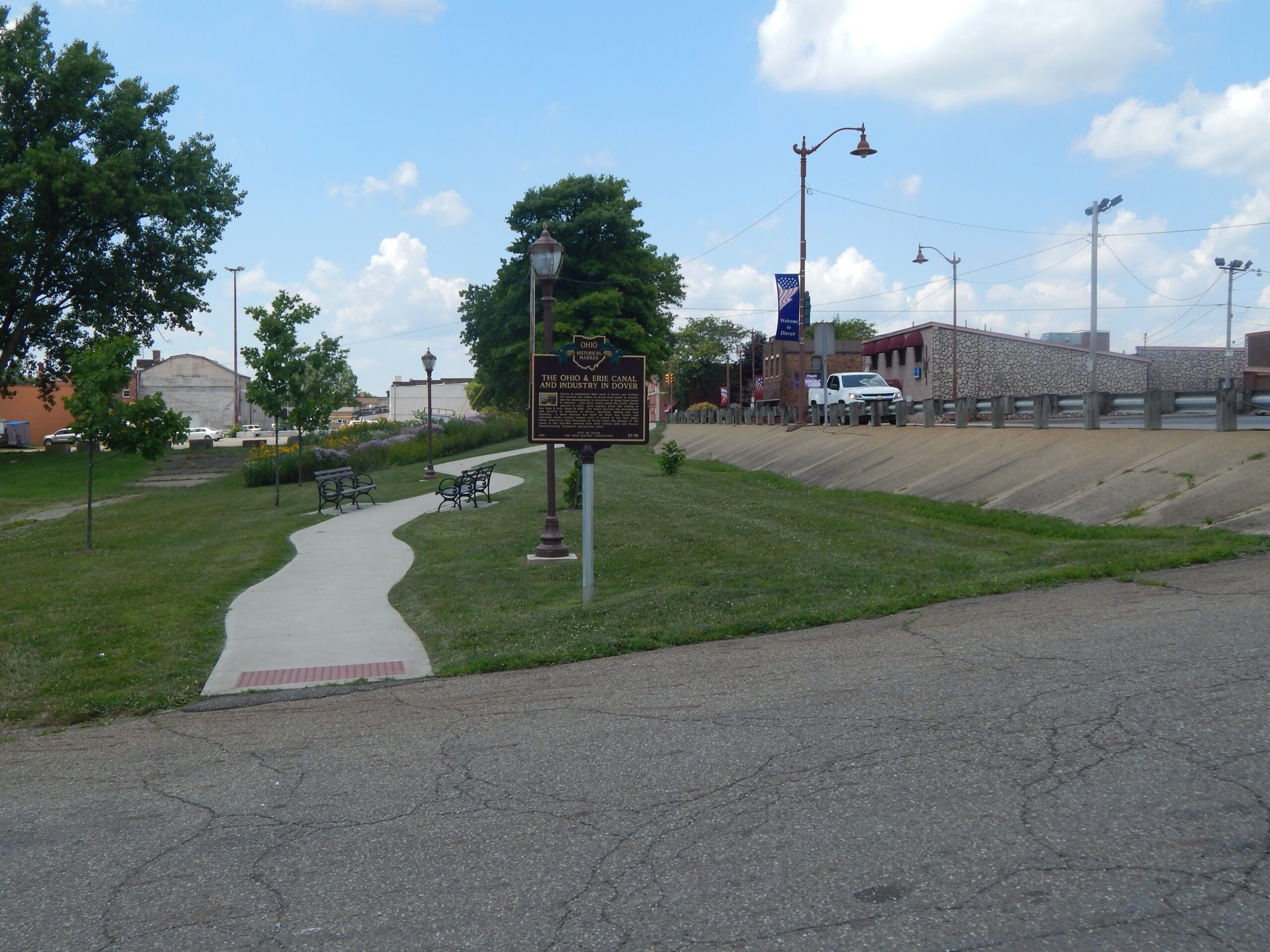
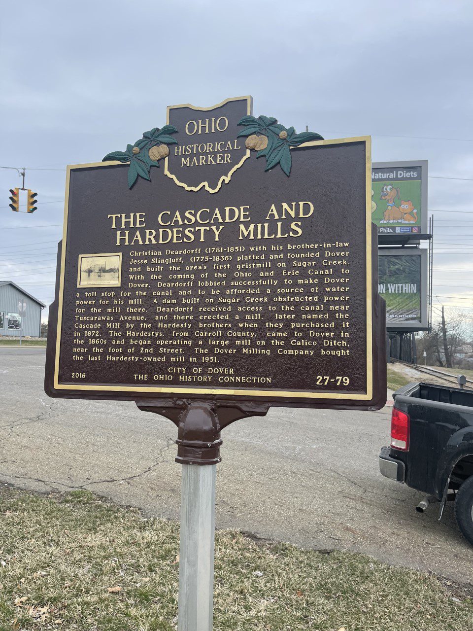
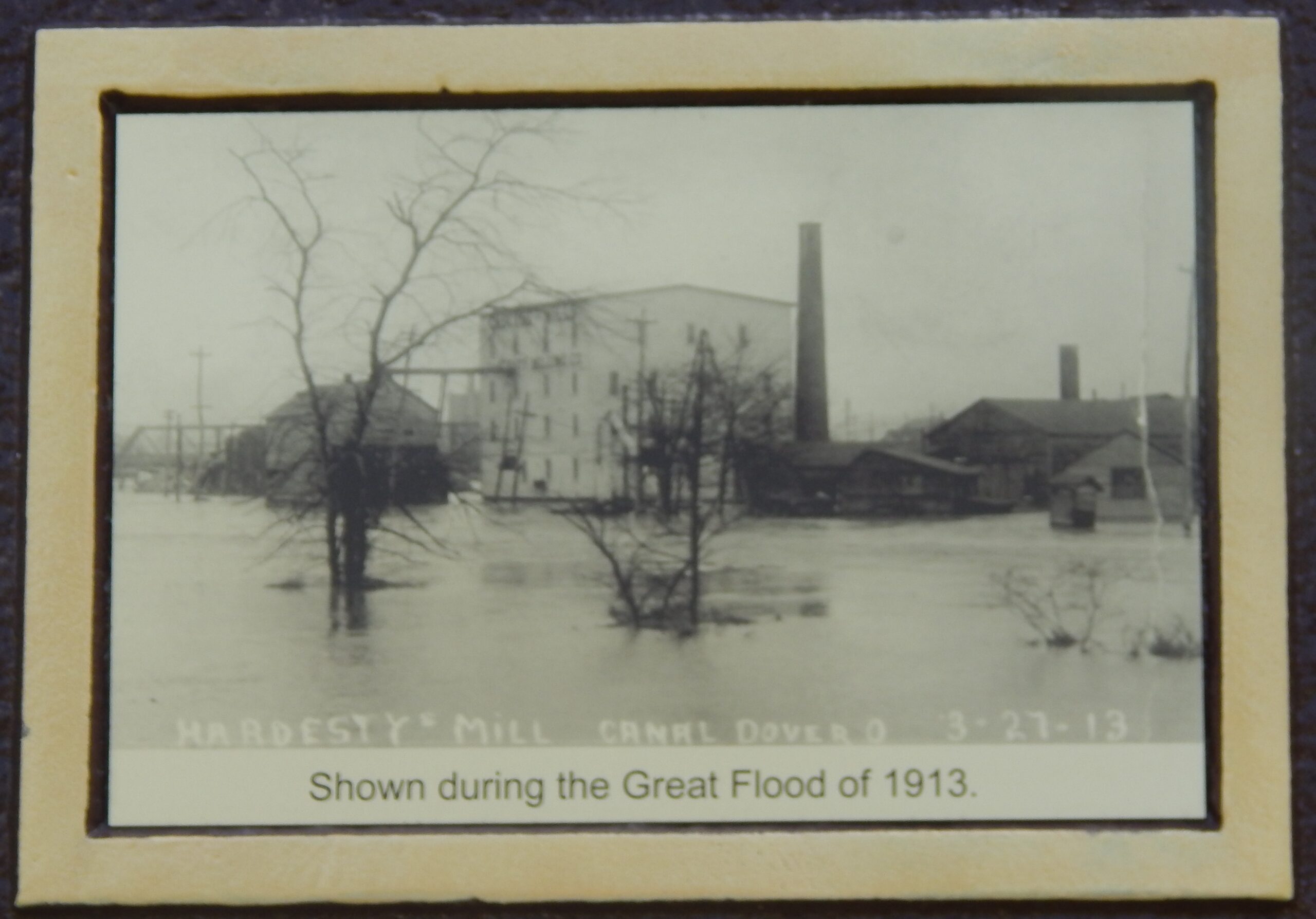
Side A: Christian Deardorff (1781-1851) with his brother-in-law Jesse Slingluff (1775-1836) platted and founded Dover and built the area’s first gristmill on Sugar Creek. With the coming of the Ohio and Erie Canal to Dover, Deardorff lobbied successfully to make Dover a toll stop for the canal and the be afforded a source of water power for his mill. A dam built on Sugar Creek obstructed for the mill there. Deardorff received access to the canal near Tuscarawas Avenue, and there erected a mill, later named the Cascade Mill by the Hardesty brothers when they purchased it in 1872. The Hardestys, from Carroll County, came to Dover in the 1860s and began operating a large mill on the Calico Ditch, near the foot of 2nd Street. The Dover Milling Company bought the last Hardesty-owned mill in 1951.
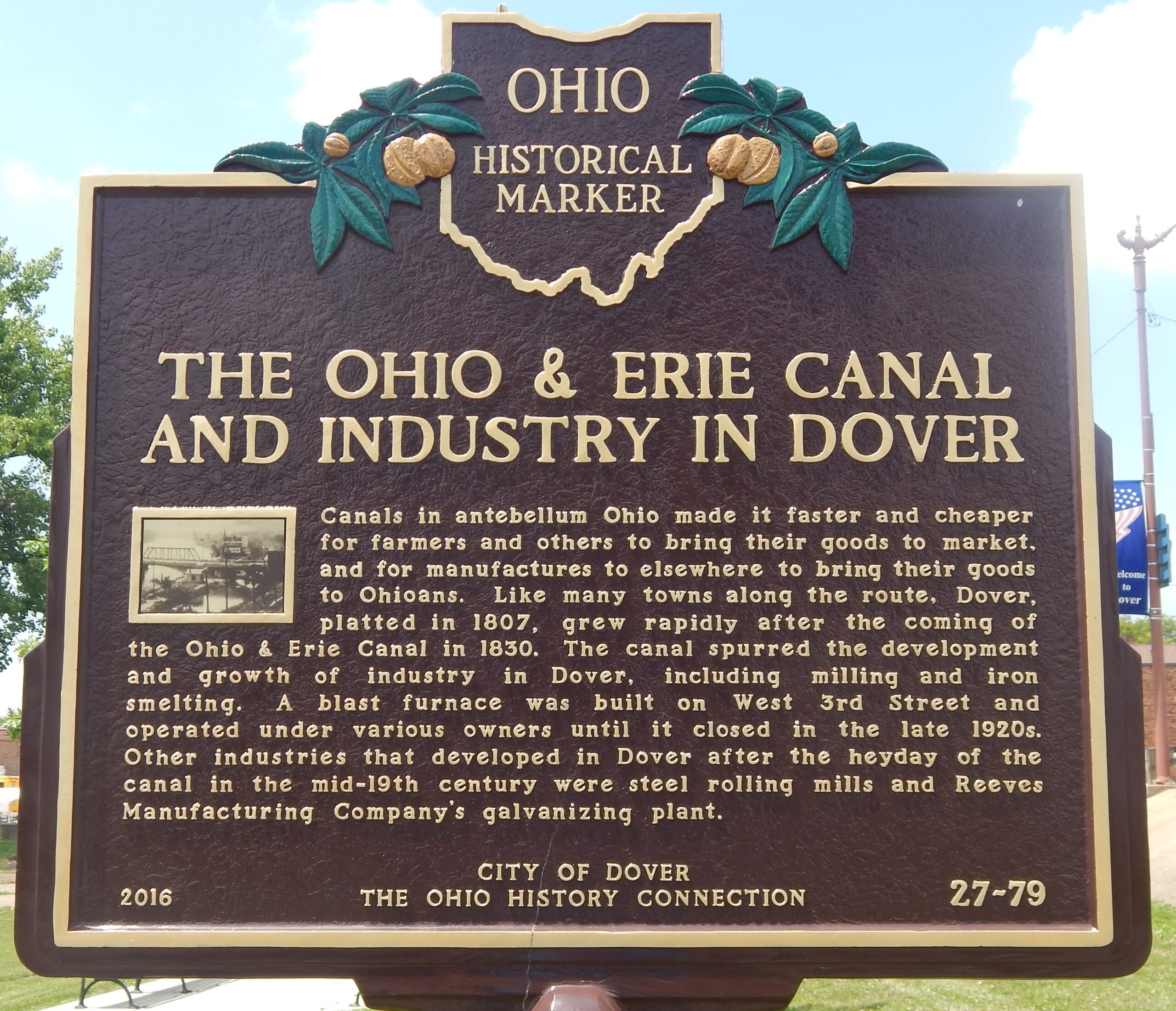
Side B: Canals in antebellum Ohio made it faster and cheaper for farmers and others to bring their goods to market and for manufacturers elsewhere to bring their goods to Ohioans. Like many towns along the route, Dover, platted in 1807, grew rapidlyafter the coming of the Ohio & Erie Canal in 1830. The canal spurred the development and growth of industry in Dover, including milling and iron smelting. A blast furnace was built on West 3rd Street and operated under various owners until it closed in the late 1920s. Other industries that developed in Dover after the heyday of the canal in the mid-19th century were steel rolling mills and Reeves Manufacturing Company’s galavanizing plant.