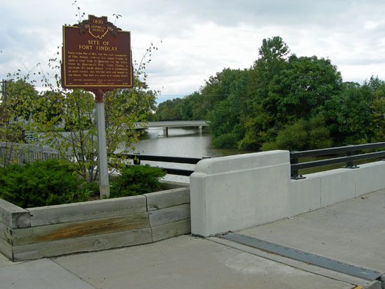
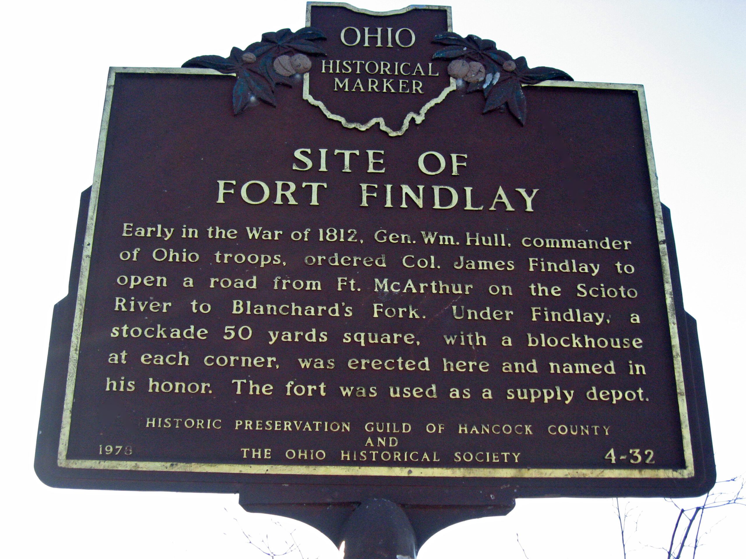
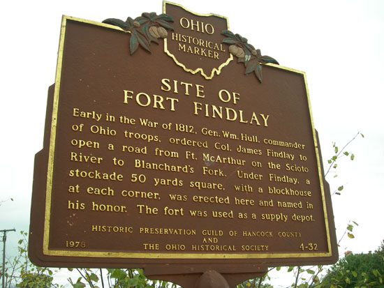
Side A: Early in the War of 1812, Gen. Wm. Hull, commander of Ohio troops, ordered Col. James Findlay to open a road from Ft. McArthur on the Scioto River to Blanchard’s Fork. Under Findlay, a stockade 50 yards square, with a blockhouse at each corner, was erected here and named in his honor. The fort was used as a supply depot.
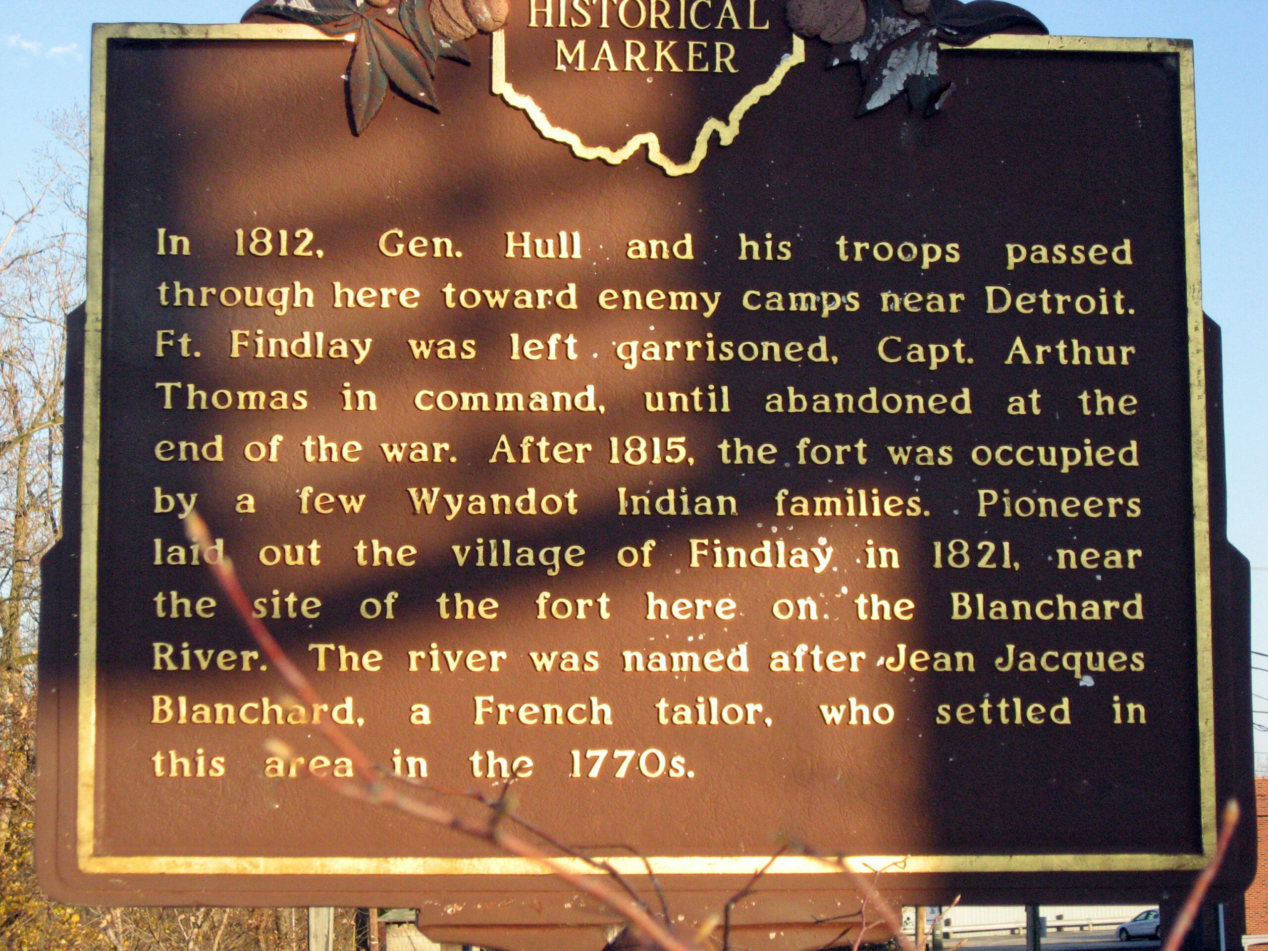
Side B: In 1812, Gen. Hull and his troops passed through here toward enemy camps near Detroit. Ft. Findlay was left garrisoned, Capt. Arthur Thomas in command, until abandoned at the end of the war. After 1815, the fort was occupied by a few Wyandot Indian families. Pioneers laid out the village of Findlay in 1821, near the site of the fort.