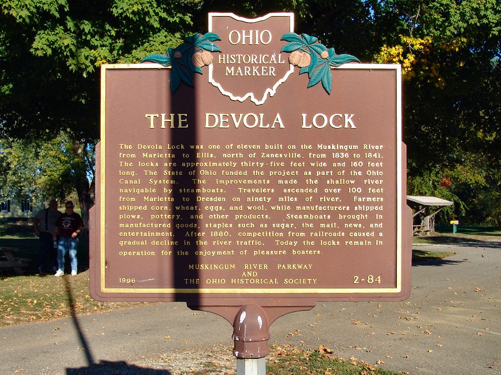
Side A: The Devola Lock was one of eleven built on the Muskingum River from Marietta to Ellis, north of Zanesville, from 1836 to 1841. The locks are approximately thirty-five feet wide and 160 feet long. The State of Ohio funded the project as part of the Ohio Canal System. The improvements made the shallow river navigable by steamboats. Travelers ascended over 100 feet from Marietta to Dresden on ninety miles of river. Farmers shipped corn, wheat, eggs, and wool, while manufacturers shipped goods, staples such as sugar, the mail, news, and entertainment. After 1880, competition from railroads caused a gradual decline in the river traffic. Today the locks remain in operation for the enjoyment of pleasure boaters.
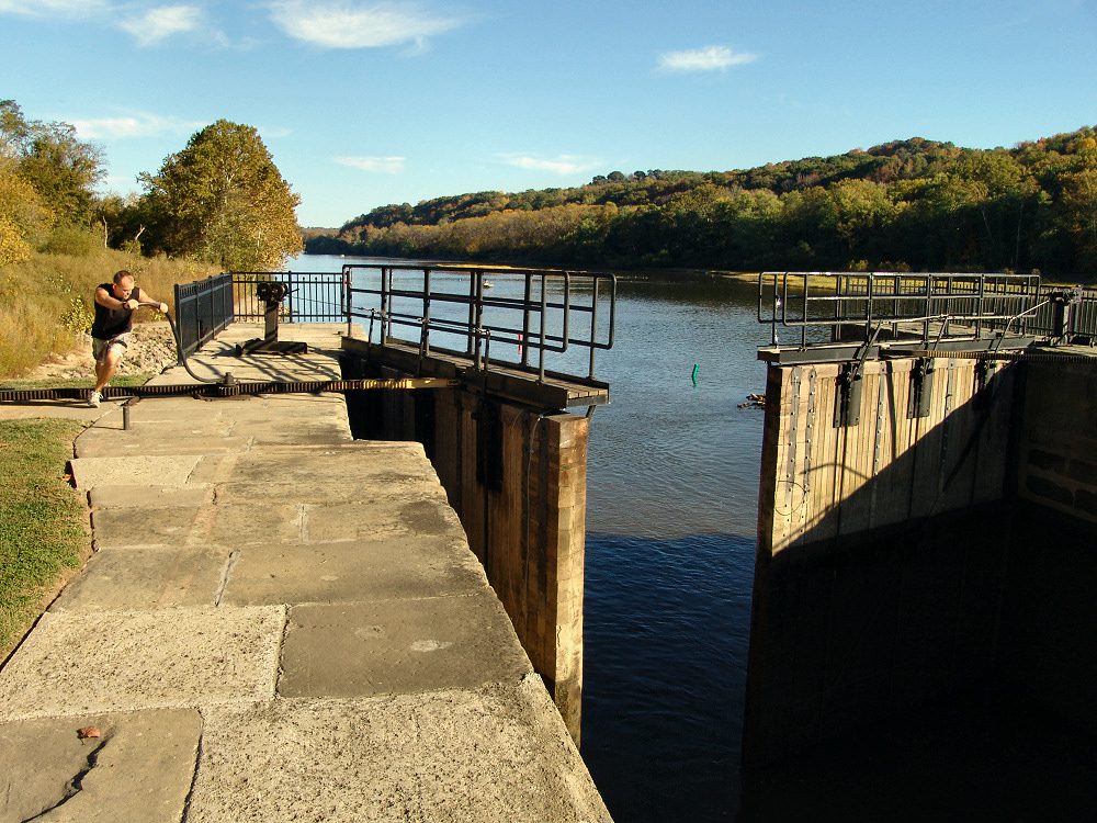
Location: Located at the town of Devola, 5.8 miles from the mouth of the Muskingum River, adjacent to the lock. From the intersection of Rt 60 and River Road follow the signs for “Devola Lock And Dam #2.” The marker is in a park beside the Lock.