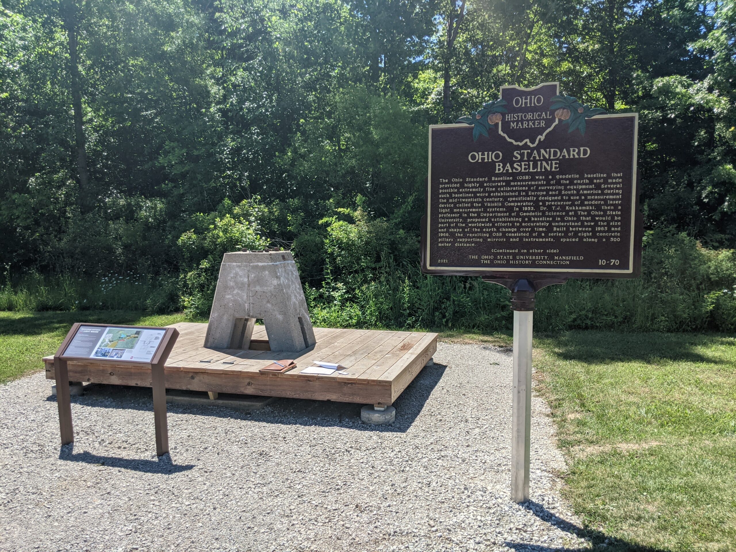
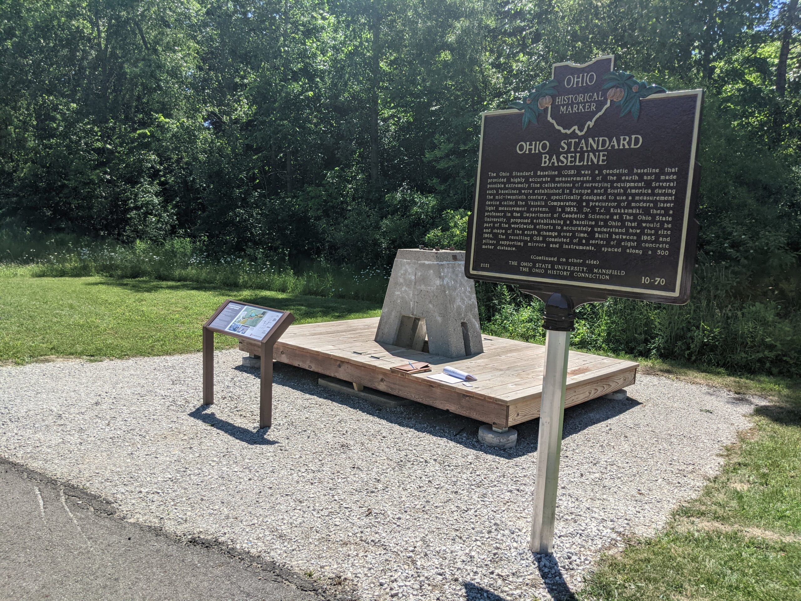
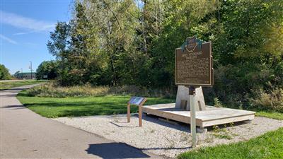
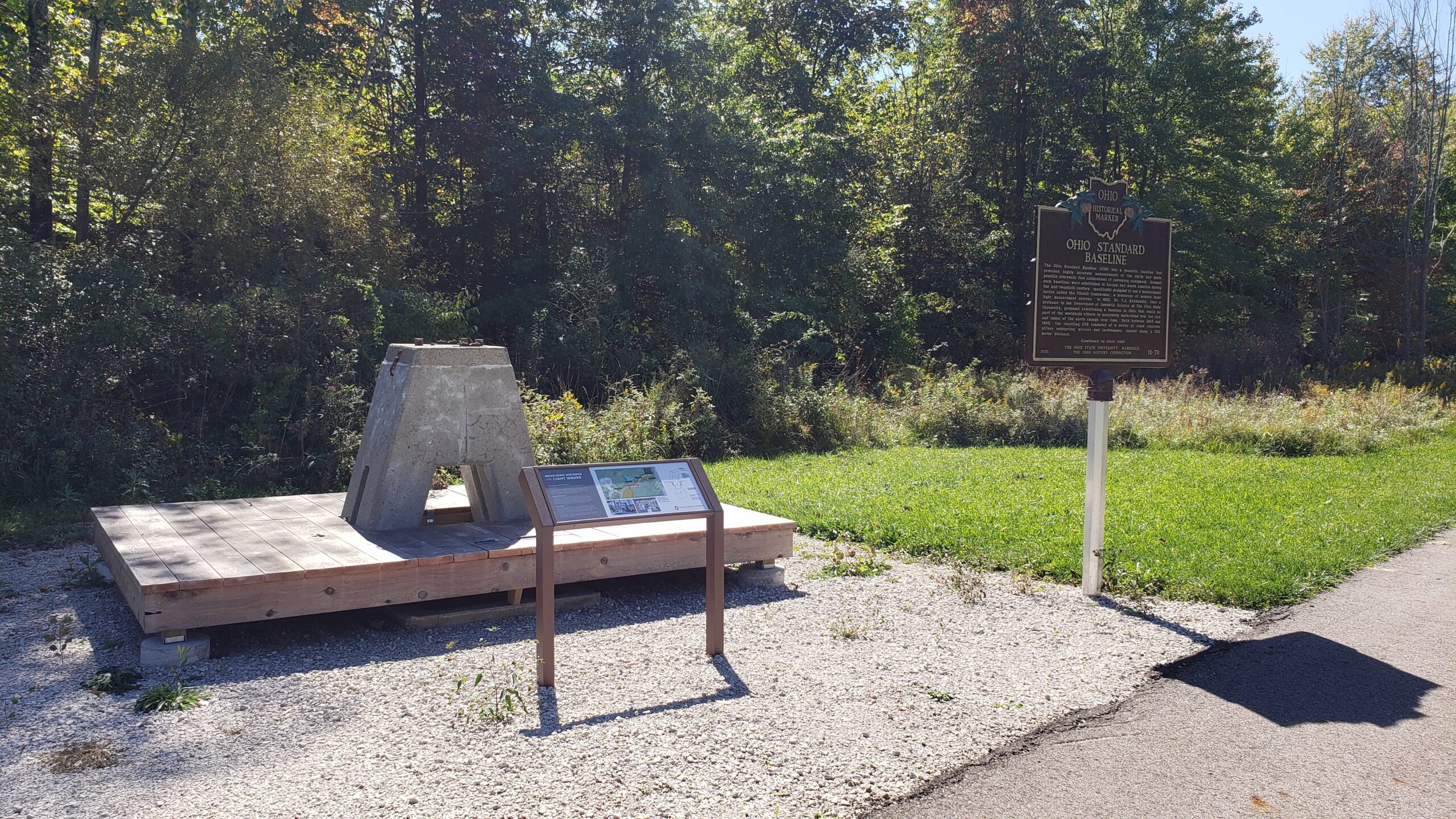
Side A: The Ohio Standard Baseline (OSB) was a geodetic baseline that provided highly accurate measurements of the earth and made possible extremely fine calibrations of surveying equipment. Several such baselines were established in Europe and South America during the mid-twentieth century, specifically designed to use a measurement device called the Vaisala Comparator, a precursor of modern laser light measurement systems. In 1953, Dr. T.J. Kukkamaki, then a professor in the Department of Geodetic Science at The Ohio State University, proposed establishing a baseline in Ohio that would be part of the worldwide efforts to accurately understand how the size and shape of the earth change over time. Built between 1965 and 1966, the resulting OSB consisted of a series of eight concrete pillars supporting mirrors and instruments, spaced along a 500 meter distance. (Continued on other side)
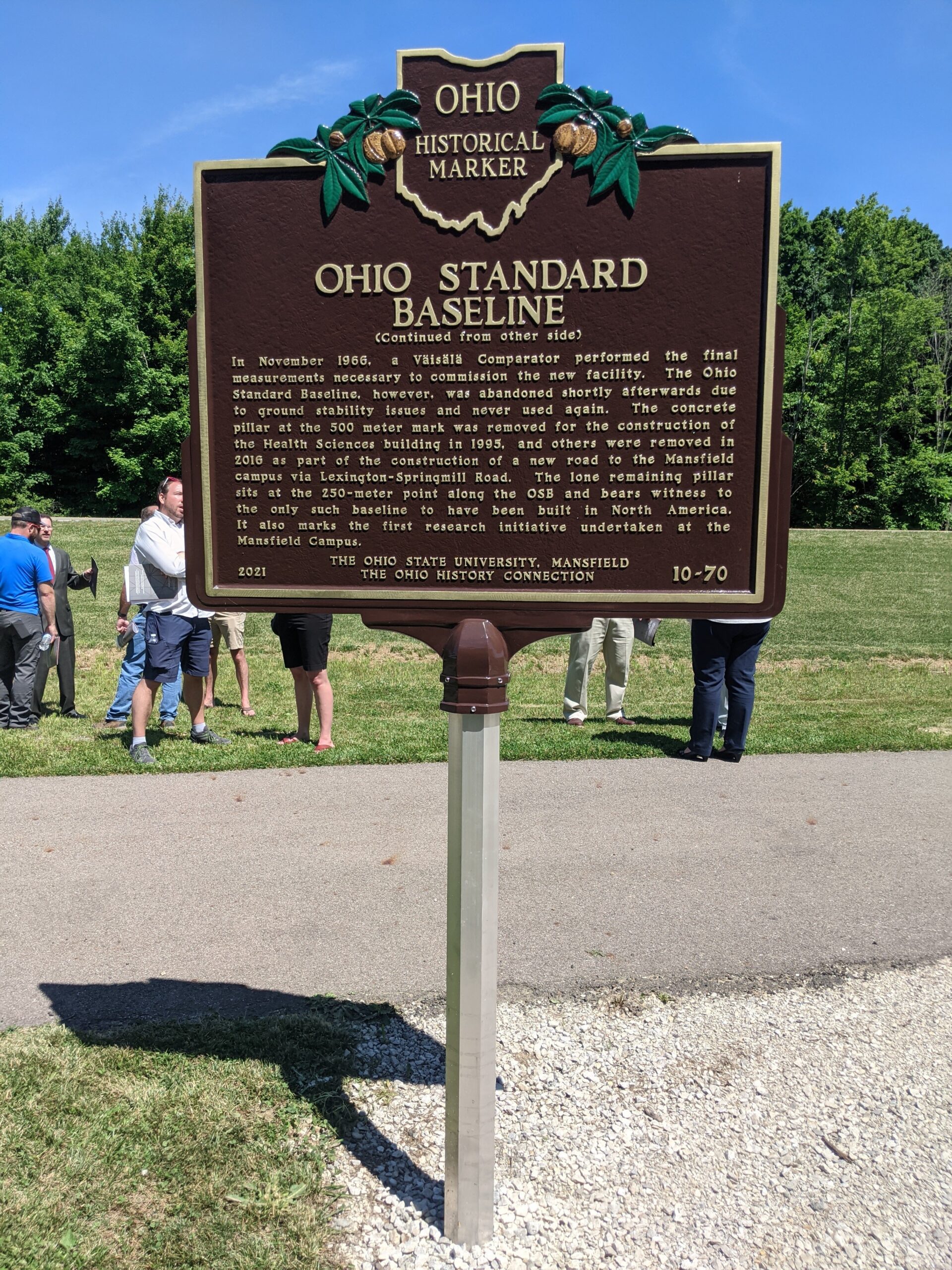
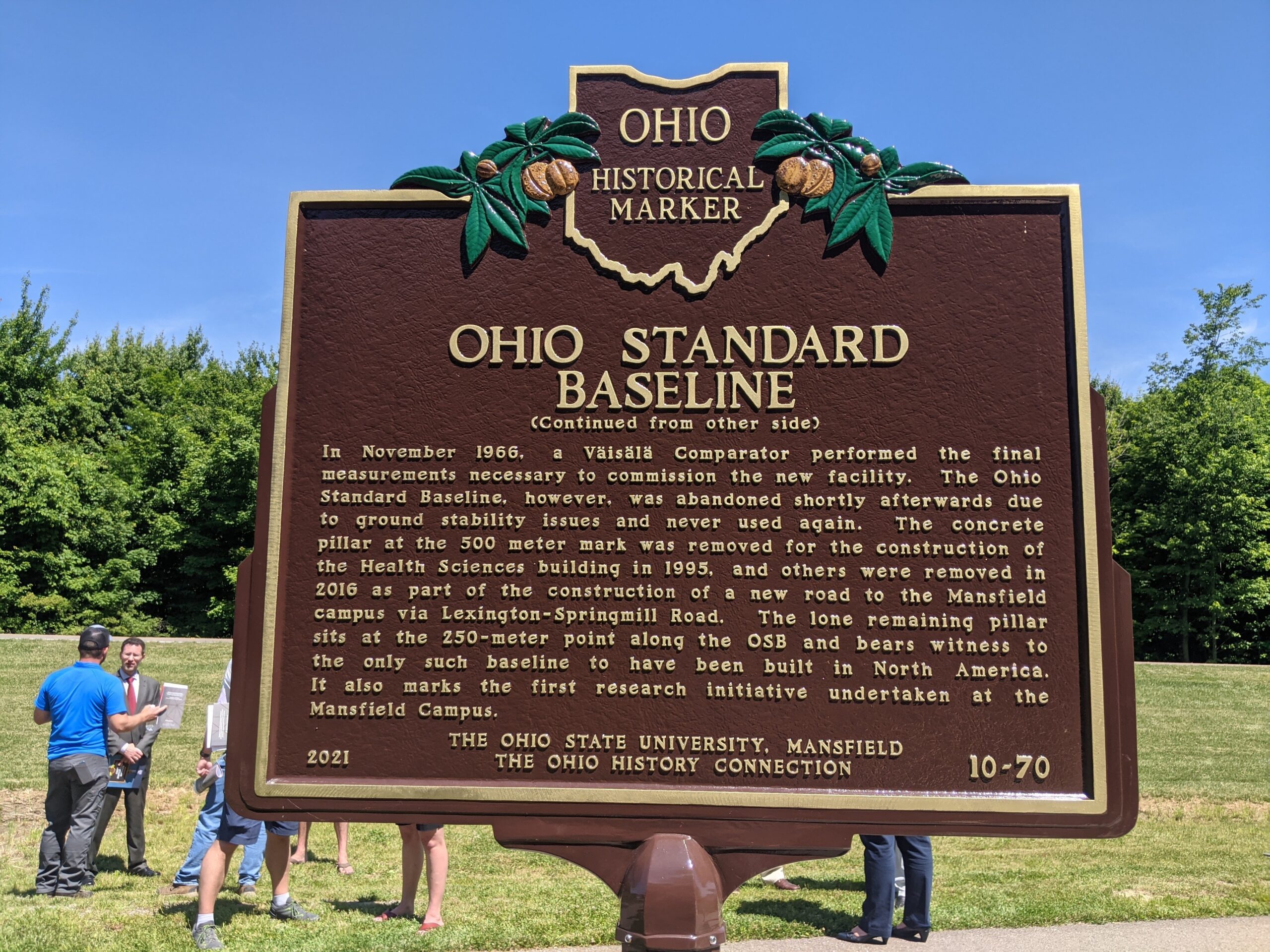
Side B: (Continued from other side) In November 1966, a Vaisala Comparator performed the final measurements necessary to commission the new facility. The Ohio Standard Baseline, however, was abandoned shortly afterwards due to ground stability issues and never used again. The concrete pillar at the 500 meter mark was removed for the construction of the Health Sciences building in 1995, and others were removed in 2016 as part of the construction of a new road to the Mansfield campus via Lexington-Springmill Road. The lone remaining pillar sits at the 250-meter point along the OSB and bears witness to the only such baseline to have been built in North America. It also marks the first research initiative undertaken at the Mansfield Campus.
Location: Marker is located on the south side of Kenwood Circle, adjacent to a bike path, approximately 1/4 mile east of its intersection with N. Lexington-Springmill Road. Park at the North Central State College Health Science Building and walk on the bike path to access marker.