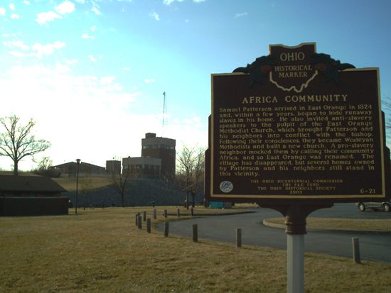
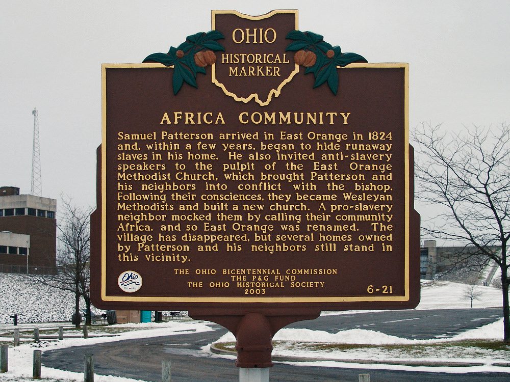
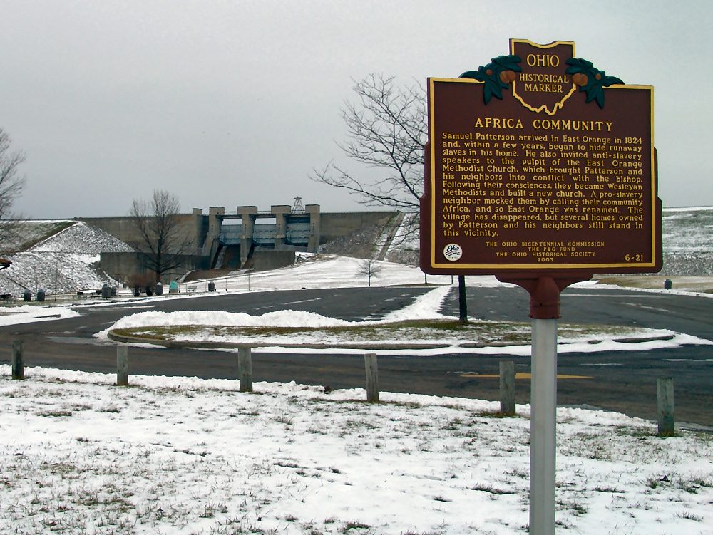
Side A: Samuel Patterson arrived in East Orange in 1824 and, within a few years, began to hide runaway slaves in his home. He also invited anti-slavery speakers to the pulpit of the East Orange Methodist Church, which brought Patterson and his neighbors into conflict with the bishop. Following their consciences, they became Wesleyan Methodists and built a new church. A pro-slavery neighbor mocked them by calling their community Africa, and so East Orange was renamed. The village has disappeared, but several homes owned by Patterson and his neighbors still stand in this vicinity.
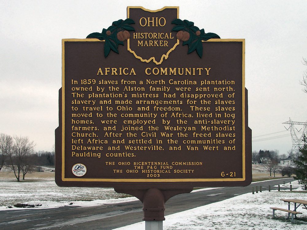
Side B: In 1859 slaves from a North Carolina plantation owned by the Alston family were sent north. The plantation’s mistress had disapproved of slavery and made arrangements for the slaves to travel to Ohio and freedom. These slaves moved to the community of Africa, lived in log homes, were employed by the anti-slavery farmers, and joined the Wesleyan Methodist Church. After the Civil War the freed slaves left Africa and settled in the communities of Delaware and Westerville, and Van Wert and Paulding counties.