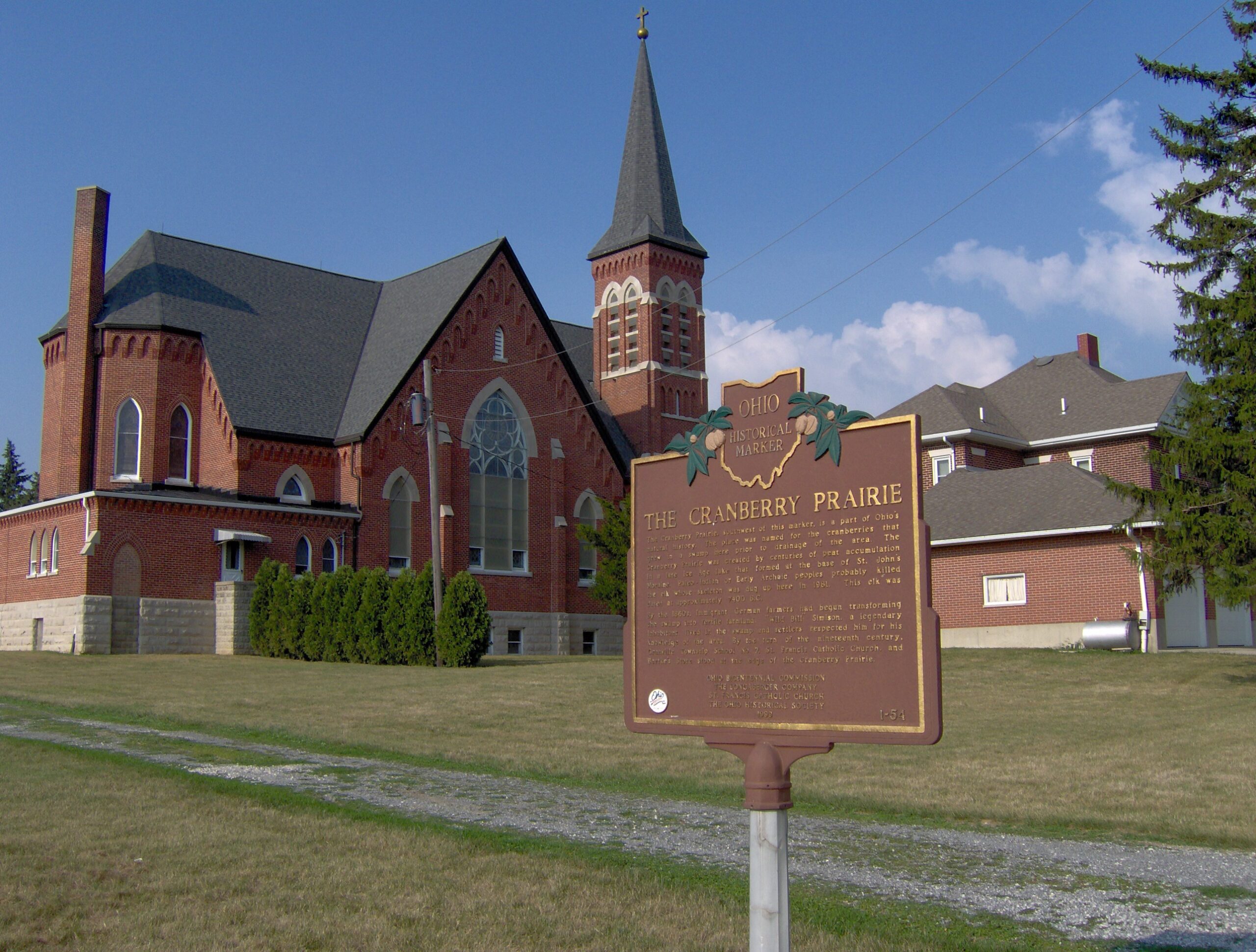
Side A: The Cranberry Prairie, southwest of this marker, is a part of Ohio’s natural history. The place was named for the cranberries that grew in a swamp here prior to drainage of the area. The Cranberry Prairie was created by centuries of peat accumulation in a late Ice Age lake that formed at the base of St. John’s Moraine. Paleo-Indian or Early Archaic peoples probably killed the elk whose skeleton was dug up here in 1981. This elk was dated at approximately 7400 B.C. By the 1860s, immigrant German farmers had begun transforming the swamp into fertile farmland. “Wild Bill” Simison, a legendary inhabitant, lived in the swamp and settlers respected him for his knowledge of the area. By the turn of the nineteenth century, Granville Township School #7, St. Francis Catholic Church, and Bertke’s Store stood at the edge of the Cranberry Prairie.
Sponsors: Ohio Bicentennial Commission, The Longaberger Company, St. Francis Catholic Church, and The Ohio Historical Society