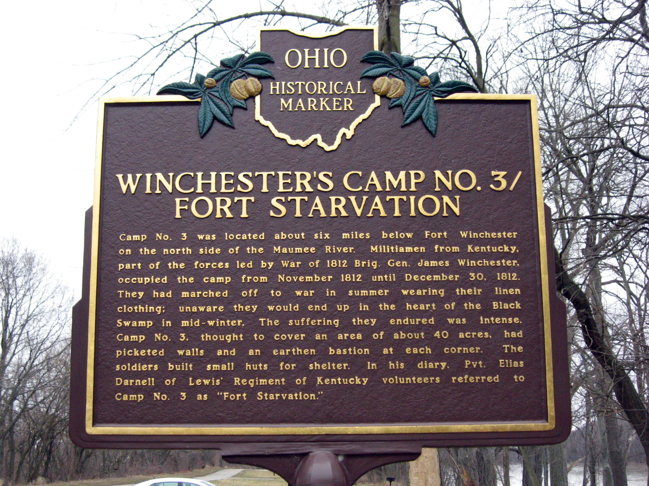
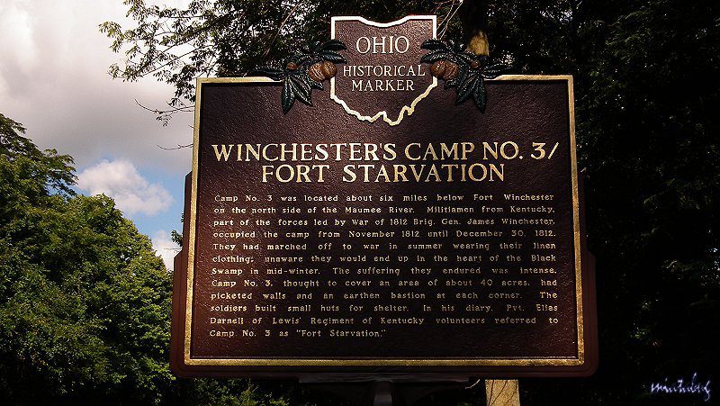
Side A: Camp No. 3 was located about six miles below Fort Winchester on the north side of the Maumee River. Militiamen from Kentucky, part of the forces led by War of 1812 Brig. Gen. James Winchester, occupied the camp from November 1812 until December 30, 1812. They had marched off to war in summer wearing their linen clothing; unaware they would end up in the heart of the Black Swamp in mid-winter. The suffering they endured was intense. Camp No. 3, thought to cover an area of about 40 acres, had picketed walls and an earthen bastion at each corner. The soldiers built small huts for shelter. In his diary, Pvt. Elias Darnell of Lewis’ Regiment of Kentucky volunteers referred to Camp No. 3 as “Fort Starvation.”
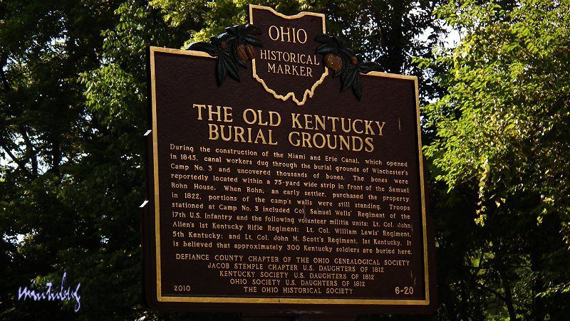
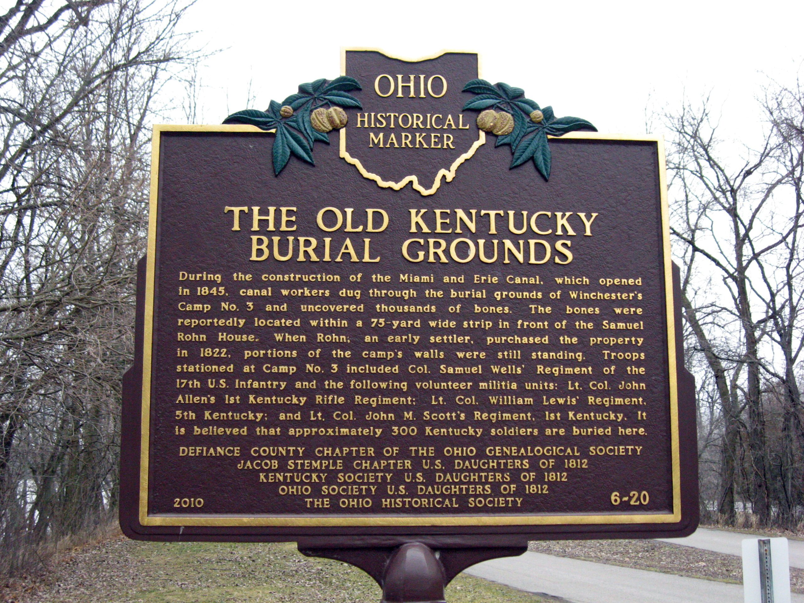
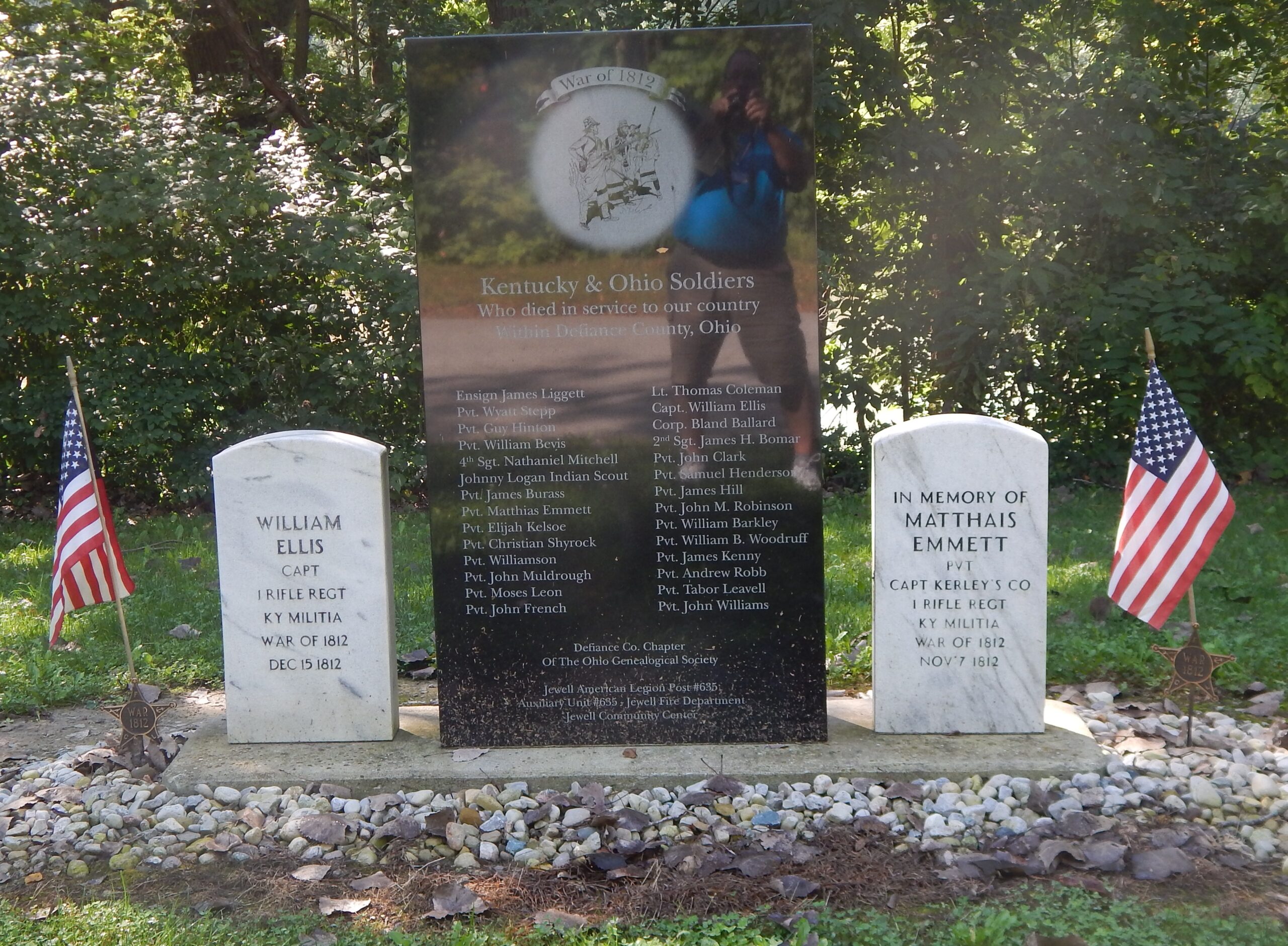
Side B: During the construction of the Miami and Erie Canal, which opened in 1845, canal workers dug through the burial grounds of Winchester’s Camp No. 3 and uncovered thousands of bones. The bones were reportedly located within a 75-yard wide strip in front of the Samuel Rohn House. When Rohn, an early settler, purchased the property in 1822, portions of the camp’s walls were still standing. Troops stationed at Camp No. 3 included Col. Samuel Wells’ Regiment of the 17th U.S. Infantry and the following volunteer militia units: Lt. Col. John Allen’s 1st Kentucky Rifle Regiment; Lt. Col. William Lewis’ Regiment, 5th Kentucky; and Lt. Col. John M. Scott’s Regiment, 1st Kentucky. It is believed that approximately 300 Kentucky soldiers are buried here.
Sponsors: DEFIANCE COUNTY CHAPTER OF THE OHIO GENEALOGICAL SOCIETY, JACOB STEMPLE CHAPTER U.S. DAUGHTERS OF 1812, KENTUCKY SOCIETY U.S. DAUGHTERS OF 1812, OHIO SOCIETY U.S. DAUGHTERS OF1812, THE OHIO HISTORICAL SOCIETY