Below is a complete listing of all Ohio Historical Markers. To find a detailed marker listing including text, photographs, and locations, click on a county below. Our listing is updated by the markers program as new markers are installed and older markers are reported damaged or missing.
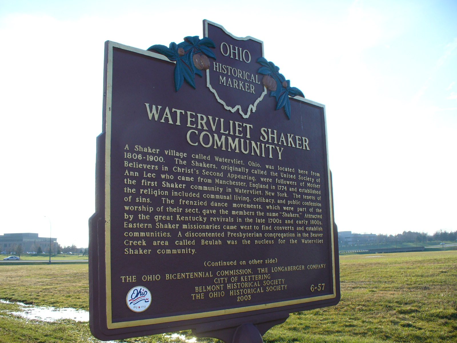
Side A: A Shaker village called Watervliet, Ohio, was located here from 1806-1900. The Shakers, originally called the United Society of Believers in Christ’s Second Appearing, were followers of Mother Ann Lee who came from Manchester, England in 1774 and established the first Shaker community in Watervliet, New York. The tenets of the religion included communal living, celibacy, and public confession of sins. The frenzied dance movements, which were part of the worship of their sect, gave the members the name “Shakers.” Attracted by the great Kentucky revivals in the late 1700s and early 1800s, Eastern Shaker missionaries came west to find converts and establish communities. A discontented Presbyterian congregation in the Beaver Creek area called Beulah was the nucleus for the Watervliet Shaker community. (continued on other side)
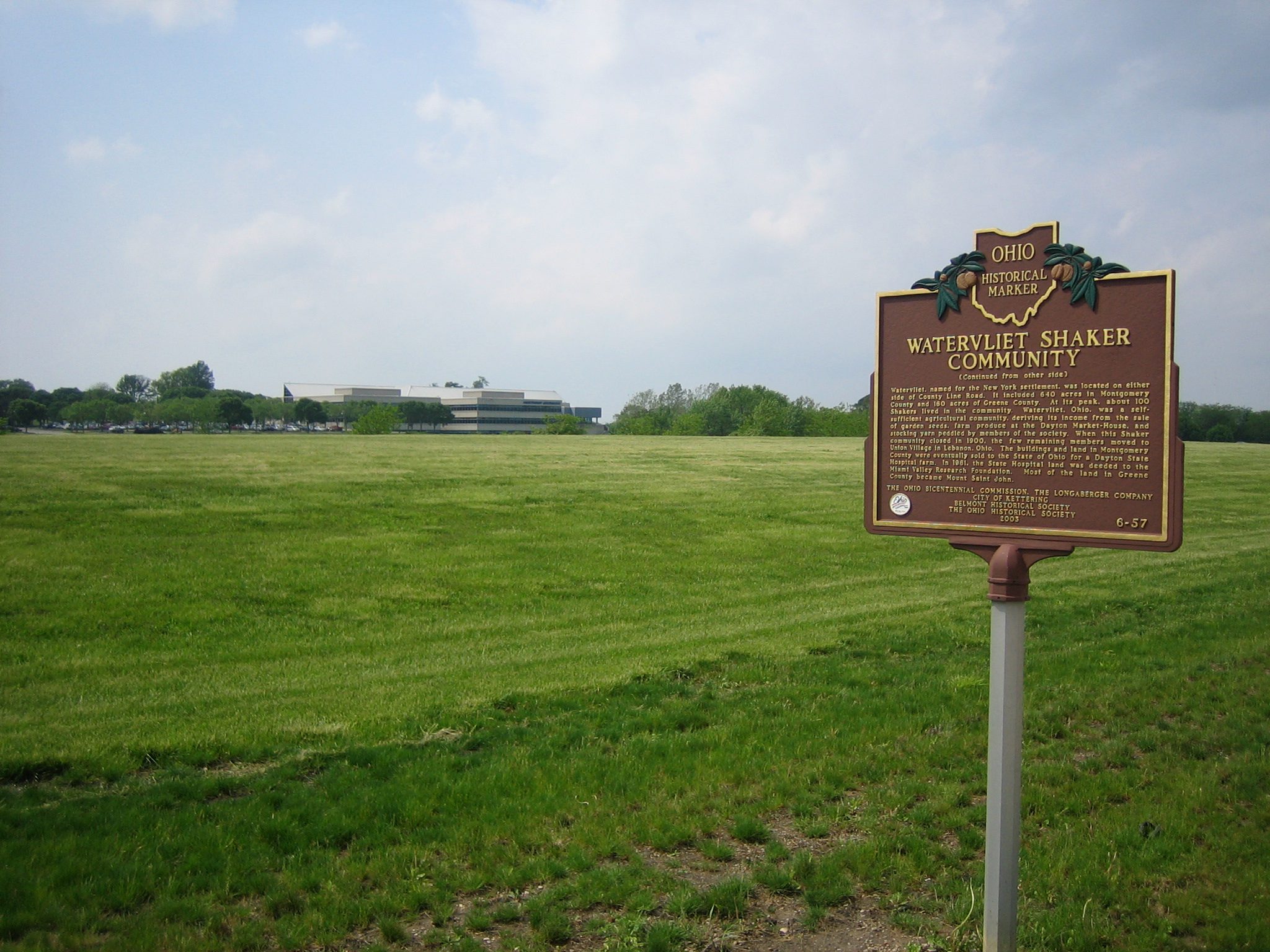
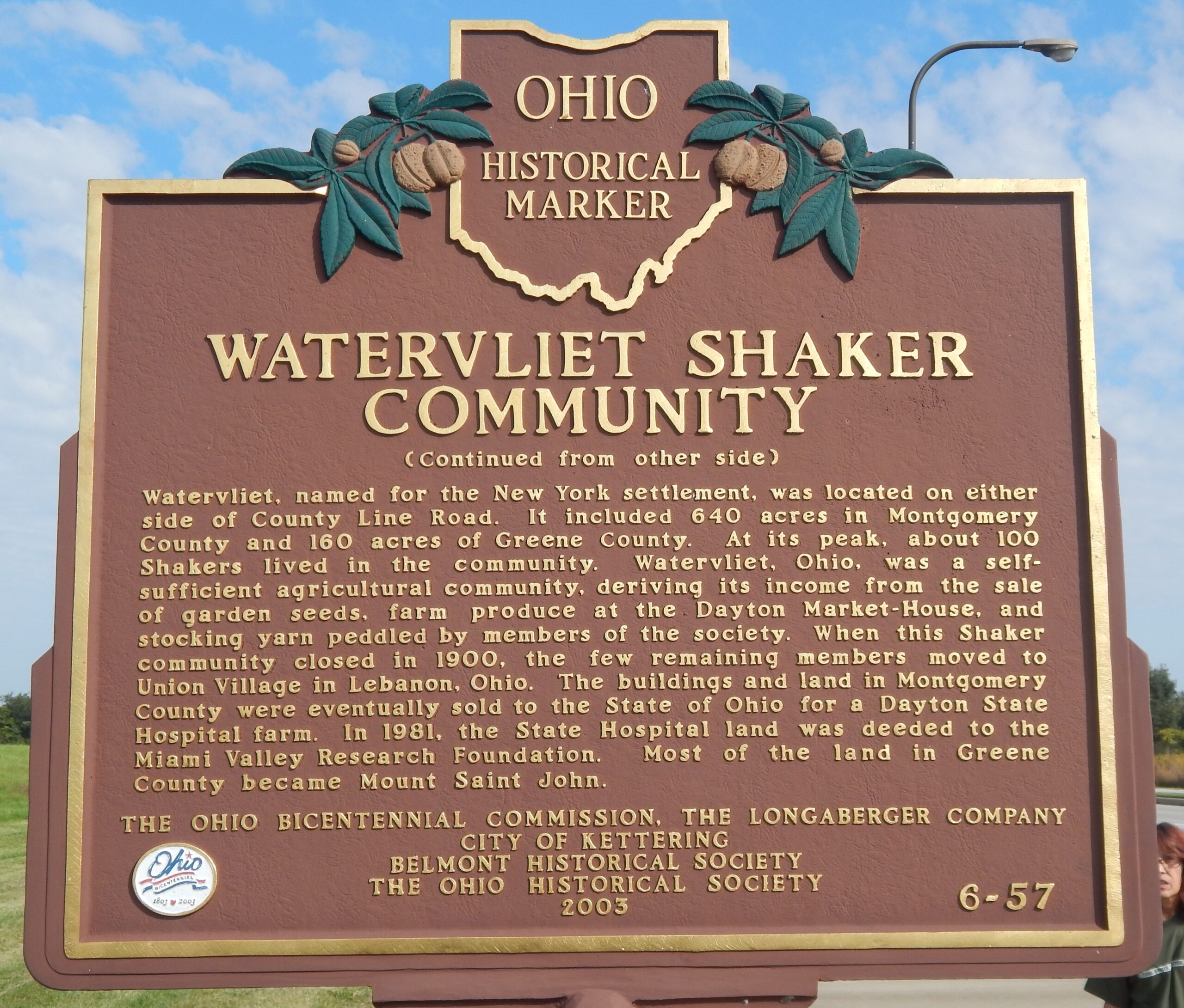
Side B: (continued from other side) Watervliet, named for the New York settlement, was located on either side of County Line Road. It included 640 acres in Montgomery County and 160 acres of Greene County. At its peak, about 100 Shakers lived in the community. Watervliet, Ohio, was a self-sufficient agricultural community, deriving its income from the sale of garden seeds, farm produce at the Dayton Market-House, and stocking yarn peddled by members of the society. When this Shaker community closed in 1900, the few remaining members moved to Union Village in Lebanon, Ohio. The buildings and land in Montgomery County were eventually sold to the State of Ohio for a Dayton State Hospital farm. In 1981, the State Hospital land was deeded to the Miami Valley Research Foundation. Most of the land in Greene County became Mount Saint John.