Below is a complete listing of all Ohio Historical Markers. To find a detailed marker listing including text, photographs, and locations, click on a county below. Our listing is updated by the markers program as new markers are installed and older markers are reported damaged or missing.
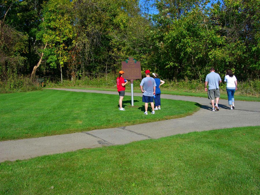
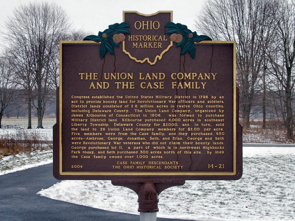
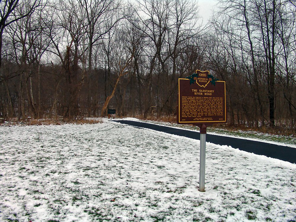
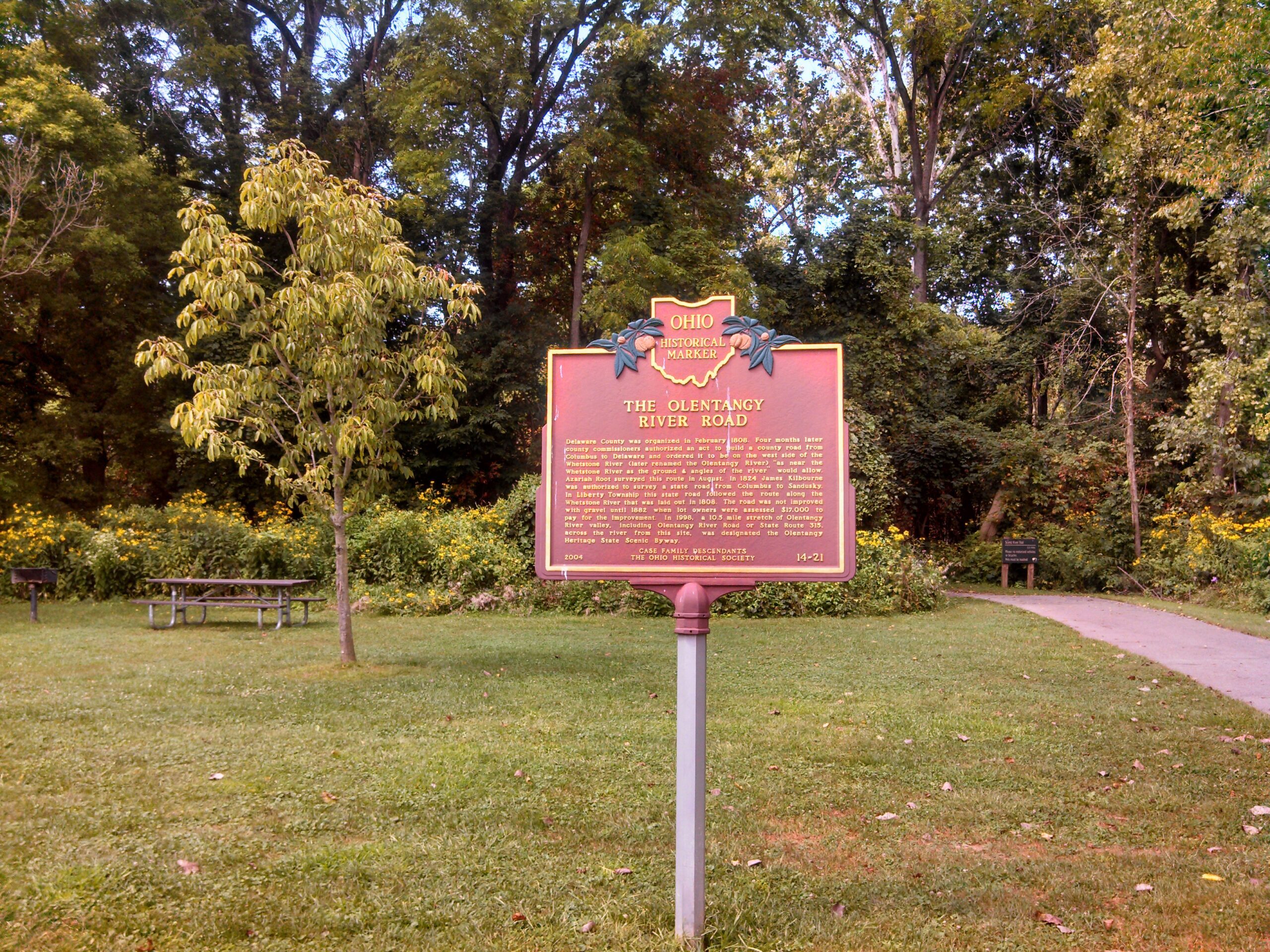
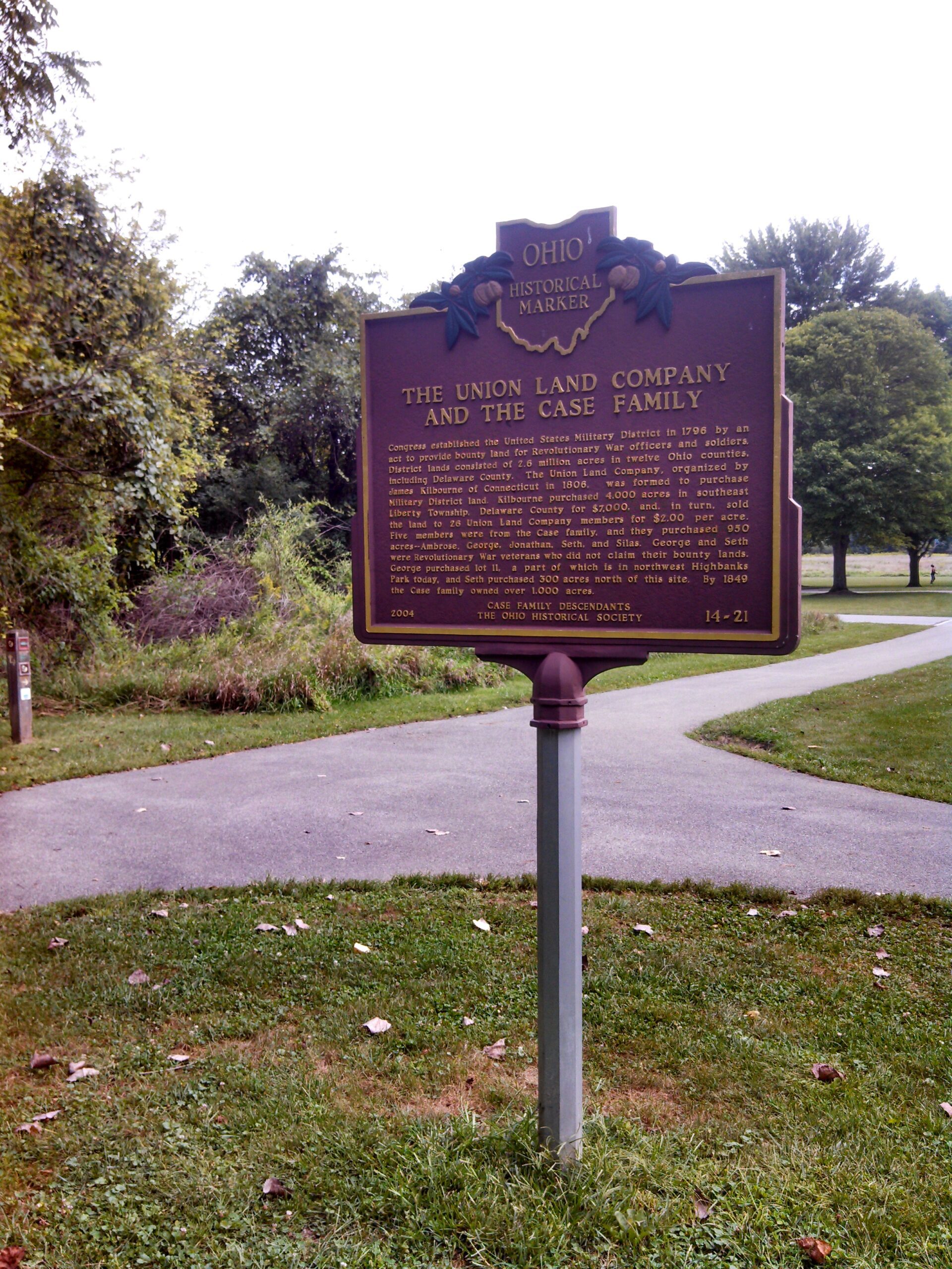
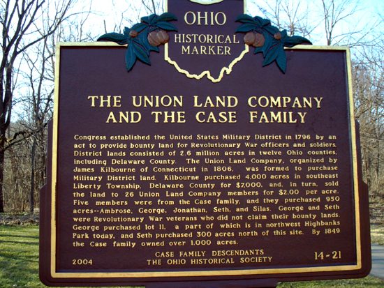
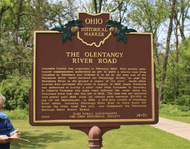
14-21 The Union Land Company and the Case Family / The Olentangy River Road
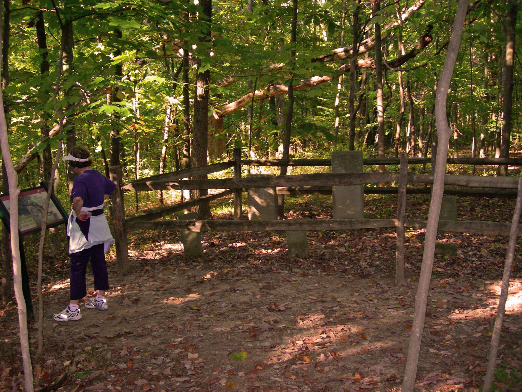
Side A: Congress established the United States Military District in 1796 by an act to provide bounty land for Revolutionary War officers and soldiers. District lands consisted of 2.6 million acres in twelve Ohio counties, including Delaware County. The Union Land Company, organized by James Kilbourne of Connecticut in 1806, was formed to purchase Military District land. Kilbourne purchased 4,000 acres in southeast Liberty Township, Delaware County for $7,000, and, in turn, sold the land to 26 Union Land Company members for $2.00 per acre. Five members were from the Case family, and they purchased 950 acres–Ambrose, George, Jonathan, Seth, and Silas. George and Seth were Revolutionary War veterans who did not claim their bounty lands. George purchased lot 11, a part of which is in northwest Highbanks Park today, and Seth purchased 300 acres north of this site. By 1849 the Case family owned over 1,000 acres.
Side B: Delaware County was organized in February 1808. Four months later county commissioners authorized an act to build a county road from Columbus to Delaware and ordered it to be on the west side of the Whetstone River (later renamed the Olentangy River) “as near the Whetstone River as the ground & angles of the river” would allow. Azariah Root surveyed this route in August. In 1824 James Kilbourne was authorized to survey a state road from Columbus to Sandusky. In Liberty Township this state road followed the route along the Whetstone River that was laid out in 1808. The road was not improved with gravel until 1882 when lot owners were assessed $17,000 to pay for the improvement. In 1998, a 10.5 mile stretch of Olentangy River valley, including Olentangy River Road or State Route 315, across the river from this site, was designated the Olentangy Heritage State Scenic Byway.