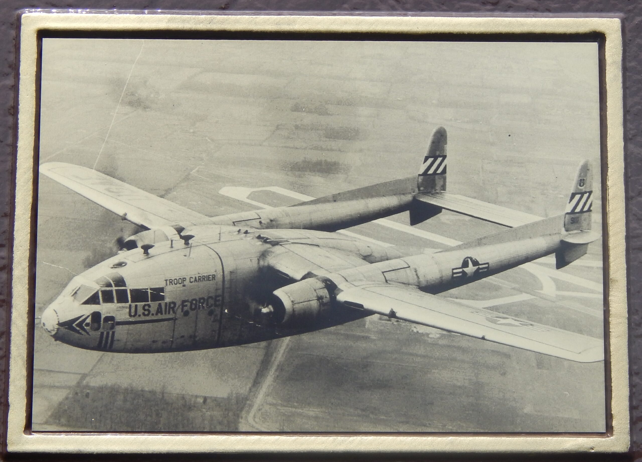
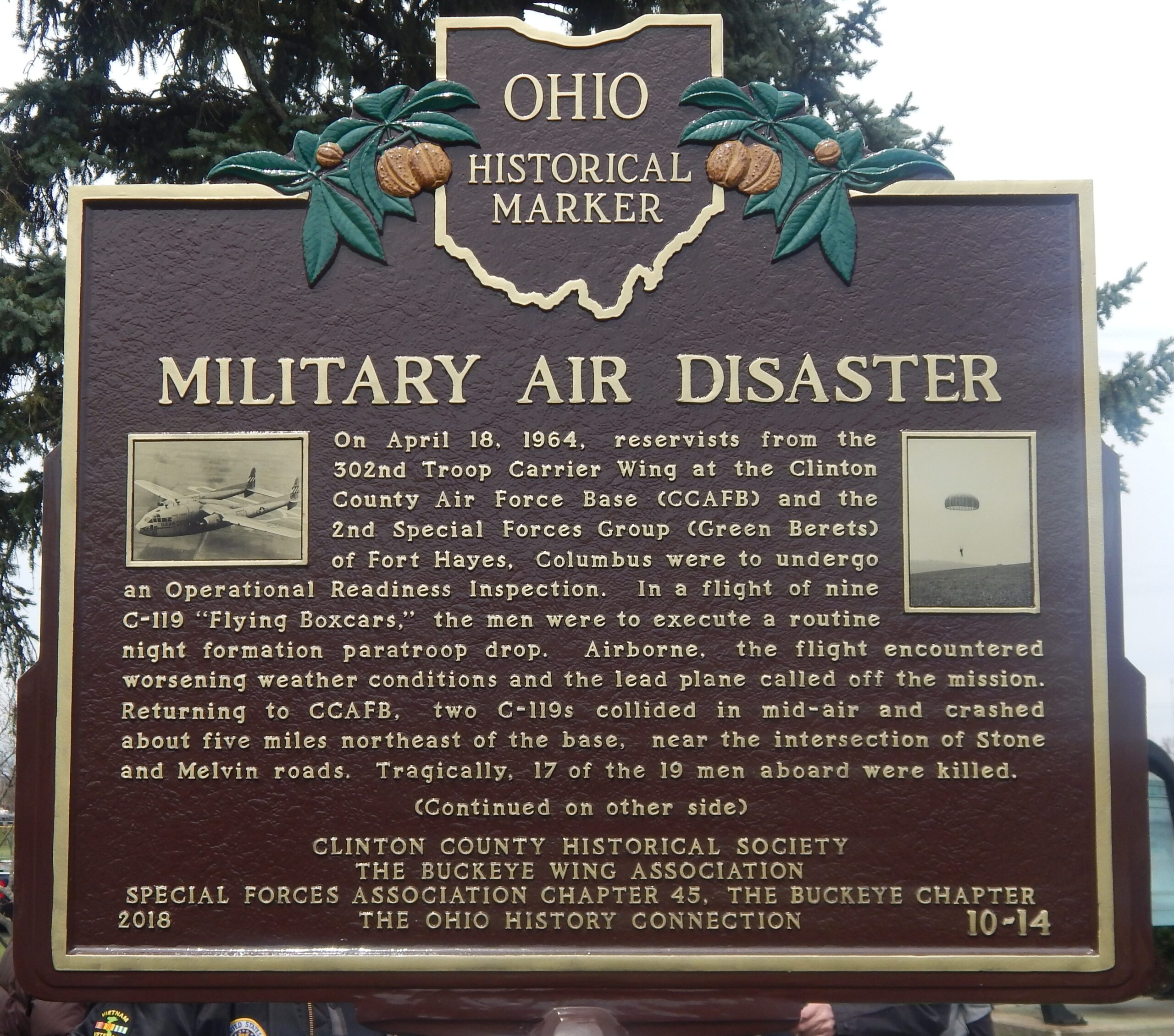
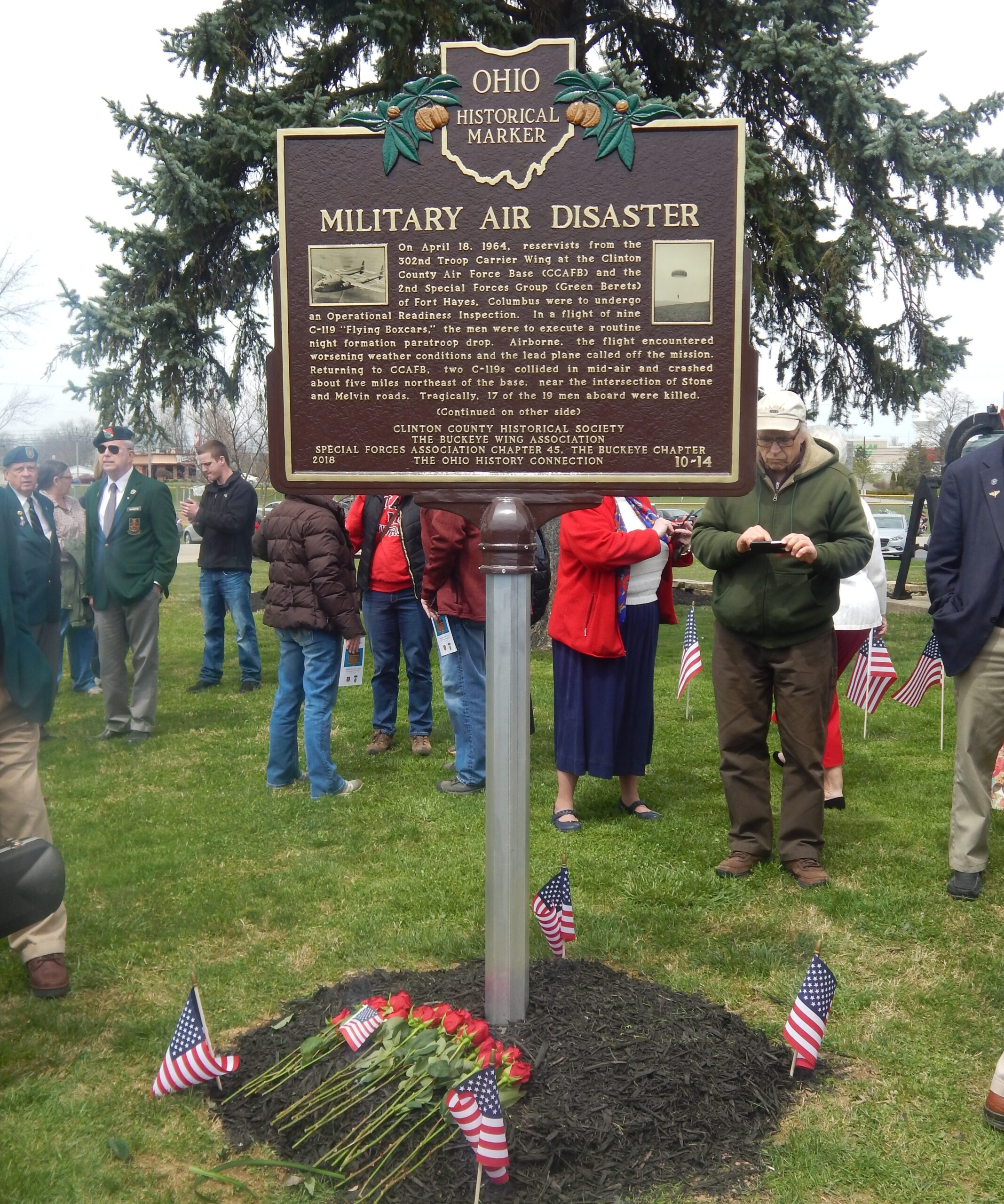
Side A: On April 18, 1964, reservists from the 302nd Troop Carrier Wing at the Clinton County Air Force Base (CCAFB) and 2nd Special Forces Group (Green Berets) of Fort Hayes, Columbus were to undergo an Operational Readiness Inspection. In a flight of nine C-119 “Flying Boxcars,” the men were to execute a routine night formation paratroop drop. Airborne, the flight encountered worsening weather conditions and the lead plane called off the mission. Returning to CCAFB, two C-119s collided in mid-air and crashed about five miles northeast of the base, near the intersection of Stone and Melvin roads. Tragically, 17 of the 19 men aboard were killed.(Continued on other side)
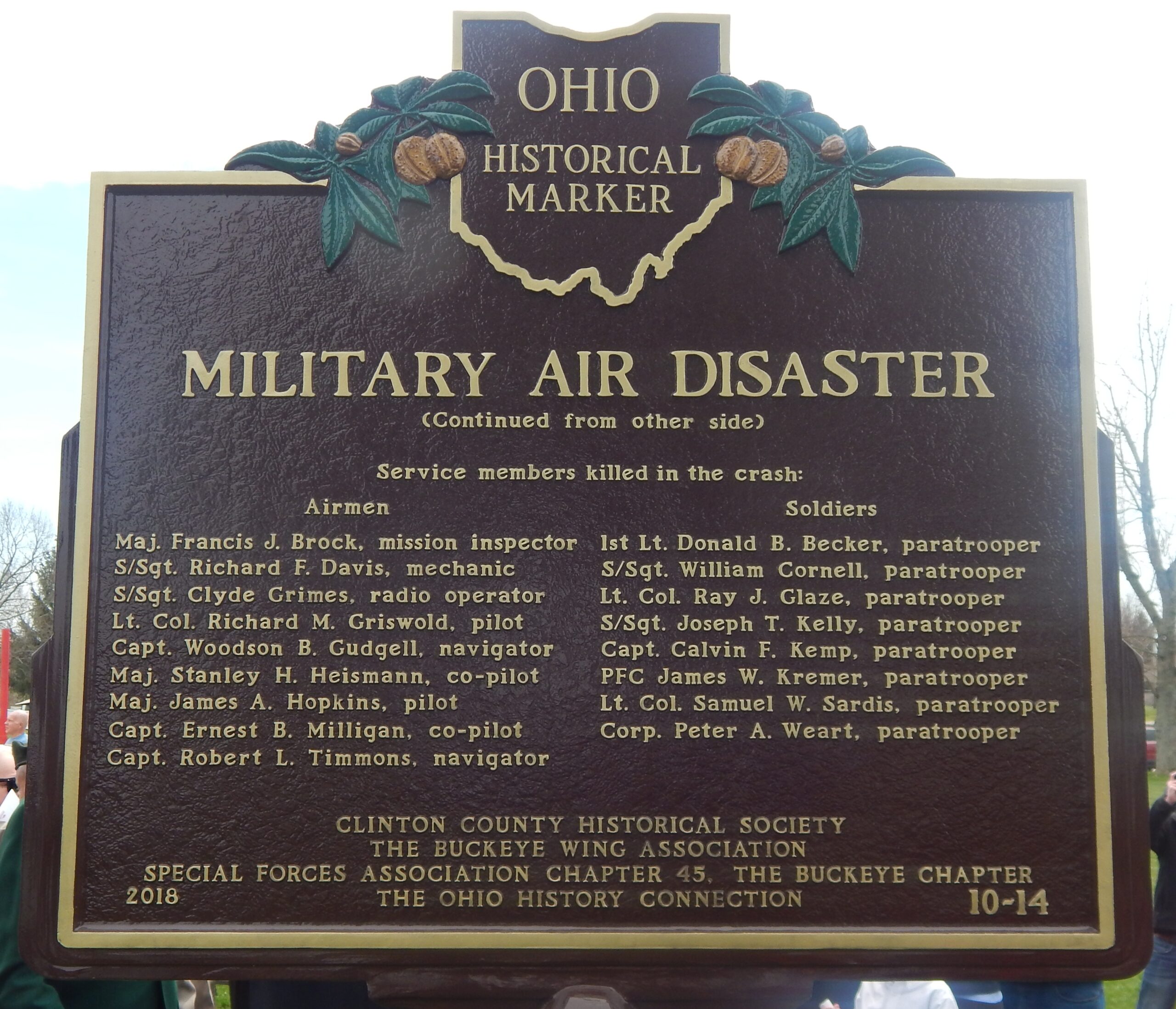
Side B: (Continued from other side) Service members killed in the crash: Airmen: Maj. Francis J. Brock, mission inspector; S/Sgt. Richard F. Davis, mechanic; S/Sgt. Clyde Grimes, radio operator; Lt. Col. Richard M. Griswold, pilot; Capt. Woodson B. Gudgell, navigator; Maj. Stanley H. Heismann, co-pilot; Maj. James A. Hopkins, pilot; Capt. Ernest B. Milligan, co-pilot; Capt. Robert L. Timmons, navigator Soldiers: 1st Lt. Donald B. Becker, paratrooper; S/Sgt. William Cornell, paratrooper; Lt. Col. Ray J. Glaze, paratrooper; S/Sgt. Joseph T. Kelly, paratrooper; Capt. Calvin F. Kemp, paratrooper; PFC James W. Kremer, paratrooper; Lt. Col. Samuel W. Sardis, paratrooper; Corp. Peter A. Weart, paratrooper