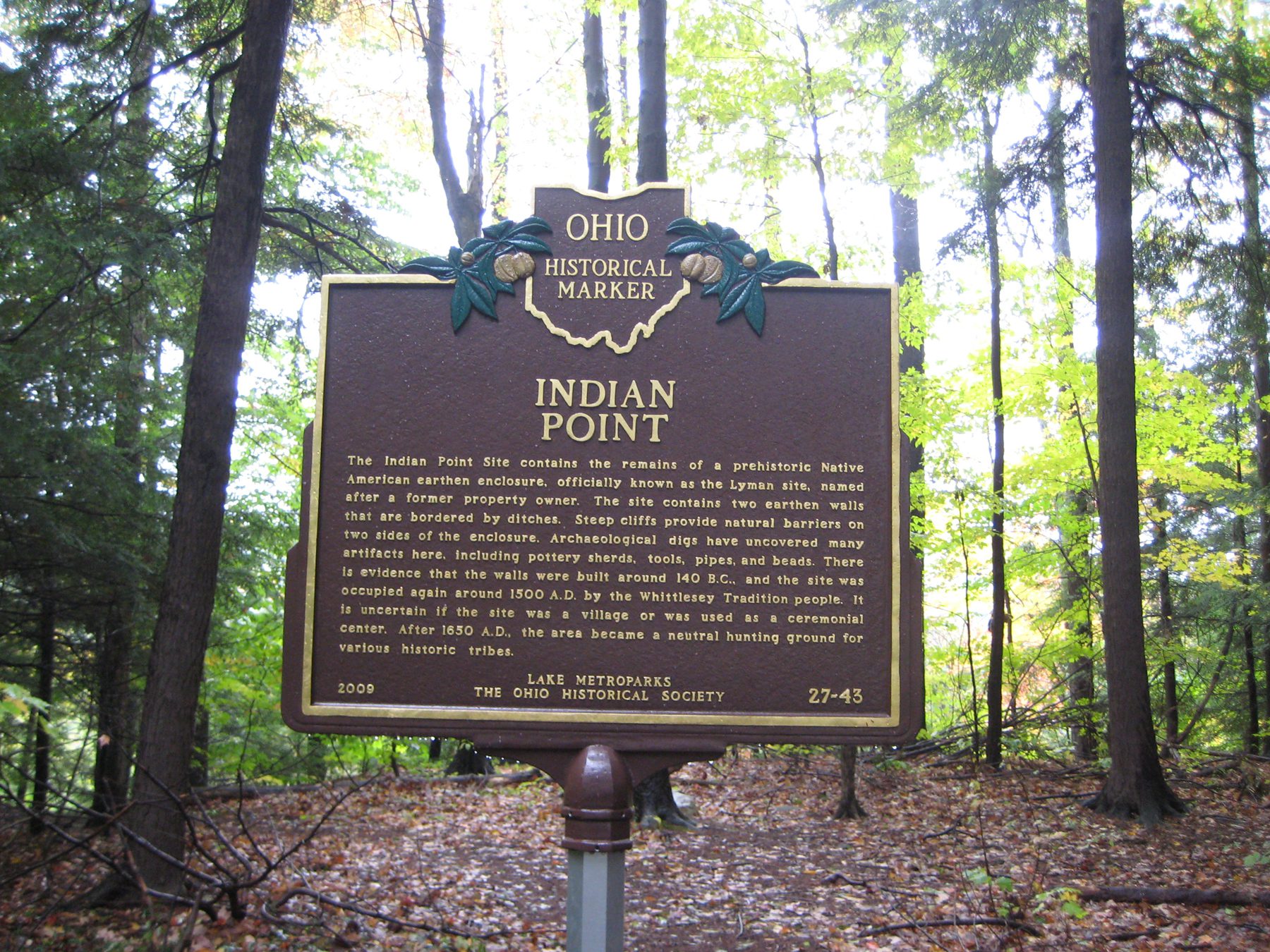
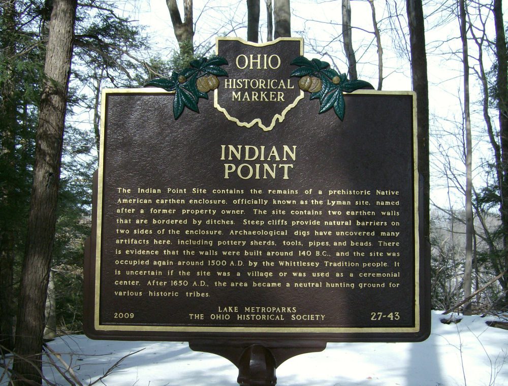
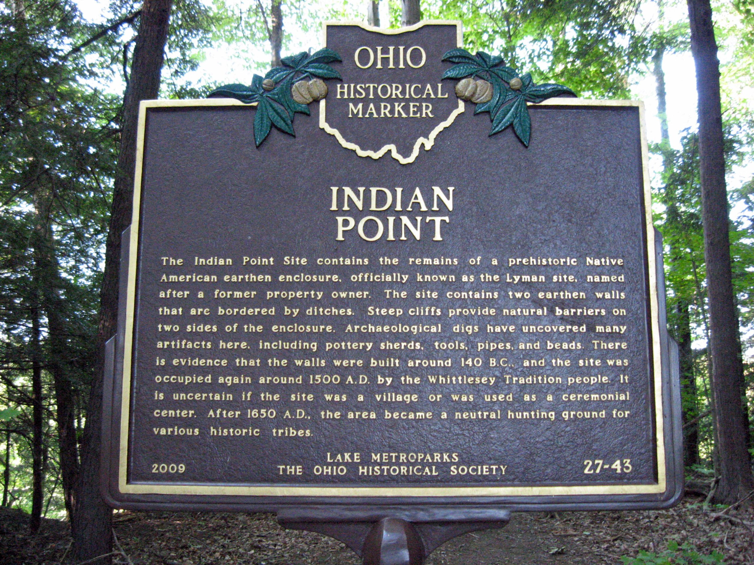
Side A: The Indian Point Site contains the remains of a prehistoric Native American earthen enclosure, officially known as the Lyman site, named after a former property owner. The site contains two earthen walls that are bordered by ditches. Steep cliffs provide natural barriers on two sides of the enclosure. Archaeological digs have uncovered many artifacts here, including pottery sherds, tools, pipes, and beads. There is evidence that the walls were built around 140 B.C., and the site was occupied again around 1500 A.D. by the Whittlesey Tradition people. It is uncertain if the site was a village or was used as a ceremonial center. After 1650 A.D., the area became a neutral hunting ground for various historic tribes.
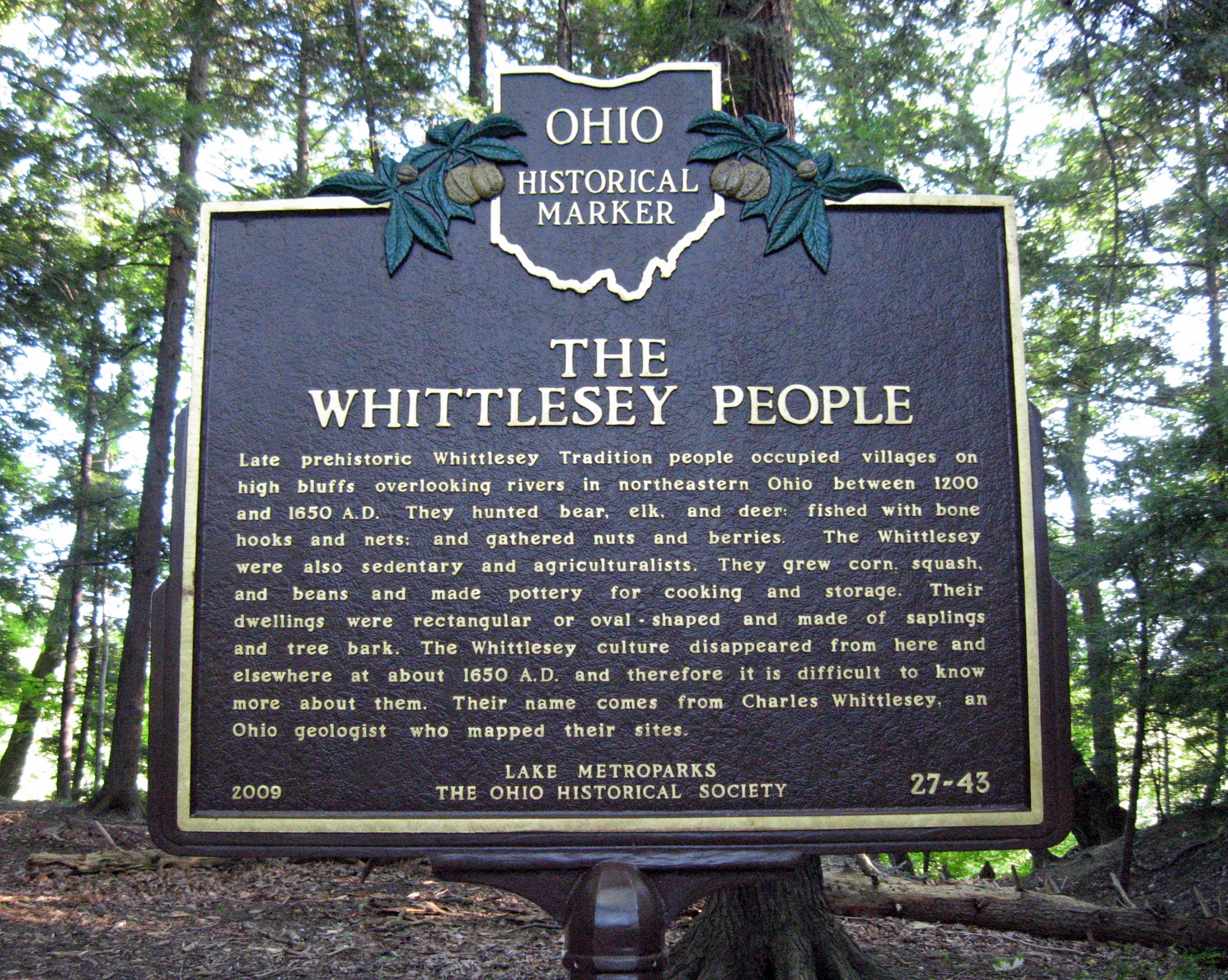
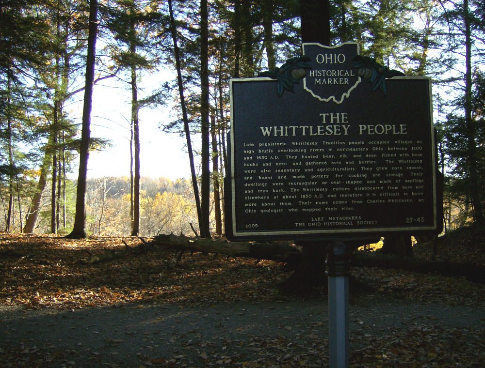
Side B: Late prehistoric Whittlesey Tradition people occupied villages on high bluffs overlooking rivers in northeastern Ohio between 1200 and 1650 A.D. They hunted bear, elk, and deer; fished with bone hooks and nets; and gathered nuts and berries. The Whittlesey were also sedentary and agriculturalists. They grew corn, squash, and beans and made pottery for cooking and storage. Their dwellings were rectangular or oval-shaped and made of saplings and tree bark. The Whittlesey culture disappeared from here and elsewhere at about 1650 A.D. and therefore it is difficult to know more about them. Their name comes from Charles Whittlesey, an Ohio geologist who mapped their sites.