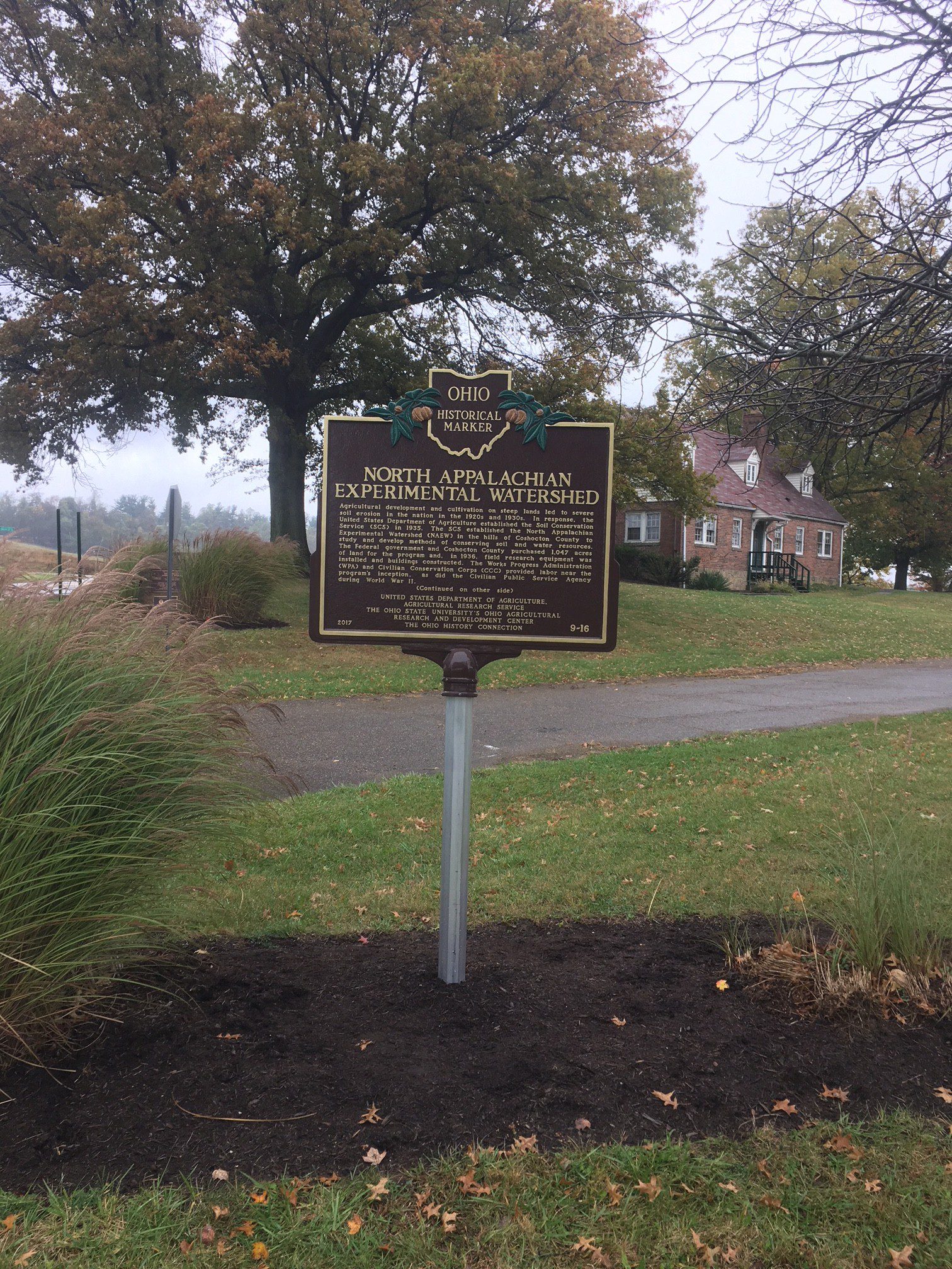
Side A: Agricultural development and cultivation on steep lands led to severe soil erosion in the nation in the 1920s and 1930s. In response, the United States Department of Agriculture established the Soil Conservation Service (SCS) in 1935. The SCS established the North Appalachian Experimental Watershed (NAEW) in the hills of Coshocton County to study and develop methods of conserving soil and water resources. The Federal government and Coshocton County purchased 1,047 acres of land for the program and, in 1936, field research equipment was installed and buildings constructed. The Works Progress Administration (WPA) and Civilian Conservation Corps (CCC) provided labor near the program’s inception, as did the Civilian Public Service Agency during World War II. (Continued on other side)
Side B: (Continued from other side) The NAEW is known worldwide for development of water measurement instrumentation, including the “Coshocton wheel,” a rotating sampler powered by flowing runoff; and weighing lysimeters (65-ton blocks of natural soil that measure surface runoff, evaporation, percolation, and water storage). The NAEW also pioneered the development of “no-till” and conservation tillage agriculture to reduce runoff and erosion in fields. Other accomplishments include improving grazing management, supporting the development of the “curve number” method (used worldwide to estimate runoff), and conducting a landmark study on mining and reclamation effects in southeast Ohio. A reorganization in 1954 transferred the station to the USDA’s Agricultural Research Service. In 1973, The Ohio State University’s Ohio Agricultural Research and Development Center became a partner at the station until it closed in 2015.