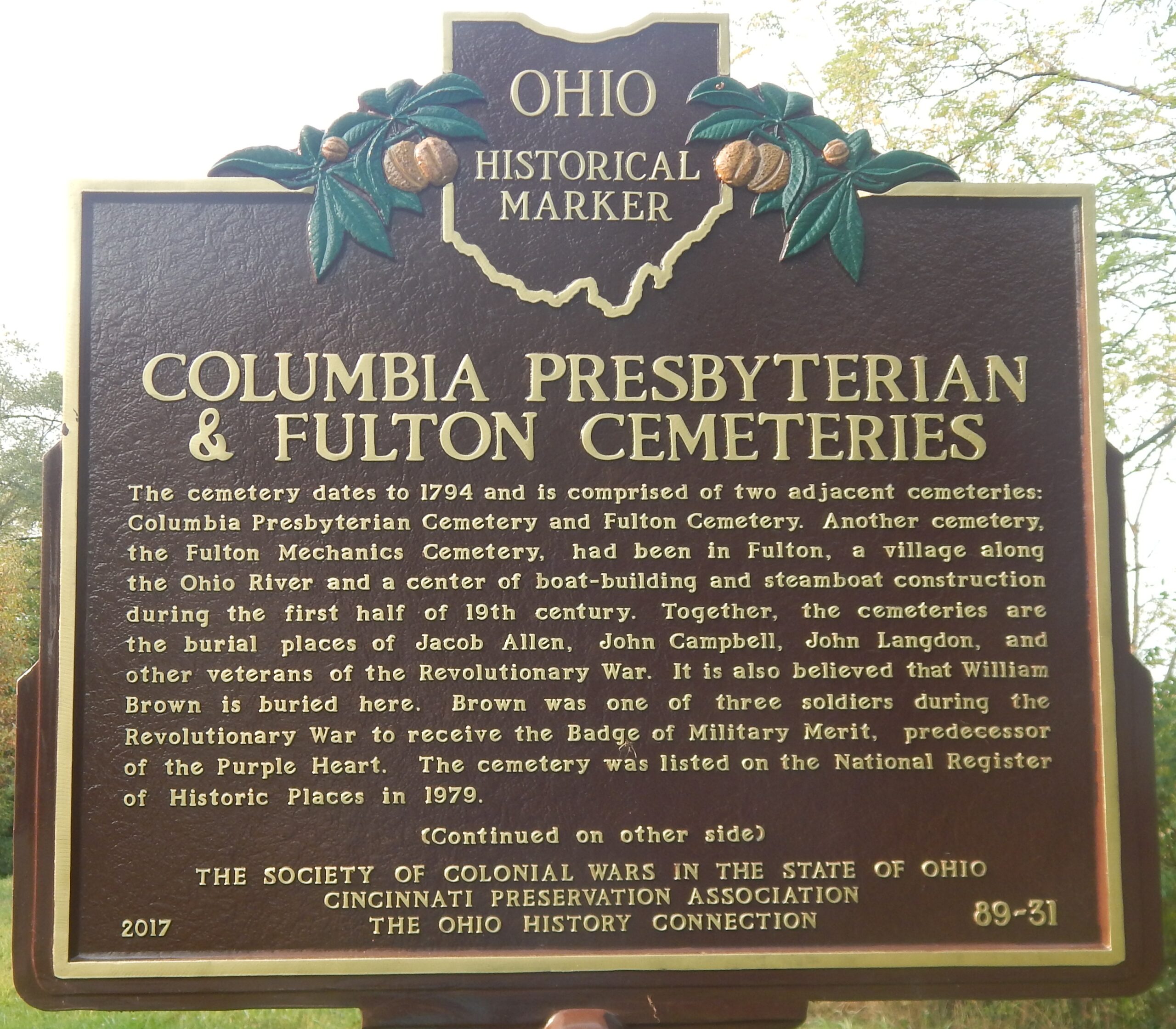
Side A: The cemetery dates to 1794 and is comprised of two adjacent cemeteries: Columbia Presbyterian Cemetery and Fulton Cemetery. Another cemetery, the Fulton Mechanics Cemetery, had been in Fulton, a village along the Ohio River and a center of boat-building and steamboat construction during the first half of 19th century. Together, the cemeteries are the burial places of Jacob Allen, John Campbell, John Langdon, and other veterans of the Revolutionary War. It is also believed that William Brown is buried here. Brown was one of three soldiers during the Revolutionary War to receive the Badge of Military Merit, predecessor of the Purple Heart. The cemetery was listed on the National Register of Historic Places in 1979. (Continued on other side)
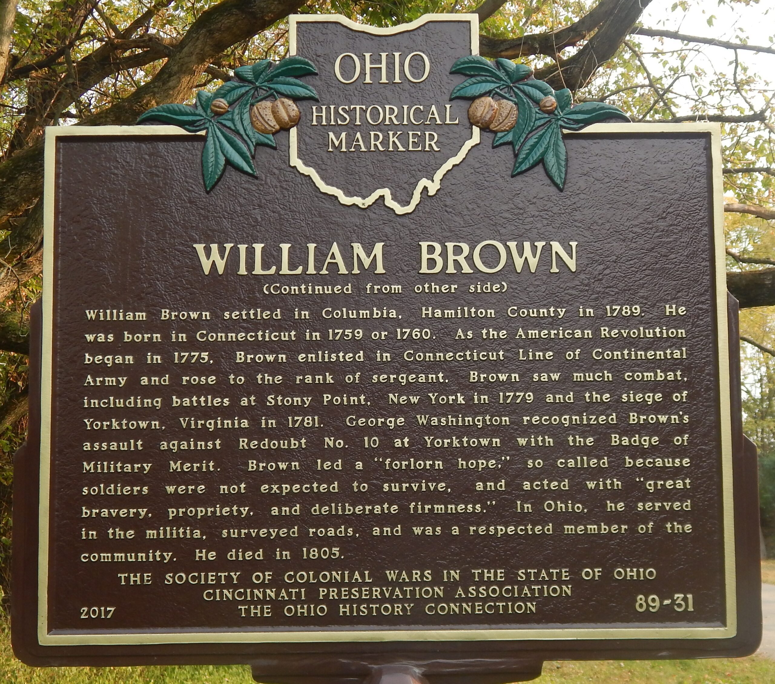
Side B: (Continued from other side) William Brown settled in Columbia, Hamilton County in 1789. He was born in Connecticut in 1759 or 1760. As the American Revolution began in 1775, Brown enlisted in Connecticut Line of Continental Army and rose to the rank of sergeant. Brown saw much combat, including battles at Stony Point, New York in 1779 and the siege of Yorktown, Virginia in 1781. George Washington recognized Brown’s assault against Redoubt No. 10 at Yorktown with the Badge of Military Merit. Brown led a “forlorn hope,” so called because soldiers were not expected to survive, and acted with “great bravery, propriety, and deliberate firmness.” In Ohio, he served in the militia, surveyed roads, and was a respected member of the community. He died in in 1805.
Sponsors: The Society of Colonial Wars in the State of Ohio, Cincinnati Preservation Association, and The Ohio History Connection