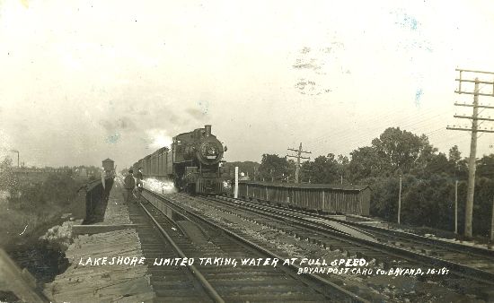
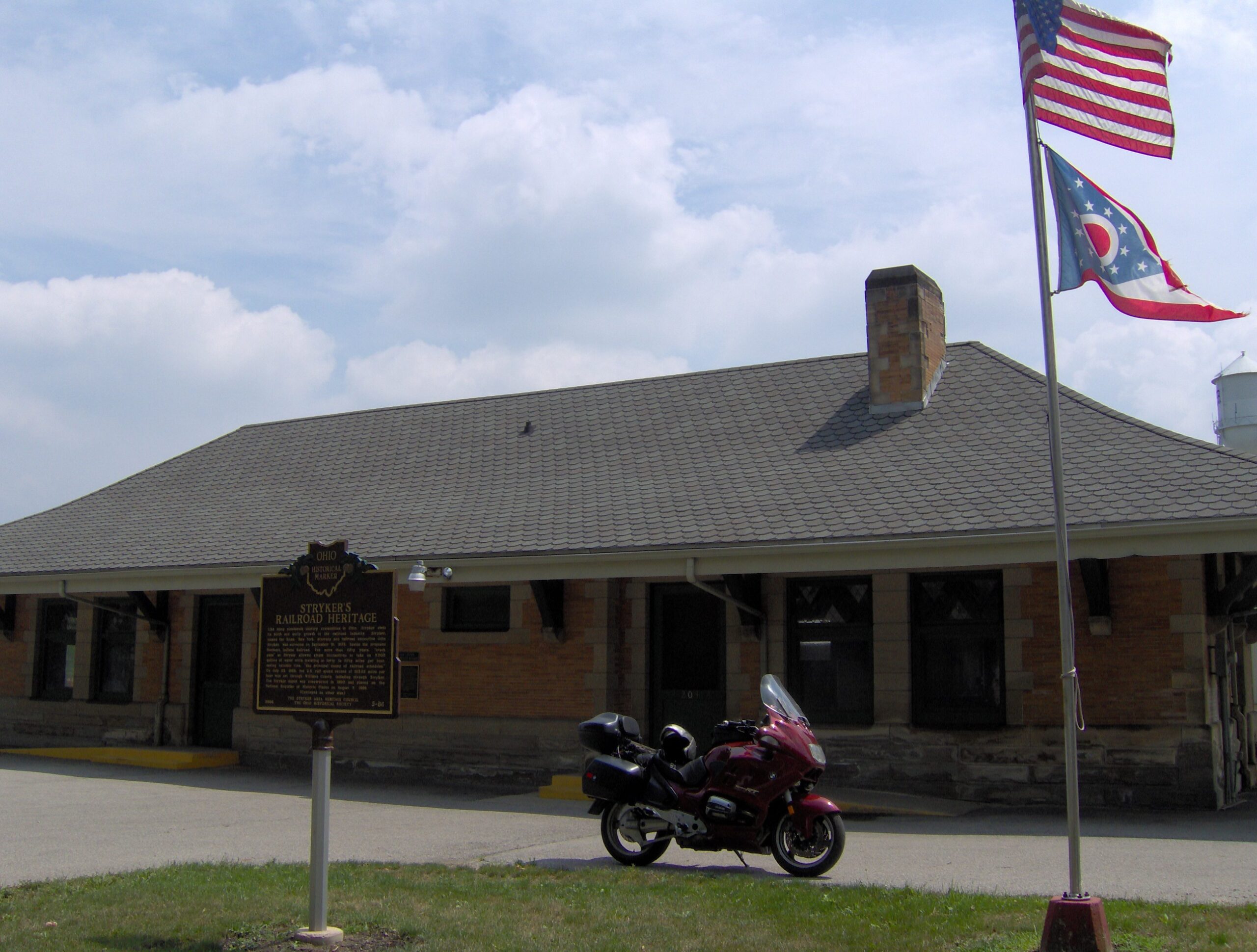
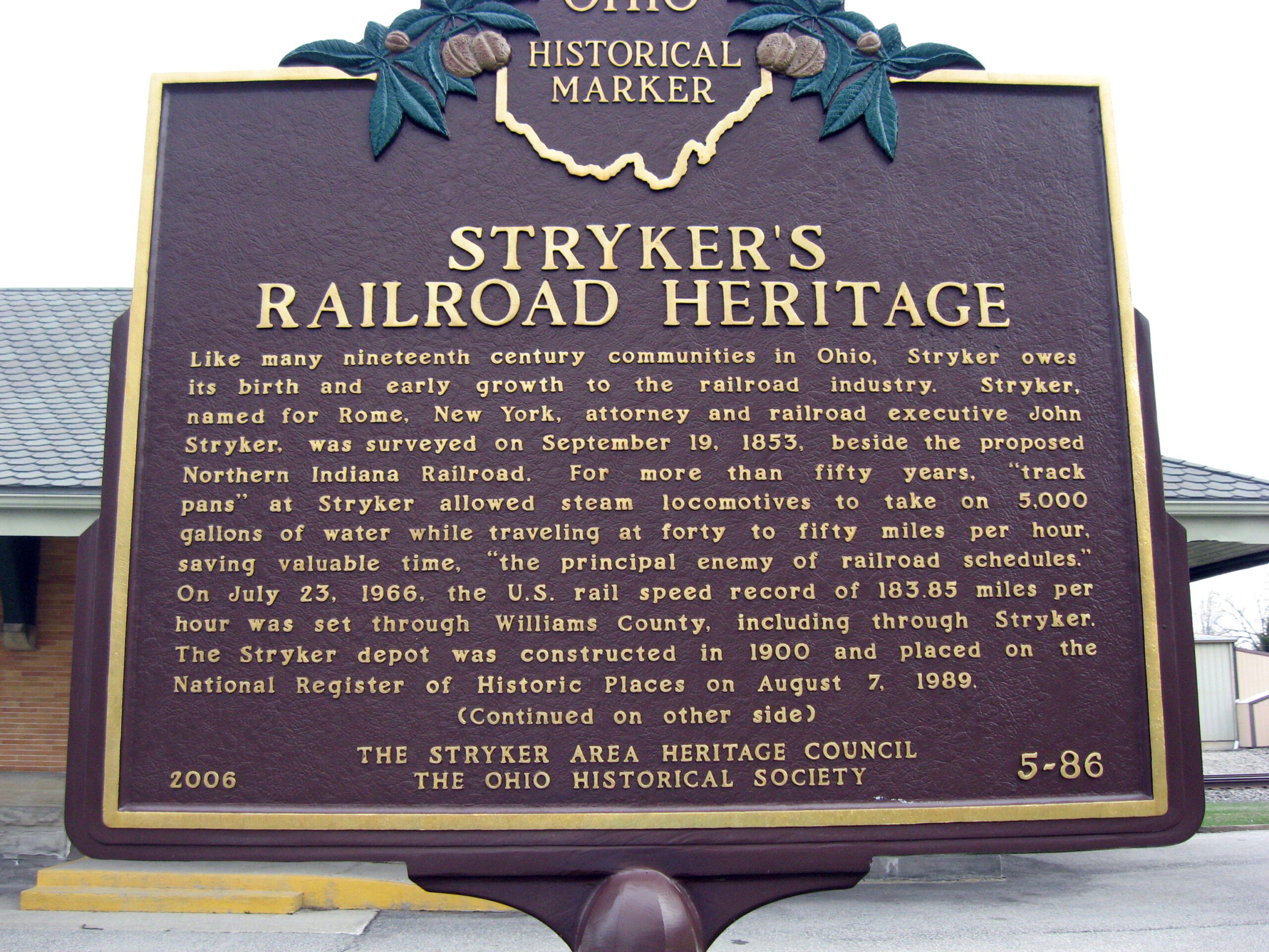
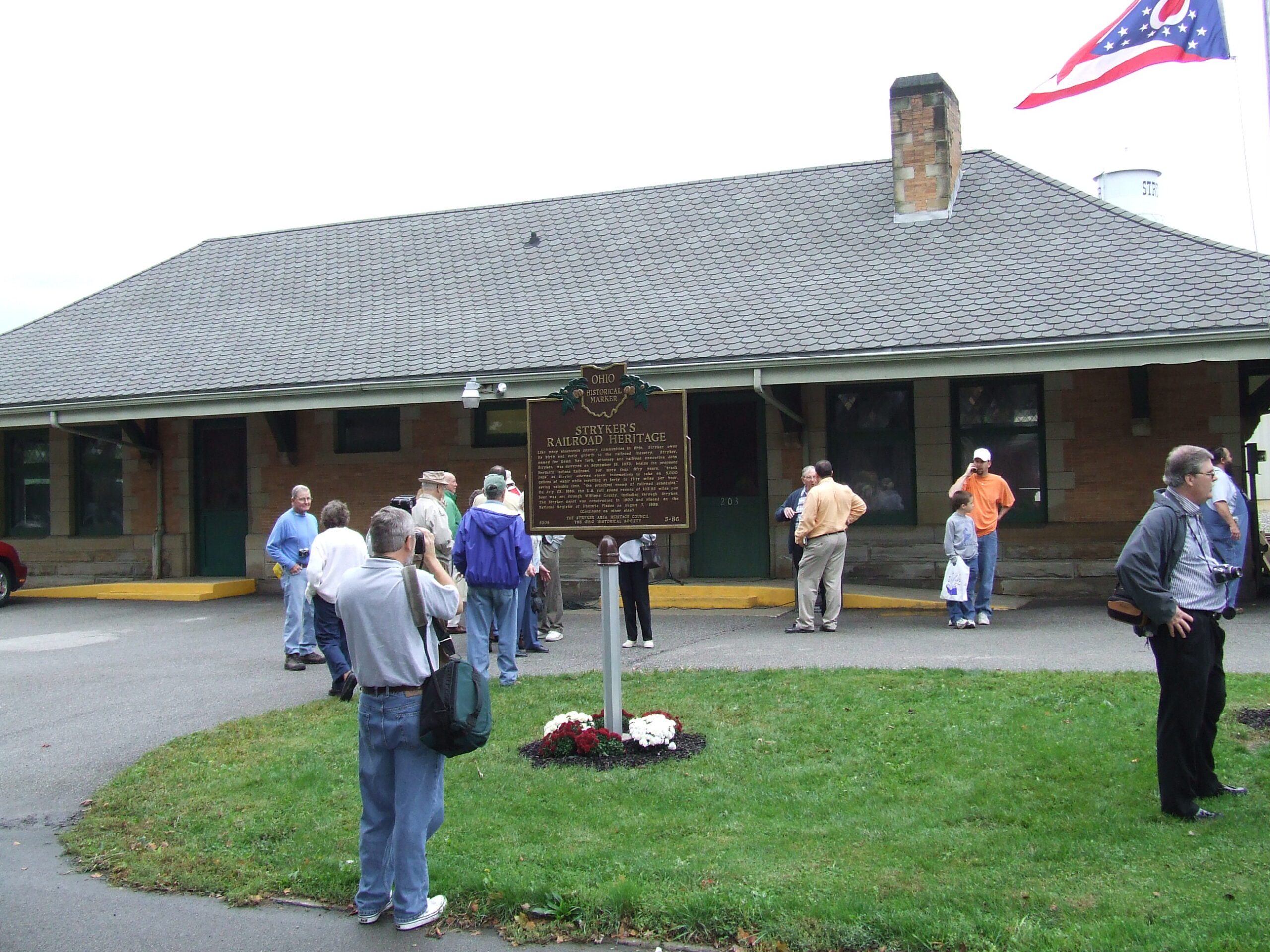
Side A: Like many nineteenth century communities in Ohio, Stryker owes its birth and early growth to the railroad industry. Stryker, named for Rome, New York, attorney and railroad executive John Stryker, was surveyed on September 19, 1853, beside the proposed Northern Indiana Railroad. For more than fifty years, “track pans” at Stryker allowed steam locomotives to take on 5,000 gallons of water while traveling at forty to fifty miles per hour, saving valuable time, “the principal enemy of railroad schedules.” On July 23, 1966, the U.S. rail speed record of 183.85 miles per hour was set through Williams County, including through Stryker. The Stryker depot was constructed in 1900 and placed on the National Register of Historic Places on August 7, 1989. (continued on other side)
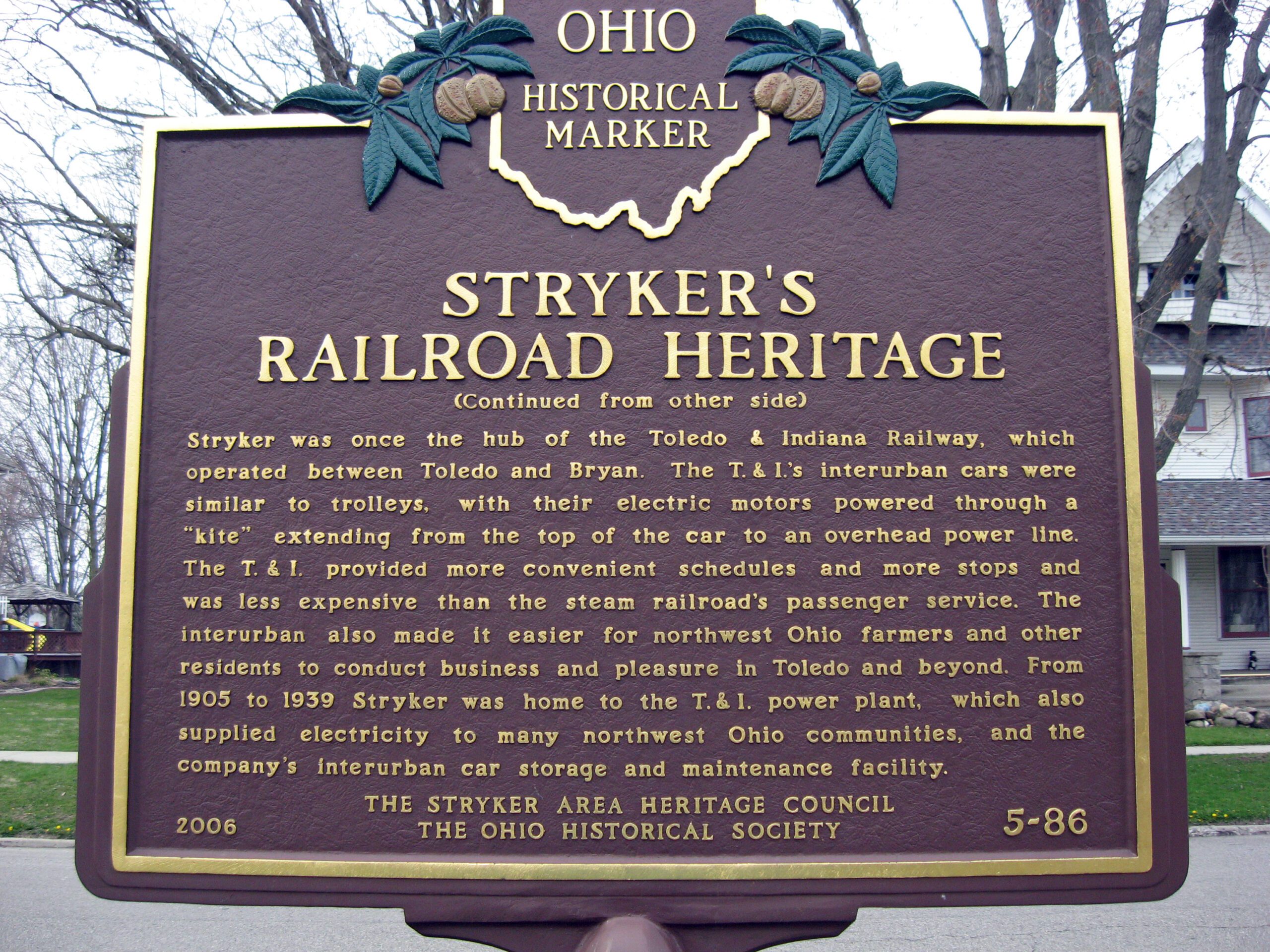
Side B: (continued from other side) Stryker was once the hub of the Toledo & Indiana Railway, which operated between Toledo and Bryan. The T. & I.’s interurban cars were similar to trolleys, with their electric motors powered through a “kite” extending from the top of the car to an overhead power line. The T. & I. provided more convenient schedules and more stops and was less expensive than the steam railroad’s passenger service. The interurban also made it easier for northwest Ohio farmers and other residents to conduct business and pleasure in Toledo and beyond. From 1905 to 1939 Stryker was home to the T. & I. power plant, which also supplied electricity to many northwest Ohio communities, and the company’s interurban car storage and maintenance facility.